world.wikisort.org - Philippines
Matnog, officially the Municipality of Matnog (Waray Sorsogon: Bungto san Matnog; Waray: Bungto han Matnog, Tagalog: Bayan ng Matnog), is a 3rd class municipality in the province of Sorsogon, Philippines. According to the 2020 census, it has a population of 41,989 people. [3]
Matnog | |
|---|---|
Municipality | |
| Municipality of Matnog | |
 Skyline of Matnog | |
 Flag  Seal | |
| Nickname: Gateway of Luzon | |
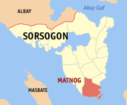 Map of Sorsogon with Matnog highlighted | |
OpenStreetMap  | |
 Matnog Location within the Philippines | |
| Coordinates: 12°35′08″N 124°05′08″E | |
| Country | Philippines |
| Region | Bicol Region |
| Province | Sorsogon |
| District | 2nd district |
| Founded | May 17, 1800 |
| Barangays | 40 (see Barangays) |
| Government | |
| • Type | Sangguniang Bayan |
| • Mayor | Claudith M. So |
| • Vice Mayor | Carlos G. Estrelon Jr. |
| • Representative | Vacant |
| • Municipal Council | Members |
| • Electorate | 27,105 voters (2019) |
| Area | |
| • Total | 162.40 km2 (62.70 sq mi) |
| Elevation | 49 m (161 ft) |
| Highest elevation | 354 m (1,161 ft) |
| Lowest elevation | 0 m (0 ft) |
| Population | |
| • Total | 41,989 |
| • Density | 260/km2 (670/sq mi) |
| • Households | 8,347 |
| Economy | |
| • Income class | 3rd municipal income class |
| • Poverty incidence | 37.12% (2018)[4] |
| • Revenue | ₱160,626,243.52 (2020) |
| • Assets | ₱195,396,487.99 (2020) |
| • Expenditure | ₱163,716,281.44 (2020) |
| • Liabilities | ₱98,049,581.46 (2020) |
| Service provider | |
| • Electricity | Sorsogon 1 Electric Cooperative (SORECO 1) |
| Time zone | UTC+8 (PST) |
| ZIP code | 4708 |
| PSGC | |
| IDD : area code | +63 (0)56 |
| Native languages | Sorsogon Tagalog |
| Website | www |
Its port is one of the busiest in the region, playing host to millions of people crossing the San Bernardino Strait to Northern Samar annually. It is the jump off point to the southern Philippines and vice versa.
History
Local elders say that the name Matnog comes from the word "matonog" (very audible) - that describes to the loud sound of the waves. The native people of Matnog are the Agta, Tabangon, and Cimaron Tribe.
Geography
Barangays
Matnog is politically subdivided into 40 barangays.
- Balocawe
- Banogao
- Banuang-daan
- Bariis
- Bolo
- Bon-Ot Dako (Big)
- Bon-Ot Saday (Small)
- Cabagahan
- Calayuan
- Calintaan
- Caloocan (Poblacion)
- Calpi
- Camachiles (Poblacion)
- Camcaman (Poblacion)
- Coron-coron
- Culasi
- Gadgaron
- Genablan Occidental
- Genablan Oriental
- Hid-hid
- Laboy
- Lajong
- Mambajog
- Manjumlad
- Manurabi
- Naburacan
- Paghuliran
- Pangi
- Pawa
- Poropandan
- Santa Isabel
- Sinalmacan
- Sinang-Atan
- Sinebaran
- Sisigon
- Sua
- Sulangan
- Tablac (Poblacion)
- Tabunan (Poblacion)
- Tugas
Climate
| Climate data for Matnog, Sorsogon | |||||||||||||
|---|---|---|---|---|---|---|---|---|---|---|---|---|---|
| Month | Jan | Feb | Mar | Apr | May | Jun | Jul | Aug | Sep | Oct | Nov | Dec | Year |
| Average high °C (°F) | 27 (81) |
28 (82) |
29 (84) |
31 (88) |
31 (88) |
30 (86) |
29 (84) |
29 (84) |
29 (84) |
29 (84) |
29 (84) |
28 (82) |
29 (84) |
| Average low °C (°F) | 22 (72) |
21 (70) |
22 (72) |
23 (73) |
24 (75) |
25 (77) |
25 (77) |
25 (77) |
25 (77) |
24 (75) |
23 (73) |
23 (73) |
24 (74) |
| Average precipitation mm (inches) | 65 (2.6) |
44 (1.7) |
42 (1.7) |
39 (1.5) |
87 (3.4) |
150 (5.9) |
184 (7.2) |
153 (6.0) |
163 (6.4) |
154 (6.1) |
127 (5.0) |
100 (3.9) |
1,308 (51.4) |
| Average rainy days | 13.9 | 9.2 | 11.0 | 12.5 | 19.6 | 24.3 | 26.5 | 25.0 | 25.5 | 24.4 | 19.4 | 15.1 | 226.4 |
| Source: Meteoblue[5] | |||||||||||||
Demographics
| Year | Pop. | ±% p.a. |
|---|---|---|
| 1903 | 2,457 | — |
| 1918 | 4,437 | +4.02% |
| 1939 | 10,119 | +4.00% |
| 1948 | 12,036 | +1.95% |
| 1960 | 15,570 | +2.17% |
| 1970 | 20,330 | +2.70% |
| 1975 | 20,680 | +0.34% |
| 1980 | 24,193 | +3.19% |
| 1990 | 25,957 | +0.71% |
| 1995 | 29,309 | +2.30% |
| 2000 | 32,712 | +2.38% |
| 2007 | 34,517 | +0.74% |
| 2010 | 37,641 | +3.20% |
| 2015 | 41,101 | +1.69% |
| 2020 | 41,989 | +0.42% |
| Source: Philippine Statistics Authority [6] [7] [8][9] | ||
Economy
Transportation
Transportation includes buses going to and from Metro Manila and Bulan and ferries going to and from Allen, Northern Samar.[17]
In order to spur development in the municipality, The Toll Regulatory Board declared Toll Road 5 the extension of South Luzon Expressway.[18] A 420-kilometer, four lane expressway starting from the terminal point of the now under construction SLEX Toll Road 4 at Barangay Mayao, Lucena City in Quezon to Matnog, Sorsogon, near the Matnog Ferry Terminal. On August 25, 2020, San Miguel Corporation announced that they will invest the project which will reduce travel time from Lucena to Matnog from 9 hours to 5.5 hours.[19]
Gallery
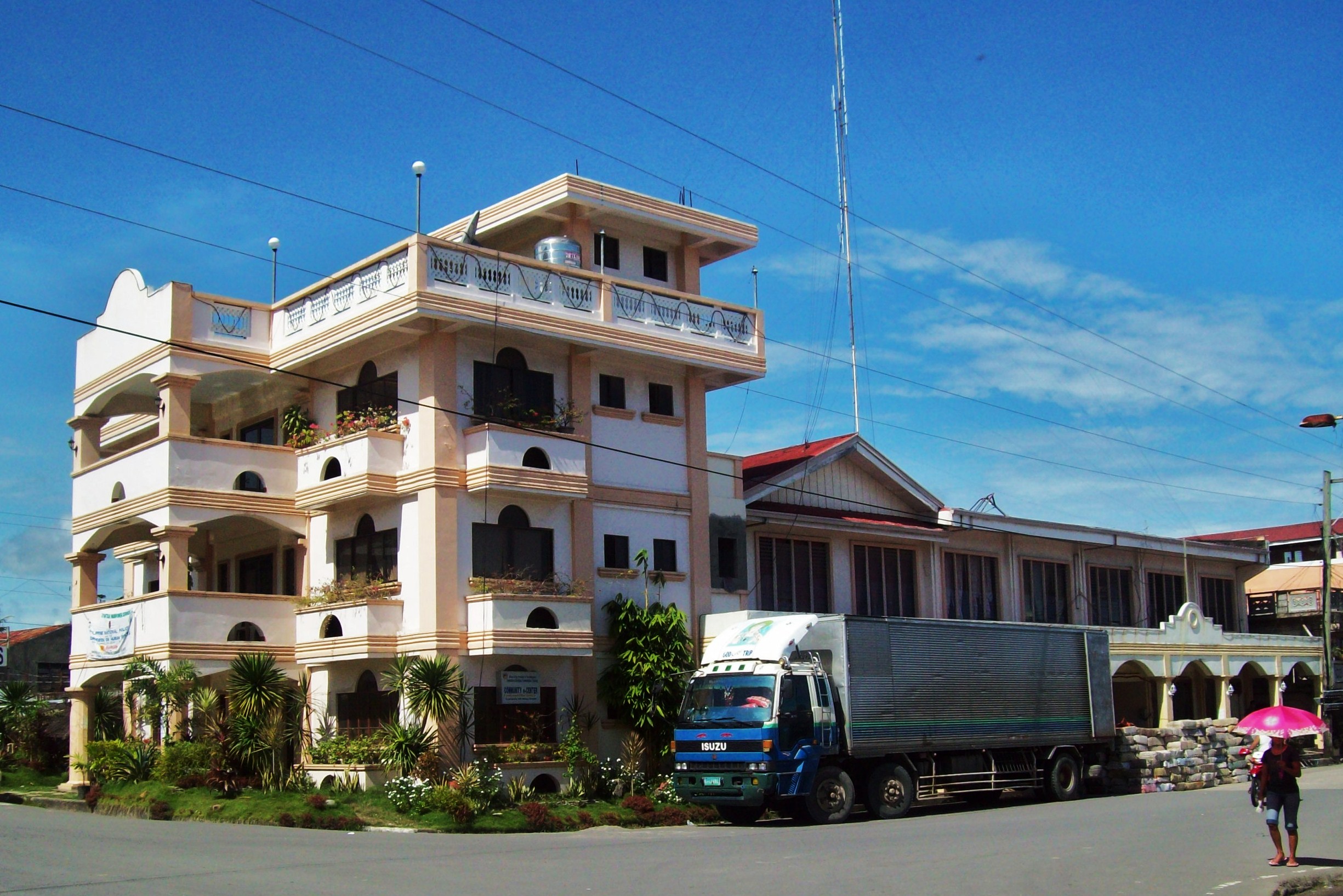
 Matnog Municipal Hall
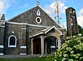 Matnog Church
 Matnog Beach


References
- Municipality of Matnog | (DILG)
- "2015 Census of Population, Report No. 3 – Population, Land Area, and Population Density" (PDF). Philippine Statistics Authority. Quezon City, Philippines. August 2016. ISSN 0117-1453. Archived (PDF) from the original on May 25, 2021. Retrieved July 16, 2021.
- Census of Population (2020). "Region V (Bicol Region)". Total Population by Province, City, Municipality and Barangay. PSA. Retrieved 8 July 2021.
- "PSA Releases the 2018 Municipal and City Level Poverty Estimates". Philippine Statistics Authority. 15 December 2021. Retrieved 22 January 2022.
- "Matnog, Sorsogon : Average Temperatures and Rainfall". Meteoblue. Retrieved 29 December 2018.
- Census of Population (2015). "Region V (Bicol Region)". Total Population by Province, City, Municipality and Barangay. PSA. Retrieved 20 June 2016.
- Census of Population and Housing (2010). "Region V (Bicol Region)". Total Population by Province, City, Municipality and Barangay. NSO. Retrieved 29 June 2016.
- Censuses of Population (1903–2007). "Region V (Bicol Region)". Table 1. Population Enumerated in Various Censuses by Province/Highly Urbanized City: 1903 to 2007. NSO.
- "Province of Sorsogon". Municipality Population Data. Local Water Utilities Administration Research Division. Retrieved 17 December 2016.
- "Poverty incidence (PI):". Philippine Statistics Authority. Retrieved 28 December 2020.
- https://psa.gov.ph/sites/default/files/NSCB_LocalPovertyPhilippines_0.pdf; publication date: 29 November 2005; publisher: Philippine Statistics Authority.
- https://psa.gov.ph/sites/default/files/2003%20SAE%20of%20poverty%20%28Full%20Report%29_1.pdf; publication date: 23 March 2009; publisher: Philippine Statistics Authority.
- https://psa.gov.ph/sites/default/files/2006%20and%202009%20City%20and%20Municipal%20Level%20Poverty%20Estimates_0_1.pdf; publication date: 3 August 2012; publisher: Philippine Statistics Authority.
- https://psa.gov.ph/sites/default/files/2012%20Municipal%20and%20City%20Level%20Poverty%20Estima7tes%20Publication%20%281%29.pdf; publication date: 31 May 2016; publisher: Philippine Statistics Authority.
- https://psa.gov.ph/sites/default/files/City%20and%20Municipal-level%20Small%20Area%20Poverty%20Estimates_%202009%2C%202012%20and%202015_0.xlsx; publication date: 10 July 2019; publisher: Philippine Statistics Authority.
- "PSA Releases the 2018 Municipal and City Level Poverty Estimates". Philippine Statistics Authority. 15 December 2021. Retrieved 22 January 2022.
- Bloom, Greg (September 15, 2010). Philippines. Lonely Planet. p. 202. ISBN 9781742203706.
- "SLEX Toll Road 5 to connect Quezon province to Sorsogon". YugaTech. August 18, 2020. Retrieved January 9, 2021.
- "San Miguel investing P122B for SLEX Toll Road 5, Pasig River Expressway projects". GMA News Online. August 25, 2020. Retrieved January 9, 2021.
External links
- Matnog Profile at PhilAtlas.com
- Philippine Standard Geographic Code
- Philippine Census Information
- Local Governance Performance Management System
- Matnog, Sorsogon LGU Profile
Places adjacent to Matnog | ||||||||||||||||
|---|---|---|---|---|---|---|---|---|---|---|---|---|---|---|---|---|
| ||||||||||||||||
Sorsogon City (capital) | |
| Municipalities | |
| Component city | |
На других языках
[de] Matnog
Matnog ist eine philippinische Stadtgemeinde in der Provinz Sorsogon. Sie hat 41.101 Einwohner (Zensus 1. August 2015), die in 40 Barangays lebten. Matnog gehört zur dritten Einkommensklasse der Gemeinden auf den Philippinen. Sie liegt ca. 48 km südlich der Provinzhauptstadt Sorsogon City an der San-Bernardino-Straße. Ihre Nachbargemeinden sind Bulan im Nordwesten, Irosin im Norden und Santa Magdalena im Nordosten.- [en] Matnog
Другой контент может иметь иную лицензию. Перед использованием материалов сайта WikiSort.org внимательно изучите правила лицензирования конкретных элементов наполнения сайта.
WikiSort.org - проект по пересортировке и дополнению контента Википедии