world.wikisort.org - Philippines
Jabonga, officially the Municipality of Jabonga (Cebuano: Lungsod sa Jabonga; Tagalog: Bayan ng Jabonga), is a 3rd class municipality in the province of Agusan del Norte, Philippines. According to the 2020 census, it has a population of 24,855 people. [3]
Jabonga | |
|---|---|
Municipality | |
| Municipality of Jabonga | |
 Municipal Hall | |
 Seal | |
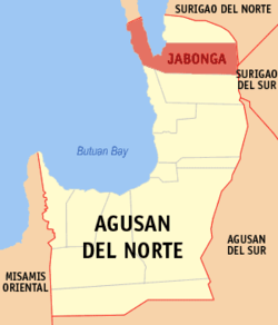 Map of Agusan del Norte with Jabonga highlighted | |
OpenStreetMap  | |
 Jabonga Location within the Philippines | |
| Coordinates: 9°20′35″N 125°30′56″E | |
| Country | Philippines |
| Region | Caraga |
| Province | Agusan del Norte |
| District | 2nd district |
| Barangays | 15 (see Barangays) |
| Government | |
| • Type | Sangguniang Bayan |
| • Mayor | Napoleon M. Montero |
| • Vice Mayor | Glicerio M. Monton Jr. |
| • Representative | Ma. Angelica Amante-Matba |
| • Municipal Council | Members |
| • Electorate | 17,138 voters (2019) |
| Area | |
| • Total | 293 km2 (113 sq mi) |
| Elevation | 114 m (374 ft) |
| Highest elevation | 627 m (2,057 ft) |
| Lowest elevation | 0 m (0 ft) |
| Population | |
| • Total | 24,855 |
| • Density | 85/km2 (220/sq mi) |
| • Households | 5,114 |
| Economy | |
| • Income class | 3rd municipal income class |
| • Poverty incidence | 31.30% (2018)[4] |
| • Revenue | ₱138,569,303.30 (2020) |
| • Assets | ₱287,154,282.46 (2020) |
| • Expenditure | ₱116,416,094.89 (2020) |
| • Liabilities | ₱160,287,381.15 (2020) |
| Service provider | |
| • Electricity | Agusan del Norte Electric Cooperative (ANECO) |
| Time zone | UTC+8 (PST) |
| ZIP code | 8607 |
| PSGC | |
| IDD : area code | +63 (0)85 |
| Native languages | Agusan Butuanon Cebuano Higaonon Mamanwa Tagalog |
| Website | www |
Geography
According to the Philippine Statistics Authority, the municipality has a land area of 293 square kilometres (113 sq mi) [5] constituting 10.73% of the 2,730.24-square-kilometre- (1,054.15 sq mi) total area of Agusan del Norte.
Jabonga is bounded by Kitcharao and Surigao del Norte to the north; Butuan Bay to the west; Tubay and Santiago to the south; Surigao del Sur to the east. It is 60 kilometres (37 mi) from Butuan City.
The topography of the land features plain to rolling and hills. Among the municipalities, Jabonga ranks first in total area and number of farms (464) mostly owned by individuals. It has one of the 36 crop storage facilities of the province. Its major crops are coconut, rice, corn, timber and both fresh and sea-water fish.
Climate
| Climate data for Jabonga, Agusan del Norte | |||||||||||||
|---|---|---|---|---|---|---|---|---|---|---|---|---|---|
| Month | Jan | Feb | Mar | Apr | May | Jun | Jul | Aug | Sep | Oct | Nov | Dec | Year |
| Average high °C (°F) | 27 (81) |
27 (81) |
28 (82) |
29 (84) |
30 (86) |
29 (84) |
29 (84) |
29 (84) |
29 (84) |
29 (84) |
28 (82) |
28 (82) |
29 (83) |
| Average low °C (°F) | 23 (73) |
23 (73) |
23 (73) |
23 (73) |
24 (75) |
25 (77) |
24 (75) |
24 (75) |
24 (75) |
24 (75) |
24 (75) |
23 (73) |
24 (74) |
| Average precipitation mm (inches) | 210 (8.3) |
161 (6.3) |
123 (4.8) |
85 (3.3) |
148 (5.8) |
186 (7.3) |
164 (6.5) |
157 (6.2) |
141 (5.6) |
190 (7.5) |
223 (8.8) |
200 (7.9) |
1,988 (78.3) |
| Average rainy days | 21.0 | 16.8 | 18.5 | 18.2 | 24.9 | 27.7 | 28.4 | 27.0 | 26.1 | 27.6 | 24.6 | 22.0 | 282.8 |
| Source: Meteoblue[6] | |||||||||||||
Barangays
Jabonga is politically subdivided into 15 barangays.[7]
| PSGC | Barangay | Population | ±% p.a. | |||
|---|---|---|---|---|---|---|
| 2020 [3] | 2010 [8] | |||||
| 160205003 | A. Beltran (Camalig) | 4.3% | 1,077 | 1,149 | −0.62% | |
| 160205001 | Baleguian | 9.3% | 2,301 | 2,136 | 0.72% | |
| 160205002 | Bangonay | 13.5% | 3,361 | 3,073 | 0.86% | |
| 160205004 | Bunga | 3.4% | 842 | 951 | −1.16% | |
| 160205005 | Colorado | 7.5% | 1,858 | 1,570 | 1.63% | |
| 160205006 | Cuyago | 7.8% | 1,949 | 2,015 | −0.32% | |
| 160205007 | Libas | 5.8% | 1,437 | 1,455 | −0.12% | |
| 160205008 | Magdagooc | 6.4% | 1,585 | 1,464 | 0.76% | |
| 160205009 | Magsaysay | 4.5% | 1,117 | 1,155 | −0.32% | |
| 160205010 | Maraiging | 2.1% | 526 | 507 | 0.35% | |
| 160205011 | Poblacion (Jabonga) | 16.1% | 4,004 | 3,713 | 0.73% | |
| 160205012 | San Jose | 3.7% | 921 | 977 | −0.56% | |
| 160205013 | San Pablo | 5.2% | 1,299 | 957 | 2.97% | |
| 160205014 | San Vicente | 6.5% | 1,611 | 1,747 | −0.77% | |
| 160205015 | Santo Niño | 3.9% | 967 | 964 | 0.03% | |
| Total | 24,855 | 23,833 | 0.40% | |||
Demographics
| Year | Pop. | ±% p.a. |
|---|---|---|
| 1903 | 1,450 | — |
| 1918 | 2,545 | +3.82% |
| 1939 | 5,004 | +3.27% |
| 1948 | 7,700 | +4.91% |
| 1960 | 14,721 | +5.55% |
| 1970 | 12,129 | −1.92% |
| 1975 | 14,742 | +3.99% |
| 1980 | 15,912 | +1.54% |
| 1990 | 18,610 | +1.58% |
| 1995 | 20,196 | +1.54% |
| 2000 | 20,501 | +0.32% |
| 2007 | 23,052 | +1.63% |
| 2010 | 23,833 | +1.22% |
| 2015 | 23,184 | −0.52% |
| 2020 | 24,855 | +1.38% |
| Source: Philippine Statistics Authority [9] [8] [10][11] | ||
In the 2020 census, Jabonga had a population of 24,855. [3] The population density was 85 inhabitants per square kilometre (220/sq mi).
Economy
References
- Municipality of Jabonga | (DILG)
- "2015 Census of Population, Report No. 3 – Population, Land Area, and Population Density" (PDF). Philippine Statistics Authority. Quezon City, Philippines. August 2016. ISSN 0117-1453. Archived (PDF) from the original on May 25, 2021. Retrieved July 16, 2021.
- Census of Population (2020). "Caraga". Total Population by Province, City, Municipality and Barangay. PSA. Retrieved 8 July 2021.
- "PSA Releases the 2018 Municipal and City Level Poverty Estimates". Philippine Statistics Authority. 15 December 2021. Retrieved 22 January 2022.
- "Province: Agusan del Norte". PSGC Interactive. Quezon City, Philippines: Philippine Statistics Authority. Retrieved 12 November 2016.
- "Jabonga: Average Temperatures and Rainfall". Meteoblue. Retrieved 2 February 2020.
- "Municipal: Jabonga". PSGC Interactive. Quezon City, Philippines: Philippine Statistics Authority. Retrieved 8 January 2016.
- Census of Population and Housing (2010). "Caraga". Total Population by Province, City, Municipality and Barangay. NSO. Retrieved 29 June 2016.
- Census of Population (2015). "Caraga". Total Population by Province, City, Municipality and Barangay. PSA. Retrieved 20 June 2016.
- Censuses of Population (1903–2007). "Caraga". Table 1. Population Enumerated in Various Censuses by Province/Highly Urbanized City: 1903 to 2007. NSO.
- "Province of Agusan del Norte". Municipality Population Data. Local Water Utilities Administration Research Division. Retrieved 17 December 2016.
- "Poverty incidence (PI):". Philippine Statistics Authority. Retrieved 28 December 2020.
- https://psa.gov.ph/sites/default/files/NSCB_LocalPovertyPhilippines_0.pdf; publication date: 29 November 2005; publisher: Philippine Statistics Authority.
- https://psa.gov.ph/sites/default/files/2003%20SAE%20of%20poverty%20%28Full%20Report%29_1.pdf; publication date: 23 March 2009; publisher: Philippine Statistics Authority.
- https://psa.gov.ph/sites/default/files/2006%20and%202009%20City%20and%20Municipal%20Level%20Poverty%20Estimates_0_1.pdf; publication date: 3 August 2012; publisher: Philippine Statistics Authority.
- https://psa.gov.ph/sites/default/files/2012%20Municipal%20and%20City%20Level%20Poverty%20Estima7tes%20Publication%20%281%29.pdf; publication date: 31 May 2016; publisher: Philippine Statistics Authority.
- https://psa.gov.ph/sites/default/files/City%20and%20Municipal-level%20Small%20Area%20Poverty%20Estimates_%202009%2C%202012%20and%202015_0.xlsx; publication date: 10 July 2019; publisher: Philippine Statistics Authority.
- "PSA Releases the 2018 Municipal and City Level Poverty Estimates". Philippine Statistics Authority. 15 December 2021. Retrieved 22 January 2022.
External links
Places adjacent to Jabonga | ||||||||||||||||
|---|---|---|---|---|---|---|---|---|---|---|---|---|---|---|---|---|
| ||||||||||||||||
Cabadbaran (capital) | |
| Municipalities | |
| Component city | |
| Highly urbanized city |
|
На других языках
[de] Jabonga
Jabonga ist eine Stadtgemeinde in der Provinz Agusan del Norte auf der Insel Mindanao im Süden der Philippinen.- [en] Jabonga
Другой контент может иметь иную лицензию. Перед использованием материалов сайта WikiSort.org внимательно изучите правила лицензирования конкретных элементов наполнения сайта.
WikiSort.org - проект по пересортировке и дополнению контента Википедии