world.wikisort.org - Philippines
Claver, officially the Municipality of Claver (Surigaonon: Lungsod nan Claver; Tagalog: Bayan ng Claver), is a 2nd class municipality in the province of Surigao del Norte, Philippines. According to the 2020 census, it has a population of 36,033 people. [3]
Claver | |
|---|---|
Municipality | |
| Municipality of Claver | |
 Flag  Seal | |
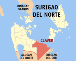 Map of Surigao del Norte with Claver highlighted | |
OpenStreetMap  | |
 Claver Location within the Philippines | |
| Coordinates: 9°34′27″N 125°43′58″E | |
| Country | Philippines |
| Region | Caraga |
| Province | Surigao del Norte |
| District | 2nd district |
| Founded | 1955 |
| Barangays | 14 (see Barangays) |
| Government | |
| • Type | Sangguniang Bayan |
| • Mayor | Georgia D. Gokiangkee |
| • Vice Mayor | Narlito G. Jamesula |
| • Representative | Robert Ace S. Barbers |
| • Electorate | 28,296 voters (2019) |
| Area | |
| • Total | 322.60 km2 (124.56 sq mi) |
| Elevation | 36 m (118 ft) |
| Highest elevation | 337 m (1,106 ft) |
| Lowest elevation | 0 m (0 ft) |
| Population | |
| • Total | 36,033 |
| • Density | 110/km2 (290/sq mi) |
| • Households | 7,201 |
| Economy | |
| • Income class | 2nd municipal income class |
| • Poverty incidence | 32.33% (2018)[4] |
| • Revenue | ₱792,074,461.14 (2020) |
| • Assets | ₱2,325,188,397.72 (2020) |
| • Expenditure | ₱380,826,068.75 (2020) |
| • Liabilities | ₱180,296,218.88 (2020) |
| Service provider | |
| • Electricity | Surigao del Norte Electric Cooperative (SURNECO) |
| Time zone | UTC+8 (PST) |
| ZIP code | 8410 |
| PSGC | |
| IDD : area code | +63 (0)86 |
| Native languages | Surigaonon Agusan Cebuano Tagalog |
| Website | claver |
The town can be reached by bus, van-for-hire and jeepney from the Surigao Integrated Bus & Jeepney Terminal or at any point along the national highway. Its patron saint is St. Peter Claver and fiesta is celebrated every ninth day of September.
A large part of the municipal land area is a mining reservation due to extensive mineral deposits.[5] This includes the Nickel ore loading port at Taganito, located 10 kilometers from the town proper of Claver, on the banks of Taganito river.[6]
History
World War II
Claver was one of many coastal towns that for some time were ignored after the American and Filipino military forces surrendered to the Japanese in May 1942. Claver became the headquarters of the 114th Infantry Regiment of 10th Military District, which was the guerrilla organization under the jurisdiction of the United States Army. Some residents had fled for fear of a Japanese raid or occupation of the town, but an American whose family took refuge there said Claver still had a feeling of normalcy to it. On a hill above town the guerrillas maintained a radio station by which they kept in contact with other military units. The radio operator decided, without the knowledge of his superiors, to jam wavelengths used by the Japanese. The Japanese got a fix on the location of the station as a result.[7]
On November 30, 1943, the Japanese took action to put the radio station out of business. Very early in the morning several Japanese ships appeared off the coast and began shelling the town with five-inch guns. After a prolonged shelling, Japanese troops landed and destroyed the radio station. The guerrillas left as the Japanese entered town and moved their headquarters elsewhere. Because the town had supported the guerrillas, the town was ransacked. The troops then returned to the ships, which left.[8]
Most of the residents fled south to avoid the Japanese, who did not occupy Claver. Claver remained almost abandoned until the end of the war.[9]
Geography
In the north-east, Claver is bounded by the Pacific Ocean, to the west by the town of Gigaquit, and to the south by the boundary town of Carrascal, Surigao del Sur. It is approximately 60 kilometres (37 mi) southeast of the provincial capital, Surigao City.
Barangays
Claver is politically divided into 14 barangays:
- Bagakay (Pob. West)
- Cabugo
- Cagdianao
- Daywan
- Hayanggabon
- Ladgaron (Poblacion)
- Lapinigan
- Magallanes
- Panatao
- Sapa
- Taganito
- Tayaga (Pob. East)
- Urbiztondo
- Wangke
The Mamanwa village of Toyatoya is located in Barangay Urbiztondo.[10]
Climate
| Climate data for Claver, Surigao del Norte | |||||||||||||
|---|---|---|---|---|---|---|---|---|---|---|---|---|---|
| Month | Jan | Feb | Mar | Apr | May | Jun | Jul | Aug | Sep | Oct | Nov | Dec | Year |
| Average high °C (°F) | 27 (81) |
28 (82) |
28 (82) |
30 (86) |
30 (86) |
30 (86) |
29 (84) |
30 (86) |
30 (86) |
29 (84) |
29 (84) |
28 (82) |
29 (84) |
| Average low °C (°F) | 23 (73) |
23 (73) |
23 (73) |
23 (73) |
25 (77) |
25 (77) |
25 (77) |
25 (77) |
25 (77) |
25 (77) |
24 (75) |
24 (75) |
24 (75) |
| Average precipitation mm (inches) | 210 (8.3) |
161 (6.3) |
123 (4.8) |
85 (3.3) |
148 (5.8) |
186 (7.3) |
164 (6.5) |
157 (6.2) |
141 (5.6) |
190 (7.5) |
223 (8.8) |
200 (7.9) |
1,988 (78.3) |
| Average rainy days | 21.0 | 16.8 | 18.5 | 18.2 | 24.9 | 27.7 | 28.4 | 27.0 | 26.1 | 27.6 | 24.6 | 22.0 | 282.8 |
| Source: Meteoblue (modeled/calculated data, not measured locally)[11] | |||||||||||||
Demographics
| Year | Pop. | ±% p.a. |
|---|---|---|
| 1903 | 2,469 | — |
| 1960 | 7,744 | +2.03% |
| 1970 | 9,659 | +2.23% |
| 1975 | 10,755 | +2.18% |
| 1980 | 12,232 | +2.61% |
| 1990 | 13,452 | +0.96% |
| 1995 | 14,300 | +1.15% |
| 2000 | 16,403 | +2.98% |
| 2007 | 18,258 | +1.49% |
| 2010 | 23,702 | +9.96% |
| 2015 | 32,773 | +6.37% |
| 2020 | 36,033 | +1.88% |
| Source: Philippine Statistics Authority [12] [13] [14][15] | ||
Economy

Claver is primarily a mining town with iron, nickel, copper and silver deposits on its Pulang Lupan mountains which are exploited mainly by the Taganito Mining Corporation.[23][24] Mining, trading, and -traditionally - farming and fishing are the main sources of livelihood among residents. Fishing has become increasingly difficult due to water pollution as a consequence of mining activities.[25][26]
References
- Municipality of Claver | (DILG)
- "2015 Census of Population, Report No. 3 – Population, Land Area, and Population Density" (PDF). Philippine Statistics Authority. Quezon City, Philippines. August 2016. ISSN 0117-1453. Archived (PDF) from the original on May 25, 2021. Retrieved July 16, 2021.
- Census of Population (2020). "Caraga". Total Population by Province, City, Municipality and Barangay. PSA. Retrieved 8 July 2021.
- "PSA Releases the 2018 Municipal and City Level Poverty Estimates". Philippine Statistics Authority. 15 December 2021. Retrieved 22 January 2022.
- "Taganito mining corporation". www.nickelasia.com. Nickel asia corporation. Retrieved 4 January 2018.
- "Nickel smelting plant (Taganito)". www.jgc.com. JGC Corporation. Retrieved 4 January 2018.
- Virginia Hansen Holmes, Guerrilla Daughter (Kent, Ohio: Kent State U. Press, 2009), pp. 84-5, 95, 115.
- Holmes, pp. 114, 116-7.
- Holmes, p. 117-8.
- "Mamanwa1". Archived from the original on 2017-06-25. Retrieved 2017-09-12.
- "Claver: Average Temperatures and Rainfall". Meteoblue. Retrieved 20 November 2019.
- Census of Population (2015). "Caraga". Total Population by Province, City, Municipality and Barangay. PSA. Retrieved 20 June 2016.
- Census of Population and Housing (2010). "Caraga". Total Population by Province, City, Municipality and Barangay. NSO. Retrieved 29 June 2016.
- Censuses of Population (1903–2007). "Caraga". Table 1. Population Enumerated in Various Censuses by Province/Highly Urbanized City: 1903 to 2007. NSO.
- "Province of Surigao del Norte". Municipality Population Data. Local Water Utilities Administration Research Division. Retrieved 17 December 2016.
- "Poverty incidence (PI):". Philippine Statistics Authority. Retrieved 28 December 2020.
- https://psa.gov.ph/sites/default/files/NSCB_LocalPovertyPhilippines_0.pdf; publication date: 29 November 2005; publisher: Philippine Statistics Authority.
- https://psa.gov.ph/sites/default/files/2003%20SAE%20of%20poverty%20%28Full%20Report%29_1.pdf; publication date: 23 March 2009; publisher: Philippine Statistics Authority.
- https://psa.gov.ph/sites/default/files/2006%20and%202009%20City%20and%20Municipal%20Level%20Poverty%20Estimates_0_1.pdf; publication date: 3 August 2012; publisher: Philippine Statistics Authority.
- https://psa.gov.ph/sites/default/files/2012%20Municipal%20and%20City%20Level%20Poverty%20Estima7tes%20Publication%20%281%29.pdf; publication date: 31 May 2016; publisher: Philippine Statistics Authority.
- https://psa.gov.ph/sites/default/files/City%20and%20Municipal-level%20Small%20Area%20Poverty%20Estimates_%202009%2C%202012%20and%202015_0.xlsx; publication date: 10 July 2019; publisher: Philippine Statistics Authority.
- "PSA Releases the 2018 Municipal and City Level Poverty Estimates". Philippine Statistics Authority. 15 December 2021. Retrieved 22 January 2022.
- "Taganito Mining Corporation - Nickel Asia". Archived from the original on 2018-11-08. Retrieved 2017-04-04.
- "About Us".
-
Shaira Panela (October 10, 2012). "Toxicity of Mindanao mining sites is 3,000x above int'l safety limit –FoE". GMA News.
Hexavalent chromium —a highly toxic carcinogenic compound made famous by the movie, Erin Brokovich— has reared its ugly head in a big way in Mindanao
- "Philippinen - Bagger fressen Heimat".
External links
- Claver Profile at PhilAtlas.com
- Claver Profile at the DTI Cities and Municipalities Competitive Index
- Philippine Standard Geographic Code
- Philippine Census Information
- https://web.archive.org/web/20140201233832/http://www.surigaodelnorte.gov.ph/index.php?option=com_content&view=article&id=75&Itemid=112
- gov.ph
- https://web.archive.org/web/20140204025455/http://www.blgs.gov.ph/lgpmsv2/cmshome/index.php?pageID=23&frmIdDcfCode=7&fLguType=CM&frmIdRegion=16&frmIdProvince=85&frmIdLgu=1585
Places adjacent to Claver, Surigao del Norte | ||||||||||||||||
|---|---|---|---|---|---|---|---|---|---|---|---|---|---|---|---|---|
| ||||||||||||||||
Surigao City (capital) | |
| Municipalities | |
| Component city | |
На других языках
[de] Claver (Surigao del Norte)
Claver ist eine philippinische Stadtgemeinde in der Provinz Surigao del Norte.- [en] Claver, Surigao del Norte
Другой контент может иметь иную лицензию. Перед использованием материалов сайта WikiSort.org внимательно изучите правила лицензирования конкретных элементов наполнения сайта.
WikiSort.org - проект по пересортировке и дополнению контента Википедии