world.wikisort.org - Peru
Colcabamba (from Quechua: Qullqa Pampa, meaning "deposit plain") is one of sixteen districts of the Tayacaja Province in Peru.[1]
Colcabamba
Qullqa Pampa | |
|---|---|
District | |
 Campo Armiño, Colcabamba District | |
 Coat of arms | |
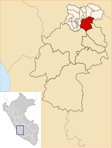 Location of Colcabamba in the Tayacaja province | |
| Coordinates: 12°24.5′S 74°40.6′W | |
| Country | |
| Region | Huancavelica |
| Province | Tayacaja |
| Capital | Colcabamba |
| Government | |
| • Mayor | Augusto Maravi Romani |
| Area | |
| • Total | 598.12 km2 (230.94 sq mi) |
| Elevation | 2,979 m (9,774 ft) |
| Population (2005 census) | |
| • Total | 21,593 |
| • Density | 36/km2 (94/sq mi) |
| Time zone | UTC-5 (PET) |
| UBIGEO | 090705 |
Geography
One of the highest peaks of the district is Atuq Punta at approximately 4,400 m (14,400 ft). Other mountains are listed below:[2]
- Arpayuq
- Ch'uñuna Mach'ay
- Kimsa Chumpi
- Minas Qucha
- Pakay Raqra
- Panti
- Parya Qaqa
- Pawkaray
- Qillwa Qucha
- Q'illu Qucha
- Tayanku
- Wanu Pata
- Waylla
- Wiska
Ethnic groups
The people in the district are mainly Indigenous citizens of Quechua descent. Quechua is the language which the majority of the population (76.32%) learnt to speak in childhood, 23.21% of the residents started speaking using the Spanish language (2007 Peru Census).[3]
References
- (in Spanish) Instituto Nacional de Estadística e Informática. Banco de Información Distrital Archived April 23, 2008, at the Wayback Machine. Retrieved April 11, 2008.
- escale.minedu.gob.pe/ UGEL map Tayacaja Province (Apurímac Region) 2017
- inei.gob.pe Archived January 27, 2013, at the Wayback Machine INEI, Peru, Censos Nacionales 2007, Frequencias: Preguntas de Población: Idioma o lengua con el que aprendió hablar (in Spanish)
| |
|---|---|
| Acobamba | |
| Angaraes | |
| Castrovirreyna |
|
| Churcampa |
|
| Huancavelica | |
| Huaytará | |
| Tayacaja | |
This Huancavelica Region geography article is a stub. You can help Wikipedia by expanding it. |
Текст в блоке "Читать" взят с сайта "Википедия" и доступен по лицензии Creative Commons Attribution-ShareAlike; в отдельных случаях могут действовать дополнительные условия.
Другой контент может иметь иную лицензию. Перед использованием материалов сайта WikiSort.org внимательно изучите правила лицензирования конкретных элементов наполнения сайта.
Другой контент может иметь иную лицензию. Перед использованием материалов сайта WikiSort.org внимательно изучите правила лицензирования конкретных элементов наполнения сайта.
2019-2026
WikiSort.org - проект по пересортировке и дополнению контента Википедии
WikiSort.org - проект по пересортировке и дополнению контента Википедии