world.wikisort.org - Pakistan
Choti Bala/Chak Nangar (چک ننگر) is a town and union council of Dera Ghazi Khan District in the Punjab province of Pakistan.[1] It is located at 29°49'0N 70°15'0E and has an altitude of 217 metres (715 feet).[2]
Choti Bala | |
|---|---|
Union council and town | |
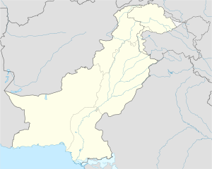
 Choti Bala Location in Pakistan | |
| Coordinates: 29°49′0″N 70°15′2″E | |
| Country | Pakistan |
| Province | Punjab |
| District | Dera Ghazi Khan District |
| Government | |
| Elevation | 712 ft (217 m) |
| Time zone | UTC+5 (PST) |
| • Summer (DST) | +6 |
HISTORY OF CHOTI BALA Chak NANGAR
Chak Nangar is rich in fertile land, water is available in abundance here, water level is 20 to 60 feet. Local people here are Nangri Laghari, before them Pathans settled here. This tribe was known as Baghlani tribe before settling in Nangar. The native language of the people here is Balochi. And later it was converted to Saraiki language.
When it rains on Mount Sulaiman, there are two streams here that give the view of a river. There is a passage of two streams, one is called Mithavan and the other is Khonkhar, which irrigates the entire area. Its water falls in DG Kanal. Due to lack of bridge, difficulties of the people here increase during rainy days. It is very difficult to cross these streams. Patients and business people get trapped. Lack of education. Due to which most of the population is illiterate.
References
- Tehsils & Unions in the District of D.G. Khan - Government of Pakistan Archived February 9, 2012, at the Wayback Machine
- Location of Choti Bala - Falling Rain Genomics
Другой контент может иметь иную лицензию. Перед использованием материалов сайта WikiSort.org внимательно изучите правила лицензирования конкретных элементов наполнения сайта.
WikiSort.org - проект по пересортировке и дополнению контента Википедии