world.wikisort.org - Norway
Nannestad is a municipality in Akershus in Viken county, Norway. It is part of the traditional region of Romerike. The administrative centre of the municipality is the village of Teigebyen.
Nannestad kommune | |
|---|---|
Municipality | |
 The characteristic landscape of Nannestad | |
 Coat of arms  Viken within Norway | |
 Nannestad within Viken | |
| Coordinates: 60°14′44″N 10°57′10″E | |
| Country | Norway |
| County | Viken |
| District | Romerike |
| Administrative centre | Teigebyen |
| Government | |
| • Mayor (2007-) | Anne-Ragni K. Amundsen (Ap) |
| Area | |
| • Total | 341 km2 (132 sq mi) |
| • Land | 324 km2 (125 sq mi) |
| • Rank | #259 in Norway |
| Population (2012) | |
| • Total | 11,362 |
| • Rank | #102 in Norway |
| • Density | 31/km2 (80/sq mi) |
| • Change (10 years) | |
| Demonym(s) | Nannestadsokning[1] |
| Official language | |
| • Norwegian form | Bokmål |
| Time zone | UTC+01:00 (CET) |
| • Summer (DST) | UTC+02:00 (CEST) |
| ISO 3166 code | NO-3036 |
| Website | Official website |
History
Nannestad was established as a municipality on 1 January 1838 (see formannskapsdistrikt).
Store norske leksikon writes that "At søndre Låke gård (a farm), South of Nannestad Church, Skule Bårdsson beat Birkebeinar (a political group), [... on a battlefield] South of the farm".[3]
Name and coat-of-arms
The municipality (originally the parish) is named after the old Nannestad farm (Old Norse: Nannastaðir), since the first church was built here. The first element is the genitive case of Nanni (an old Norse male name) and the last element is staðir which means "homestead" or "farm".
The coat-of-arms is from modern times. They were granted in 1990. The arms show three yellow coltsfoot flowers on a green background. This is a flower that is prevalent in the area.[4]
Geography
Nannestad is located in northwestern Viken county, with inhabitants concentrated at Romerikssletta. It includes the villages of Maura, Åsgreina, Eltonåsen, Steinsgård and Teigebyen, that last being the administrative centre.
Demographics
In 2017, 539 inhabitants had Polish parents and/or were Polish (themselves); 239 had Lithuanian parents and/or were Lithuanian.[5]
| Ancestry | Number[6] |
|---|---|
| 539 | |
| 239 | |
| 179 | |
| 156 | |
| 143 | |
| 117 | |
| 61 | |
| 56 | |
| 56 | |
| 53 |
Notable people

- Hans Georg Jacob Stang (1830 in Nannestad – 1907) a Norwegian attorney and Norway's Prime Minister in Stockholm from 1888–1889
- Oluf Wesmann-Kjær (1874 in Nannestad – 1945) a shooter, competed at the 1920 & 1924 Summer Olympics
- Olaf Helset (1892 in Nannestad – 1960) an Army Major General and sports administrator
- Håkon Christie (1922 in Nannestad – 2010) an architectural historian, antiquarian and author
- Bjarne Røtterud (1929 in Nannestad – 2011) a Norwegian abstract painter
- Gard Kristiansen (born 1972 in Nannestad) a retired football defender with 269 club caps
- Katrine Moholt (born 1973 in Nannestad) a Norwegian TV personality and singer [7]
- Sven Atle Kopperud (born 1977 in Nannestad) stage name Silenoz, guitarist, founded the symphonic black metal band Dimmu Borgir in 1993
- Posthum (founded 2004) a black metal band founded by Jon Kristian Skare and Morten Edseth
Gallery
 Nannestad plaza
 Nannestad upper secondary school
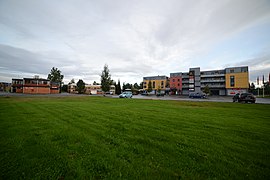
 Field of Nannestad


References
- "Navn på steder og personer: Innbyggjarnamn" (in Norwegian). Språkrådet.
- "Forskrift om målvedtak i kommunar og fylkeskommunar" (in Norwegian). Lovdata.no.
- https://snl.no/Nannestad "På søndre Låke gård, sør for Nannestad kirke, skal hertug Skule Bårdsson ha slått birkebeinerne i et slag sør for gården i 1240."
- "Kommunevåpen" (in Norwegian). Retrieved 2008-12-20.
- "Immigrants and Norwegian-born to immigrant parents, by immigration category, country background and percentages of the population". ssb.no. Retrieved 25 June 2017.
- "Immigrants and Norwegian-born to immigrant parents, by immigration category, country background and percentages of the population". ssb.no. Retrieved 25 June 2017.
- IMDb Database retrieved 21 February 2021
External links
 Media related to Nannestad at Wikimedia Commons
 The dictionary definition of Nannestad at Wiktionary
- Municipal fact sheet from Statistics Norway
 Akershus travel guide from Wikivoyage
- Municipality website (in Norwegian)
Viken county, Norway | |||||||||||||||||||||||
|---|---|---|---|---|---|---|---|---|---|---|---|---|---|---|---|---|---|---|---|---|---|---|---|
| |||||||||||||||||||||||
 | Towns and cities |
|  | ||||||||||||||||||||
| Municipalities |
| ||||||||||||||||||||||
Authority control | |
|---|---|
| General |
|
| Other |
|
На других языках
- [en] Nannestad
[ru] Наннестад
Наннестад — коммуна, входящая в состав губернии Акерсхус, Норвегия. Административный центр — Тейгебюн. Наннестад как коммуна существует с 1 января 1838 года.Другой контент может иметь иную лицензию. Перед использованием материалов сайта WikiSort.org внимательно изучите правила лицензирования конкретных элементов наполнения сайта.
WikiSort.org - проект по пересортировке и дополнению контента Википедии