world.wikisort.org - Nigeria
Shiroro is a Local Government Area in Niger State, Nigeria. Its headquarters is in the town of Kuta, which has fifteen [15] wards as follows:
- Allawa
- Bangajiya
- Bassa/kukoki
- Egwa/gwada
- Erena
- Galkogo
- Gurmana
- Gussoro
- Kato
- Kushaka/kurebe
- Kwaki/chukuba
- Manta
- Pina
- She
- Ubandoma
and their major language is Gbagyi. [1][2]
Shiroro | |
|---|---|
LGA | |
 Shiroro Location of Shiroro in Nigeria | |
| Coordinates: 9°57′25″N 6°49′55″E | |
| Country | |
| State | Niger State |
| Government | |
| • Local Government Chairman and the Head of the Local Government Council | Suleiman Dauda Chukuba |
| Time zone | UTC+1 (WAT) |
It has an area of 5,015 square kilometres (1,936 sq mi) and a population of 235,404 at the 2006 census.
The postal code of the area is 921.[3]
See also
- Shiroro Airstrip
- Shiroro Hydroelectric Power Station
- List of dams and reservoirs in Nigeria
References
- "Shiroro". Open Street Map. Retrieved 13 June 2018.
- "Shiroro". Google Maps. Google. Retrieved 13 June 2018.
- "Post Offices- with map of LGA". NIPOST. Archived from the original on 2012-11-26. Retrieved 2009-10-20.
State capital: Minna | ||
| Local Government Areas | 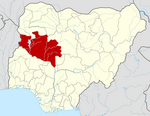 | |
This Niger State, Nigeria location article is a stub. You can help Wikipedia by expanding it. |
Текст в блоке "Читать" взят с сайта "Википедия" и доступен по лицензии Creative Commons Attribution-ShareAlike; в отдельных случаях могут действовать дополнительные условия.
Другой контент может иметь иную лицензию. Перед использованием материалов сайта WikiSort.org внимательно изучите правила лицензирования конкретных элементов наполнения сайта.
Другой контент может иметь иную лицензию. Перед использованием материалов сайта WikiSort.org внимательно изучите правила лицензирования конкретных элементов наполнения сайта.
2019-2026
WikiSort.org - проект по пересортировке и дополнению контента Википедии
WikiSort.org - проект по пересортировке и дополнению контента Википедии