world.wikisort.org - Nigeria
Munya is a Local Government Area in Niger State, Nigeria. Its headquarters are in the town of Sarkin Pawa in the north of the area near Kaduna State at10°01′00″N 7°06′00″E.
This article needs additional citations for verification. (January 2008) |
Munya | |
|---|---|
LGA | |
 Munya Location in Nigeria | |
| Coordinates: 9°47′N 7°02′E | |
| Country | |
| State | Niger State |
| Government | |
| • Local Government Chairman and the Head of the Local Government Council | Abdullahi Moh’d Ricco |
| Area | |
| • Total | 2,176 km2 (840 sq mi) |
| Population (2006 census) | |
| • Total | 103,651 |
| Time zone | UTC+1 (WAT) |
| 3-digit postal code prefix | 921 |
| ISO 3166 code | NG.NI.MU |
It has an area of 2,176 km2 and a population of 103,651 at the 2006 census.
The postal code of the area is 921.[1]
It is located in the eastern region of the state. Its main inhabitants are the Gwari people with farming as their main occupation.
Guni
Munya is made up of eight political wards with Guni ward as the largest and strongest of all. Guni as its popularly called, is the back bone of the whole state at large with most of the missionary schools in the state capital were relocated from Guni. in the local government level, Guni is the town with the most elite people to include the Magaji's family which over the years have contributed to the development and creation of the local government and partly the state at large.
2021 raid
On 17 November 2021, a gang of 80 armed bandits raided a village in Munya, killing 2 people and kidnapping 66 more, including the two wives of a local politician, and the mayor's two children.[2] The attack was part of a broader campaign by bandits in the region.[3]
References
- "Post Offices- with map of LGA". NIPOST. Archived from the original on 2009-10-07. Retrieved 2009-10-20.
- "Niger: Bandits raid Zagzaga kill 2, abduct children of village head, wives of counsellors, 64 others". The Sun (Nigeria). 2021-11-17. Retrieved 2021-11-27.
{{cite web}}: CS1 maint: url-status (link) - "Niger Insecurity: Bandits stop communities from evacuating bodies of 5 slain vigilantes". The Sun (Nigeria). 2021-11-27. Retrieved 2021-11-27.
{{cite web}}: CS1 maint: url-status (link)
State capital: Minna | ||
| Local Government Areas | 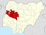 | |
This Niger State, Nigeria location article is a stub. You can help Wikipedia by expanding it. |
Другой контент может иметь иную лицензию. Перед использованием материалов сайта WikiSort.org внимательно изучите правила лицензирования конкретных элементов наполнения сайта.
WikiSort.org - проект по пересортировке и дополнению контента Википедии