world.wikisort.org - Nigeria
Demsa is a Local Government Area of Adamawa State, Nigeria with headquarters located in Demsa. Demsa lies on the Benue River.
Demsa | |
|---|---|
LGA and town | |
 Demsa | |
| Coordinates: 9°25′N 12°8′E | |
| Country | |
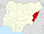
| State | Adamawa State |
| Headquarters | Demsa |
| Population (2006) | |
| • Total | 180,251 |
| Time zone | UTC+1 (WAT) |
History
Demsa Local Government Area is one of the twenty one LGAs in Adamawa State and has the postal code of 642.
The LGA administrative office is situated in Demsa Town and has the incumbent LGA Chairman as the head while the Chiefs are the head of the respective communities that made up the town, and the Councillors being the representatives of each wards that made up the community.[1]
Population
Population is 180,251.[2] It is inhabited by ethnic groups such as the Bachama (Bwatiye)Batta, Yandang, Bille, Mbula, Maya, Bare and fulani.[3]
Languages
The languages spoken in Demsa LGA are,[4]
- Bacama
- Bali
- Bata
- Bille
- Mbula-Bwazza
Government
References
- "Demsa Local Government Area". www.finelib.com. Retrieved 2022-05-14.
- Nigeria Census, 2006
- "AN OVERVIEW OF BACHAMA HISTORY". Adigaproductions's Blog. 2010-07-01. Retrieved 2017-11-12.
- "Nigeria - Languages". Ethnologue, 22d edition. Feb 2019.
State capital: Yola | ||
| Local Government Areas |
|  |
This Adamawa state location article is a stub. You can help Wikipedia by expanding it. |
Другой контент может иметь иную лицензию. Перед использованием материалов сайта WikiSort.org внимательно изучите правила лицензирования конкретных элементов наполнения сайта.
WikiSort.org - проект по пересортировке и дополнению контента Википедии