world.wikisort.org - New_Zealand
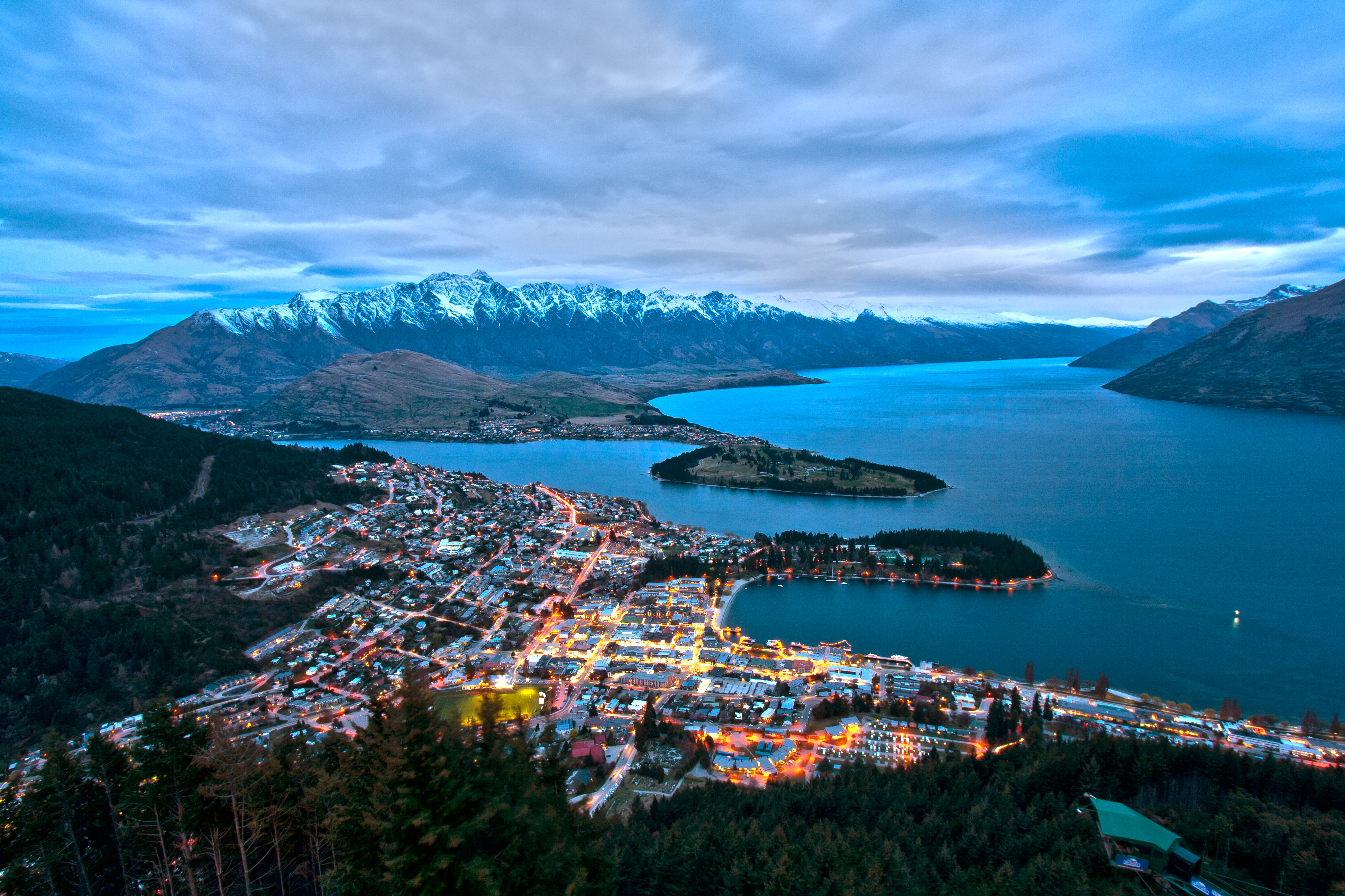
Queenstown Central is the central business district of Queenstown in the South Island of New Zealand. It also contains residential areas. The area contains Queenstown Primary and St Joseph's schools, and contained Wakatipu High School until it moved to Frankton at the beginning of 2018.[3]
Queenstown Central | |
|---|---|
Suburb of Queenstown | |
 | |
| Coordinates: 45.030°S 168.661°E | |
| Country | New Zealand |
| City | Queenstown |
| Local authority | Queenstown-Lakes District Council |
| Electoral ward | Queenstown-Wakatipu Ward |
| Area | |
| • Land | 175 ha (432 acres) |
| Population (June 2021)[2] | |
| • Total | 2,750 |
| (Ben Lomond) | Arthurs Point | Queenstown Hill |
|
|
Queenstown East | |
| Fernhill | (Lake Wakatipu) |
Skyline Queenstown operates a gondola and luge to and from Ben Lomond, with the gondola operating since 1967 and the luge since 1998.[4]
Demographics
Queenstown Central covers 1.75 km2 (0.68 sq mi)[1] and had an estimated population of 2,750 as of June 2021,[2] with a population density of 1,571 people per km2.
| Year | Pop. | ±% p.a. |
|---|---|---|
| 2006 | 2,205 | — |
| 2013 | 2,184 | −0.14% |
| 2018 | 2,502 | +2.76% |
| Source: [5] | ||
Queenstown Central had a population of 2,502 at the 2018 New Zealand census, an increase of 318 people (14.6%) since the 2013 census, and an increase of 297 people (13.5%) since the 2006 census. There were 651 households. There were 1,281 males and 1,215 females, giving a sex ratio of 1.05 males per female, with 156 people (6.2%) aged under 15 years, 1,203 (48.1%) aged 15 to 29, 1,053 (42.1%) aged 30 to 64, and 90 (3.6%) aged 65 or older.
Ethnicities were 60.2% European/Pākehā, 3.0% Māori, 0.7% Pacific peoples, 23.1% Asian, and 15.9% other ethnicities (totals add to more than 100% since people could identify with multiple ethnicities).
The proportion of people born overseas was 76.9%, compared with 27.1% nationally.
Although some people objected to giving their religion, 59.8% had no religion, 28.7% were Christian, 2.2% were Hindu, 2.0% were Buddhist and 4.0% had other religions.
Of those at least 15 years old, 549 (23.4%) people had a bachelor or higher degree, and 120 (5.1%) people had no formal qualifications. 162 people (6.9%) earned over $70,000 compared to 17.2% nationally. The employment status of those at least 15 was that 1,974 (84.1%) people were employed full-time, 159 (6.8%) were part-time, and 21 (0.9%) were unemployed.[5]
| Name | Area (km2) | Population | Density (per km2) | Households | Median age | Median income |
|---|---|---|---|---|---|---|
| Queenstown Central | 0.81 | 1,017 | 1,256 | 261 | 30.0 years | $34,300[6] |
| Warren Park | 0.94 | 1,485 | 1,580 | 390 | 28.7 years | $34,200[7] |
| New Zealand | 37.4 years | $31,800 |
References
- "ArcGIS Web Application". statsnz.maps.arcgis.com. Retrieved 19 December 2021.
- "Population estimate tables - NZ.Stat". Statistics New Zealand. Retrieved 22 October 2021.
- Williams, Guy (18 November 2017). "School gets set for the big move". Otago Daily Times.
- "Our History". Skyline Queenstown. Retrieved 19 December 2021.
- "Statistical area 1 dataset for 2018 Census". Statistics New Zealand. March 2020. Queenstown Central (348100) and Warren Park (347700).
- 2018 Census place summary: Queenstown Central
- 2018 Census place summary: Warren Park
Другой контент может иметь иную лицензию. Перед использованием материалов сайта WikiSort.org внимательно изучите правила лицензирования конкретных элементов наполнения сайта.
WikiSort.org - проект по пересортировке и дополнению контента Википедии