world.wikisort.org - New_Zealand
Mount Albert is an inner suburb of Auckland, New Zealand, which is centred on Ōwairaka / Mount Albert, a local volcanic peak which dominates the landscape. In the past Mt Albert also referred to the 2,500 acre borough that was created in 1911 on the outskirts of Auckland City. Mt Albert was also one of the original five wards within the Mt Albert Borough. The suburb is located seven kilometres to the southwest of the Central Business District (CBD).
Mount Albert | |
|---|---|
Suburb of Auckland | |
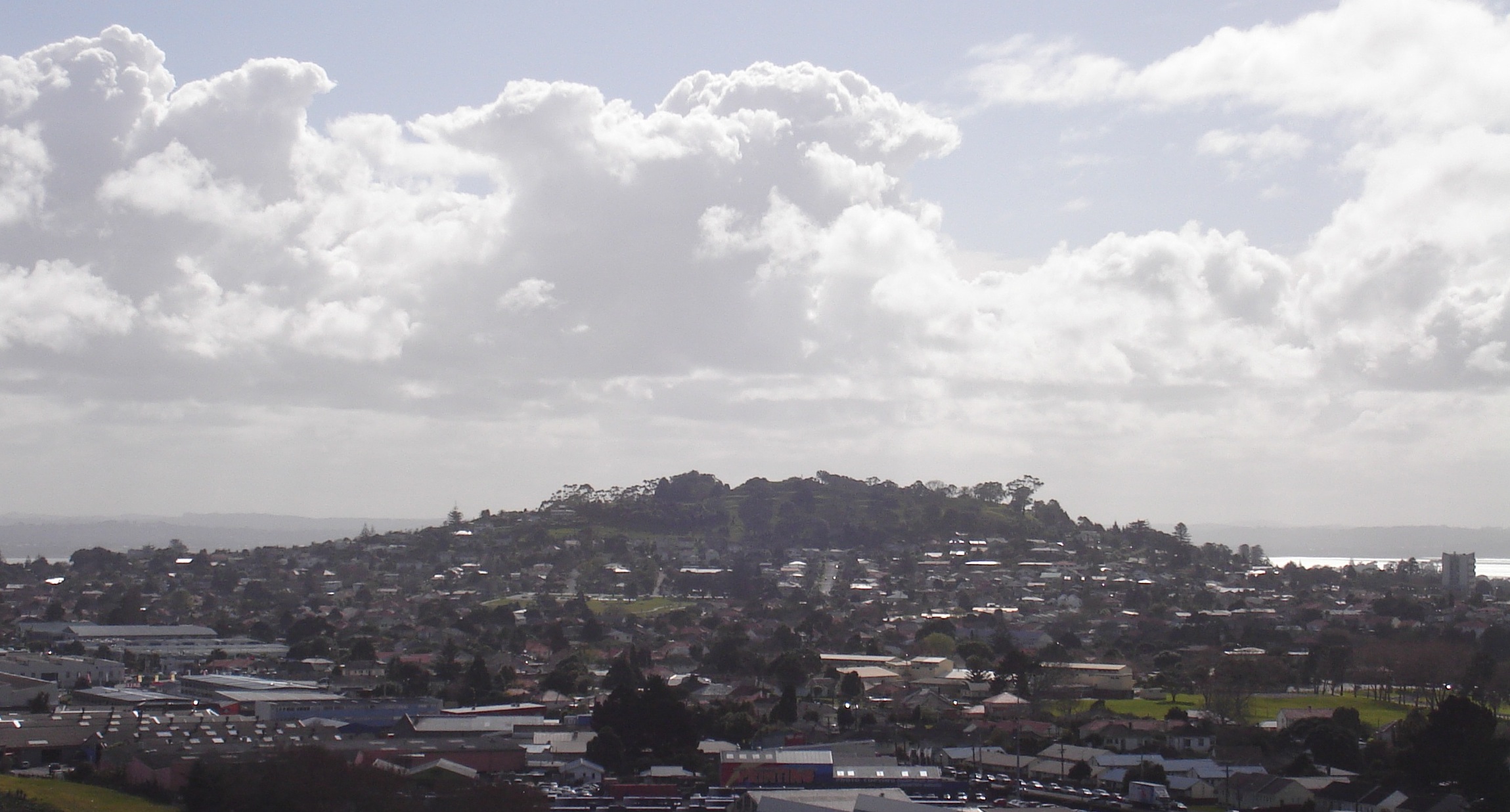
 The town centre, dominated by New North Road | |
 | |
| Coordinates: 36.884°S 174.716°E | |
| Country | New Zealand |
| City | Auckland |
| Local authority | Auckland Council |
| Electoral ward | Albert-Eden-Puketāpapa ward |
| Local board | Albert-Eden Local Board |
| Area | |
| • Land | 550 ha (1,360 acres) |
| Population (June 2021)[2] | |
| • Total | 15,710 |
| Train station(s) | Baldwin Avenue railway station Mount Albert railway station |
| Point Chevalier | Western Springs | Morningside |
| Waterview |
|
Sandringham |
| Avondale | Owairaka | Sandringham |
Volcano
The peak, in parkland at the southern end of the suburb, is 135 metres in height, and is one of the many extinct cones which dot the city of Auckland, all of which are part of the Auckland volcanic field.
Suburb
Mount Albert suburb was the second that developed in Auckland, after Remuera. It was mostly settled by well-off families in the late 1800s and early 1900s.[3] Significant growth occurred between the two world wars.[4] It is surrounded by the neighbouring suburbs of Owairaka, Sandringham, Morningside, Point Chevalier and Waterview. Its postcode is 1025.
Unitec Institute of Technology, a large tertiary educational college, is located towards the northern end of the suburb. The Mount Albert Research Centre (originally established by the DSIR) houses the Auckland centre of Plant & Food Research and other Crown Research Institutes. Fowlds Park lies in the northern area of Mount Albert.
Demographics
Mount Albert covers 5.50 km2 (2.12 sq mi)[1] and had an estimated population of 15,710 as of June 2021,[2] with a population density of 2,856 people per km2.
| Year | Pop. | ±% p.a. |
|---|---|---|
| 2006 | 13,689 | — |
| 2013 | 14,484 | +0.81% |
| 2018 | 15,204 | +0.98% |
| Source: [5] | ||
Mount Albert, comprising the statistical areas of Mount Albert West, Mount Albert North, Mount Albert Central, Mount Albert South and St Lukes, had a population of 15,204 at the 2018 New Zealand census, an increase of 720 people (5.0%) since the 2013 census, and an increase of 1,515 people (11.1%) since the 2006 census. There were 4,866 households, comprising 7,626 males and 7,584 females, giving a sex ratio of 1.01 males per female, with 2,877 people (18.9%) aged under 15 years, 3,741 (24.6%) aged 15 to 29, 7,107 (46.7%) aged 30 to 64, and 1,479 (9.7%) aged 65 or older.
Ethnicities were 60.3% European/Pākehā, 8.3% Māori, 8.1% Pacific peoples, 31.5% Asian, and 4.3% other ethnicities. People may identify with more than one ethnicity.
The percentage of people born overseas was 40.2, compared with 27.1% nationally.
Although some people chose not to answer the census's question about religious affiliation, 49.3% had no religion, 31.4% were Christian, 0.4% had Māori religious beliefs, 6.5% were Hindu, 3.5% were Muslim, 1.7% were Buddhist and 2.3% had other religions.
Of those at least 15 years old, 5,154 (41.8%) people had a bachelor's or higher degree, and 1,077 (8.7%) people had no formal qualifications. 2,850 people (23.1%) earned over $70,000 compared to 17.2% nationally. The employment status of those at least 15 was that 6,489 (52.6%) people were employed full-time, 1,893 (15.4%) were part-time, and 477 (3.9%) were unemployed.[5]
| Name | Area (km2) | Population | Density (per km2) | Households | Median age | Median income |
|---|---|---|---|---|---|---|
| Mount Albert West | 1.39 | 2,685 | 1,932 | 801 | 33.9 years | $30,100[6] |
| Mount Albert North | 1.51 | 4,044 | 2,678 | 1,323 | 33.6 years | $39,600[7] |
| Mount Albert Central | 1.31 | 3,669 | 2,801 | 1,113 | 35.1 years | $37,800[8] |
| Mount Albert South | 0.83 | 2,415 | 2,910 | 726 | 37.7 years | $35,700[9] |
| St Lukes | 0.46 | 2,391 | 5,198 | 903 | 31.3 years | $33,900[10] |
| New Zealand | 37.4 years | $31,800 |
Government
Mount Albert has been administered by Auckland Council since 2010, and Auckland City Council from 1989 to 2010. An early local government body was the Mount Albert Highway District Board, which was formed in 1866 and became Mount Albert Road Board in 1883. The road board became Mount Albert Borough Council in 1911, and then Mount Albert City Council in 1978. It amalgamated with Auckland City Council in a nationwide local government reorganisation in 1989.[11]
Mount Albert has been part of the Mount Albert electorate since 1946, except for the 1996–99 term, when it was the Owairaka electorate. The electorate has been held by Jacinda Ardern of the Labour Party since 25 February 2017.[12]
Mayors (1911–1978, Mount Albert Borough Council)
- Michael John Coyle, 1911–1914
- Murdoch McLean, 1914–1917
- Thomas Benjamin Clay, 1917–1921
- Alfred Ferdinand Bennett, 1921–1923
- Leonard Edgar Rhodes, 1923–1931
- Wilfred Fosberry Stilwell, 1931–1933
- Raymond Ferner, 1933–1936
- Henry Albert Anderson, 1936–1959
- Francis Gordon Turner, 1959–1968
- Frank Ryan, 1968–1978
Mayors (1978–1989, Mount Albert City Council)
- Frank Ryan, 1978–1989
Notable buildings and landmarks
- Mt Albert War Memorial Park. 773 New North Road.
- Mt Albert War Memorial Hall. 773 New North Road. Large modernist single span shell auditorium. Built in 1960 by the citizens of the borough of Mt Albert in memory of those who gave their lives in the service of their country. On 24 September 1989 the last civic function of the City of Mt Albert was held which marked the final act of 122 years of autonomous local government in Mt Albert.
- Mt Albert community and recreation centre. 773 New North Road.
- Rocket Park. Early 1960s children's playground with metal jungle gym shapes formed like planets, stars, comets, space ships & flying saucers.
- Mount Albert Baptist Church. 732 New North Rd. Modernist church from the 1950s.
- St Mary's Catholic Church. 10 Kitenui Ave. Roman Catholic Church attendant on the adjoining churches.
- Marist School. Alberton Avenue. Roman Catholic School.
- Marist College. 31 Alberton Ave. Roman Catholic Secondary School.
- Ferndale House. 830 New North Road. A wooden Carpenter Gothic house near the main shopping area. This was built by Jonathon Tonson Garlick as a four-room cottage in 1865 and extended in 1881. His widow sold it to Mount Albert Borough Council in the 1940s. The family firm 'Tonson Garlick' manufactured furniture. The property is distinguished by several enormous Norfolk pine trees planted in the 1860s. The house is now a community venue.[13][14]
- Mt Albert Methodist Church. 831 New North Road. Across the road from Ferndale is the wooden Gothic Mt Albert Methodist Church. The land for this building was donated by local resident Mr Stone.
- Mr Stone's House. 4 Alexis Avenue. Large masonry house in the Italianate style.
- Former Post Office. 911 New North Road. 1970s brick building with distinctive cylinder turrets.
- Mount Albert Railway Station. Opened in 1880, significantly upgraded 2013–16.
- Former Deluxe Cinema. 960 New North Road. 1920s building.
- Mt Albert Presbyterian Church. 14 Mt Albert Road.
- Alberton. 100 Mt Albert Road. A large wooden house with distinctive turrets, was built as the residence of Allan Kerr Taylor.[15] This two-storied wooden house has wrap-round verandahs and turrets in the Anglo-Indian style, possibly due to the family having spent time in India before coming to New Zealand. Originally this property commanded a view towards Auckland across a thousand-acre (4 km²) farm. Over the years the family sold off land for suburban development leaving only one acre around the house. Allan Kerr Taylor's wife Sophia was an outspoken advocate of the vote for women, as well as a singer, gardener and mother of 10. She ran the estate for 40 years after her husband's death, with her three unmarried daughters running it for a further 40 years, the last of whom left the house to the New Zealand Historic Places Trust in 1972. Allan Kerr Taylor had three brothers who lived in Auckland near the Tamaki River: Charles John Taylor at Glen Orchard (now St Heliers), William Innes Taylor at Glen Innes, and Richard James Taylor at Glen Dowie. The names of their properties later became the names of the suburbs. Claims of paranormal activity have been reported at the well-known homestead.[16]
- Crown Research Institute.120 Mt Albert Rd. The main building is a modernist highrise block from the 1960s. (Former DSIR – Department of Scientific and Industrial Research)
- Mount Albert School. Primary School on Taylor's Road. School built in its current location in 1940 on the site of Wilson's Quarry.
- Mount Albert Grammar School. Alberton Avenue. Main building from the 1920s was designed by Walter Arthur Cumming this school is unusual for an urban facility as it has an agricultural department - this is the last open ground left from the Alberton Farmlands.
- Mt Albert Aquatic Centre. 38 Alberton Ave, Mt Albert.
- Winstone House. 29 Summit Drive. Late 19th century Italianate style house located on the slopes of Mt Albert. Built for George Winstone in Upper Symonds Street and relocated here around 1910. George Winstone founded the well known Transport firm.
- Caughey House. 15 McLean Street. Distinctive house with turret. Moving to Mt Albert in 1888, Andrew Caughey (of Smith & Caughey's Department Store) built this two storied wooden house on 4-acres of Edward Allen's land. Architect Arthur White designed a 16-room house where Caughey, his wife and seven children lived until 1923. The property is now run as part of the private school, Hebron Christian College
- Former St Helens Hospital. 28a Linwood Ave. Officially opened on 15 February 1968.[17] One of a number of St Helens Hospitals built around New Zealand since 1905 and named by Prime Minister Rt Hon Richard J Seddon after the town of St Helens in Merseyside, England, near which he was born.[18] The hospital closed on 12 June 1990 following a formal closing ceremony.[19] The property was purchased by Auckland Institute of Studies in 1992,[20] refurbished and reopened the following year as the institute's St Helens Campus.


Notable residents
Rugby player Sonny Bill Williams and actress Lucy Lawless both grew up in Mount Albert. Former Prime Minister Helen Clark, famous acoustician Sir Harold Marshall and the former TVNZ's Breakfast presenter Petra Bagust are current residents of the area.
Famous New Zealand athlete, Sir Peter Snell (triple Olympic gold medalist and world mile record holder and NZ's athlete of the 20th century), was educated in and a long-time resident of Mt Albert as was Bryan Williams, an All Black great and president of the NZRFU.
Education
Mount Albert Grammar School is a high school (years 9–13) with a roll of 3034.[21] Opened in 1922, it was a single-sex boys' school until 2000, when it became co-educational.[22]
Marist College is a Catholic state-integrated girls' college (years 7–13) with a roll of 752.[23] The college was founded in 1928, and originally called Marist Sisters College,[24] changing its name to Marist College in 2000. Marist School is a Catholic contributing primary (years 1-6) school on the same site as Marist College. It has a roll of 304.[25]
Mount Albert School and Gladstone Primary School are contributing primary schools (years 1-6) with rolls of 430 and 786, respectively.[26][27] Te Kura Kaupapa Māori O Nga Maungarongo is a full primary school (years 1–8) with a roll of 78.[28] It is a Māori language-immersion school.
All these schools apart from Marist College are coeducational. Rolls are as of July 2022.[29]
Tertiary education providers in the area include Auckland Institute of Studies and Unitec.
Sport
Association football
Mount Albert is the home of association football club Metro F.C., who compete in the Lotto Sport Italia NRFL Premier, and Mount Albert-Ponsonby, who compete in the Lotto Sport Italia NRFL Division 2.
Rugby league
Mount Albert is home to both the Marist Saints and the Mount Albert Lions, who split from Marist in 1927. Both clubs compete in the Auckland Rugby League's top division, the Fox Memorial.
Transport
Mount Albert is well served by trains and buses, and is only 7 km from Auckland's CBD.[30] The railway station is centrally located, near the intersection of New North Road and Mt Albert/Carrington Road. Mount Albert Railway Station is a part of the Western Line; trains run regularly into the city and the western suburbs beyond.
The centre of all the shopping and business activities in the suburb of Mt Albert is New North Road, roughly between Richardson Road and Lloyd Avenue.
References
- "ArcGIS Web Application". statsnz.maps.arcgis.com. Retrieved 8 July 2022.
- "Population estimate tables - NZ.Stat". Statistics New Zealand. Retrieved 22 October 2021.
- "Mt Albert". The New Zealand Herald. 14 September 2005. Retrieved 19 November 2011.
- "So you want to live in...? Mt Albert". The New Zealand Herald. 14 June 2011. Retrieved 19 November 2011.
- "Statistical area 1 dataset for 2018 Census". Statistics New Zealand. March 2020. Mount Albert West (131900), Mount Albert North (132200), Mount Albert Central (134200), Mount Albert South (135200) and St Lukes (135800).
- 2018 Census place summary: Mount Albert West
- 2018 Census place summary: Mount Albert North
- 2018 Census place summary: Mount Albert Central
- 2018 Census place summary: Mount Albert South
- 2018 Census place summary: St Lukes
- "Mount Albert Highway District Rate Books 1867-1884". Auckland City Council. Retrieved 19 November 2011.
- "Mount Albert by-election Official Results". New Zealand Electoral Commission. Archived from the original on 10 September 2017. Retrieved 24 October 2017.
- "Ferndale House". Auckland Council. Archived from the original on 15 January 2012. Retrieved 19 November 2011.
- Turner, Arnold R. (March 2011). "Local heritage: Ferndale". Mount Albert Historical Society. Retrieved 19 November 2011.
- Stacpoole, John (1 September 2010). "Taylor, Allan Kerr". Dictionary of New Zealand Biography. Retrieved 19 November 2011.
- "Haunted by the memory of these visits". New Zealand Herald. Retrieved 3 June 2022.
- "1960 - 1970". National Women's Health. Retrieved 5 May 2015.
- "1906 - 1960". National Women's Health. Retrieved 5 May 2015.
- "1990 - 2000". National Women's Health. Retrieved 5 May 2015.
- "About AIS". Auckland Institute of Studies. Retrieved 5 May 2015.
- Education Counts: Mount Albert Grammar School
- "A brief history of Mount Albert Grammar School". Mount Albert Grammar School. Retrieved 17 July 2020.
- Education Counts: Marist College
- "The key to living to 100? Laughter". Stuff. 30 July 2016. Retrieved 11 June 2020.
- Education Counts: Marist School
- Education Counts: Mount Albert School
- Education Counts: Gladstone Primary School
- Education Counts: Te Kura Kaupapa Māori O Nga Maungarongo
- "New Zealand Schools Directory". New Zealand Ministry of Education. Retrieved 19 August 2022.
- "Public Transport". Auckland Transport. Archived from the original on 11 October 2012. Retrieved 16 October 2012.
- City of Volcanoes: A geology of Auckland - Searle, Ernest J.; revised by Mayhill, R.D.; Longman Paul, 1981. First published 1964. ISBN 0-582-71784-1.
- Volcanoes of Auckland: The Essential guide - Hayward, B.W., Murdoch, G., Maitland, G.; Auckland University Press, 2011.
External links
- Mt Albert Inc for community news and information
- Mount Albert Historical Society
- Early photo of Mount Albert
- Photographs of Mount Albert held in Auckland Libraries' heritage collections.
Другой контент может иметь иную лицензию. Перед использованием материалов сайта WikiSort.org внимательно изучите правила лицензирования конкретных элементов наполнения сайта.
WikiSort.org - проект по пересортировке и дополнению контента Википедии