world.wikisort.org - New_Zealand
Greenlane is a central isthmus suburb in Auckland, New Zealand.[3] It is bounded by Epsom to the west, Newmarket to the north, Remuera to the east and One Tree Hill to the south.
This article needs additional citations for verification. (January 2009) |
Greenlane | |
|---|---|
Suburb of Auckland | |
 The Logan Campbell statue at the western end of the suburb | |
 | |
| Coordinates: 36°53′29″S 174°47′34″E | |
| Country | New Zealand |
| City | Auckland |
| Local authority | Auckland Council |
| Electoral ward |
|
| Local board | |
| Area | |
| • Land | 199 ha (492 acres) |
| Population (June 2021)[2] | |
| • Total | 8,380 |
| Train station(s) | Greenlane Railway Station |
| Hospitals(s) | Greenlane Hospital |
| Newmarket | ||
| Epsom |
|
Remuera |
| Royal Oak | One Tree Hill | Ellerslie |
The Greenlane shops are situated at the intersection of Great South Road and Green Lane West. On the northern side of Green Lane West are located the Alexandra Park Raceway, the Auckland Showgrounds and the Campbell Park Tennis Club; on the southern side is Greenlane Hospital, Cornwall Park, Cornwall Cricket Club, and Maungakiekie / One Tree Hill and its park.
Within Auckland, the suburb is best-known for Cornwall Park, the Greenlane Clinical Centre, which is a large hospital complex, the Auckland Showgrounds, car yards and the Alexandra Park racecourse.
The suburb itself is one word (Greenlane), whereas the thoroughfare is two (Green Lane).
History
From the 1840s until the 1890s Greenlane was noted for its rich pasture land which supported both dairy herds and grain crops. Initially large country houses and farms dotted the landscape but from the 1890s onwards suburban development spread southwards from Newmarket across the fields of Epsom. Dr John Logan Campbell gifted part of his One Tree Hill farm to the city as a public park in 1901, coinciding with a visit from the Duke of Cornwall, after whom the park was named. Since the early 1990s there has been a considerable amount of property development, with clutches of townhouses built among the traditional tracts of villas and bungalows in some parts of Greenlane.
The broad, flat pastureland here at the intersection of Green Lane and Manukau Roads was used for sporting events from the 1850s onwards but the Alexandra Park Raceway and Auckland Showgrounds were only formally established around 1900. The Alexandra Park Raceway was named after the Duchess of Cornwall (later Queen Alexandra), and specialises in trotting races. The showgrounds have been the site of many trade exhibitions and agricultural shows, especially the annual Auckland Royal Easter Show and from 2022 the Lantern Festival makes its home here.
Adjacent to Alexandra Park was the Auckland Electric Tram Company tram depot. Established in 1902, the tram company had storage sheds and an administrative office block built here, as it was halfway between Auckland and Onehunga. The system was torn out in 1956 but the sheds remained here until the late 1970s when they were replaced by an office park. The administrative block survives as a restaurant.
The Greenlane shops were developed in conjunction with the tram line in the early 20th century, servicing the needs of the local community and visitors to the raceway, showgrounds, hospital, and parks. The make up of local businesses has changed over the years. In the past it was dominated by horseracing and pharmacies, though today is a centre for the motor vehicle trades. There are also a number of restaurants in the area. The elegant 1920s Lido Cinema still operates, one of the few stand alone suburban cinemas in Auckland to do so. The train station tucked next to the motorway makes for a swift commute to the CBD or south.
Demographics
Greenlane covers 1.99 km2 (0.77 sq mi)[1] and had an estimated population of 8,380 as of June 2021,[2] with a population density of 4,211 people per km2.
| Year | Pop. | ±% p.a. |
|---|---|---|
| 2006 | 7,074 | — |
| 2013 | 7,542 | +0.92% |
| 2018 | 8,010 | +1.21% |
| Source: [4] | ||
Greenlane had a population of 8,010 at the 2018 New Zealand census, an increase of 468 people (6.2%) since the 2013 census, and an increase of 936 people (13.2%) since the 2006 census. There were 2,577 households, comprising 3,825 males and 4,185 females, giving a sex ratio of 0.91 males per female, with 1,359 people (17.0%) aged under 15 years, 2,136 (26.7%) aged 15 to 29, 3,708 (46.3%) aged 30 to 64, and 804 (10.0%) aged 65 or older.
Ethnicities were 53.9% European/Pākehā, 5.7% Māori, 6.1% Pacific peoples, 40.1% Asian, and 3.4% other ethnicities. People may identify with more than one ethnicity.
The percentage of people born overseas was 45.2, compared with 27.1% nationally.
Although some people chose not to answer the census's question about religious affiliation, 48.2% had no religion, 35.2% were Christian, 0.2% had Māori religious beliefs, 4.5% were Hindu, 1.5% were Muslim, 3.7% were Buddhist and 2.1% had other religions.
Of those at least 15 years old, 2,925 (44.0%) people had a bachelor's or higher degree, and 504 (7.6%) people had no formal qualifications. 1,722 people (25.9%) earned over $70,000 compared to 17.2% nationally. The employment status of those at least 15 was that 3,639 (54.7%) people were employed full-time, 999 (15.0%) were part-time, and 222 (3.3%) were unemployed.[4]
| Name | Area (km2) | Population | Density (per km2) | Households | Median age | Median income |
|---|---|---|---|---|---|---|
| Greenlane North | 1.14 | 4,392 | 3,853 | 1,365 | 34.7 years | $40,600[5] |
| Greenlane South | 0.85 | 3,618 | 4,256 | 1,212 | 33.5 years | $41,100[6] |
| New Zealand | 37.4 years | $31,800 |
Greenlane Clinical Centre
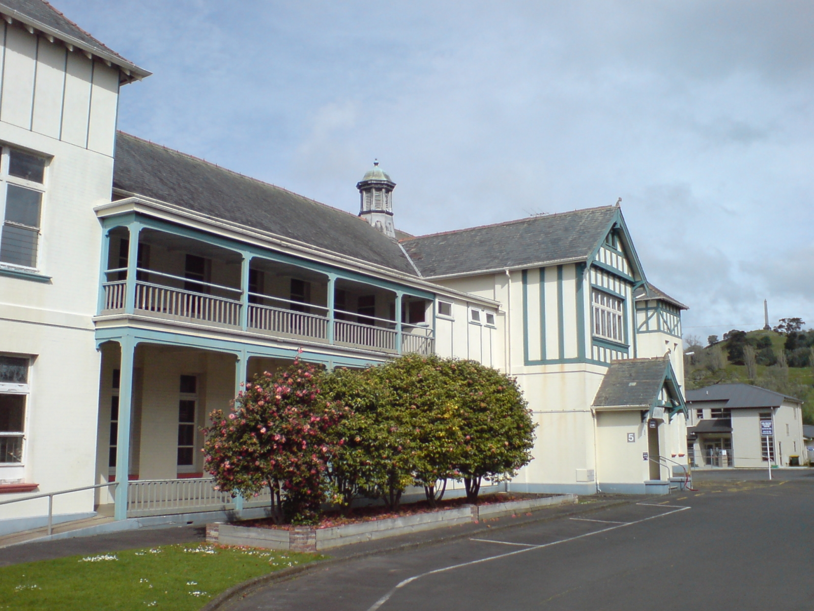
Greenlane Clinical Centre is one of the major hospital facilities within the jurisdiction of the Auckland District Health Board. The centre is a complex of several buildings dating from as early as the 1870s. One of the buildings was donated by Edward Costley, an Auckland businessman who bequeathed money for many charitable works. The National Women's Hospital building dates from the late 1950s and was an icon of modernity in its day.
Cornwall Park
During World War II large numbers of prefabricated buildings were constructed in the eastern part of Cornwall Park in readiness for wounded and sick American soldiers to be evacuated from Guadalcanal. The buildings were used during the 1950s and 60s as maternity wards until the adjacent National Women's Hospital was fully open. The buildings were progressively reduced in number in the 1960s although some remained standing empty until the mid 1970s. Now only the US flag pole and a plaque remain as a memorial to the wartime usage. The park is a thriving centre for socialising, photography and relaxation. Within the park grounds there is a licensed bistro, a cafe and coffee truck as well as a creamery selling icecreams and waffles. Cornwall Park Trust who manage this private park, put on free music concerts and educational nature workshops for the community. The iconic obelisk on top of Maungakiekie/One Tree Hill is visible night and day, thanks to the red light on its tip.
Politics
Greenlane falls across two parliamentary electorates:
- Epsom, represented by Member of Parliament David Seymour of the ACT Party
- Maungakiekie, represented by Member of Parliament Priyanca Radhakrishnan of the Labour Party
Since the 2010 amalgamation of councils, Greenlane also falls across two wards for electing local boards of the Auckland Council, and as of the 2022 local elections, the representation is as follows:
- Albert-Eden-Puketāpapa ward
- Maungakiekie-Tāmaki ward
Education
Cornwall Park District School is a coeducational contributing primary school (years 1-6) with a roll of 599 as of March 2022.[7][8] And Remuera Intermediate is also within zone.
The area is served by state secondary schools including Auckland Grammar School, Epsom Girls Grammar School and St Peter's College.
References
- "ArcGIS Web Application". statsnz.maps.arcgis.com. Retrieved 18 July 2022.
- "Population estimate tables - NZ.Stat". Statistics New Zealand. Retrieved 22 October 2021.
- "Map of Greenlane". zoomin.co.nz.
- "Statistical area 1 dataset for 2018 Census". Statistics New Zealand. March 2020. Greenlane North (142200) and Greenlane South (143800).
- 2018 Census place summary: Greenlane North
- 2018 Census place summary: Greenlane South
- "New Zealand Schools Directory". New Zealand Ministry of Education. Retrieved 23 April 2022.
- Education Counts: Cornwall Park District School
External links
- Photographs of Greenlane held in Auckland Libraries' heritage collections.
Другой контент может иметь иную лицензию. Перед использованием материалов сайта WikiSort.org внимательно изучите правила лицензирования конкретных элементов наполнения сайта.
WikiSort.org - проект по пересортировке и дополнению контента Википедии