world.wikisort.org - New_Zealand
Manapouri is a small town in Southland / Fiordland, in the southwest corner of the South Island, in New Zealand. The township is the westernmost municipality in New Zealand.[3] Located at the edge of the Fiordland National Park, on the eastern shore of Lake Manapouri, close to its outflow into the Waiau River, tourist boat services are based in the town.
Manapouri | |
|---|---|
 Manapouri township | |
 | |
| Coordinates: 45°34′0″S 167°36′0″E | |
| Country | New Zealand |
| Island | South Island |
| Region | Southland |
| Ward | Mararoa Waimea Ward |
| Government | |
| • Territorial Authority | Southland District Council |
| • Regional council | Southland Regional Council |
| Area | |
| • Total | 1.36 km2 (0.53 sq mi) |
| Elevation | 200 m (700 ft) |
| Population (2018 Census)[2] | |
| • Total | 222 |
| • Density | 160/km2 (420/sq mi) |
| Local iwi | Ngāi Tahu |
Manapouri township is a 20-minute drive from Te Anau via State Highway 95 The town is the gateway to both Doubtful Sound and Dusky Sound and the starting point for many local walking tracks. It is a popular tourist destination, particularly during the summer months.
History
At the intersection of State Highway 95 and Hillside Road is a monument to the Save Manapouri campaign which marks the first mass environmental movement in New Zealand history.
The Manapouri Hydroelectric Power Station is located on the West Arm of Lake Manapouri, with most of the electricity generated serving the Tiwai Point Aluminium Smelter (which is announced to close at the end of 2024).[4] Workers at the power plant are ferried by boat from Manapouri, as there is no road access to the power station. Manapouri was declared the "highest consumer of water" in New Zealand in 2010 because of the power station, which consumes 41 percent of the fresh water consumed by the entire country.[5] In 2002, the Government rejected an application of a business, Southland Water 2000, to bottle 40,000 cubic metres of water in 20 hours, twelve times a year, before the water from the power station is released into Doubtful Sound.[6]
Demographics
Manapouri is described by Statistics New Zealand as a rural settlement. It covers 1.36 km2 (0.53 sq mi),[1] and is part of the larger Mararoa statistical area.[7]
| Year | Pop. | ±% p.a. |
|---|---|---|
| 2006 | 294 | — |
| 2013 | 201 | −5.29% |
| 2018 | 222 | +2.01% |
| Source: [2] | ||
Manapouri had a population of 222 at the 2018 New Zealand census, an increase of 21 people (10.4%) since the 2013 census, and a decrease of 72 people (−24.5%) since the 2006 census. There were 102 households. There were 117 males and 108 females, giving a sex ratio of 1.08 males per female. The median age was 56.8 years (compared with 37.4 years nationally), with 21 people (9.5%) aged under 15 years, 30 (13.5%) aged 15 to 29, 111 (50.0%) aged 30 to 64, and 63 (28.4%) aged 65 or older.
Ethnicities were 94.6% European/Pākehā, 9.5% Māori, 1.4% Asian, and 4.1% other ethnicities (totals add to more than 100% since people could identify with multiple ethnicities).
Although some people objected to giving their religion, 54.1% had no religion, 41.9% were Christian and 2.7% had other religions.
Of those at least 15 years old, 30 (14.9%) people had a bachelor or higher degree, and 51 (25.4%) people had no formal qualifications. The median income was $30,400, compared with $31,800 nationally. The employment status of those at least 15 was that 108 (53.7%) people were employed full-time and 36 (17.9%) were part-time.[2]
Facilities & attractions
Commercial services include a petrol station/garage, art gallery, cafes, shops, two restaurant and bars as well as overnight hotel, motel and motor camp accommodations. The small Te Anau Airport is situated 5 kilometres (3.1 mi) north of the township and serves both Te Anau and Manapouri.
There are several tourist boat excursions based in Manapouri to service the Fiordland Sounds to fishing charters and boat hire. Excursions originating at Pearl Harbour at the southern end of Manapouri township take tourists across Lake Manapouri to view the underground hydroelectric facility, or continue on by bus over Wilmot Pass to boat tours of Doubtful Sound, adding up to a full day trip.

Walkways & Cycleways
Day walks are the Circle Track, the Hope Arm Track, the Shallow Bay portion of the Kepler Track and the Frazers Beach Reserve[8] walkways.
Supply Bay Road and the Rainbow Reach area are reasonably cycle-friendly. The Manapouri-Te Anau Cycle trail is currently still under negotiation between the Department of Conservation and the Fiordland Trails Trust.
A natural monument, in the form of Monument Hill, lies across the lake from the township. This sharply pointed landmark beneath the Hunter Mountains to the west on Manapouri township is a prized destination for adventurous trampers.
Kayaking
The eastern end of Lake Manapouri is possibly the best waterway in New Zealand for kayak exploration[according to whom?] with 20 islands and many coves, beaches, lagoons, waterfalls, huts, portages and channels with in a days return paddled from Manapouri township.
Lord of the Rings filming locations
Manapouri was a site of filming for Peter Jackson's the Lord of the Rings trilogy. During a late snowstorm one November, Manapouri Hall was used to film the scene in the Two Towers in which Frodo, Samwise and Gollum attempt to enter the black gates of Mordor.[9] According to Jackson, the townspeople only asked for a small fee for the film crew to use the hall but the production gifted a large sum for the refurbishment of the hall and in acknowledgement of the town's generosity.[10] The crew was not allowed to use large granite boulders located in the forest near Lake Manapouri and instead created artificial rocks, two of which were gifted to the townspeople. Other locations near the town were used for filming, including the Kepler Mire (for panning, aerial shots of the Dead Marshes and other swamps), Waiau River (for various shots of the River Anduin) and Norwest Lakes (for the iconic shot of the fellowship traversing mountain peaks).[11] It is also rumoured that locations in the Fiordland National Park were used in the Ring of Power season one, as a film crew were spotted near Manapouri.[12]
Climate
Manapouri has an oceanic climate (Cfb) under the Köppen climate classification with mild summers and cool to cold winters. In a typical winter season, snowfalls and snow on the ground are likely on a handful of occasions.[13]
| Climate data for Manapouri (1981−2010) | |||||||||||||
|---|---|---|---|---|---|---|---|---|---|---|---|---|---|
| Month | Jan | Feb | Mar | Apr | May | Jun | Jul | Aug | Sep | Oct | Nov | Dec | Year |
| Average high °C (°F) | 20.8 (69.4) |
20.6 (69.1) |
18.2 (64.8) |
14.9 (58.8) |
11.6 (52.9) |
8.4 (47.1) |
8.1 (46.6) |
10.0 (50.0) |
12.7 (54.9) |
14.9 (58.8) |
16.5 (61.7) |
18.9 (66.0) |
14.6 (58.3) |
| Daily mean °C (°F) | 14.7 (58.5) |
14.3 (57.7) |
12.1 (53.8) |
9.4 (48.9) |
7.0 (44.6) |
4.3 (39.7) |
3.8 (38.8) |
5.1 (41.2) |
7.4 (45.3) |
9.2 (48.6) |
10.7 (51.3) |
13.0 (55.4) |
9.2 (48.6) |
| Average low °C (°F) | 8.5 (47.3) |
8.0 (46.4) |
6.1 (43.0) |
4.0 (39.2) |
2.3 (36.1) |
0.3 (32.5) |
−0.7 (30.7) |
0.2 (32.4) |
2.1 (35.8) |
3.6 (38.5) |
4.9 (40.8) |
7.0 (44.6) |
3.9 (39.0) |
| Average precipitation mm (inches) | 85.4 (3.36) |
84.3 (3.32) |
86.5 (3.41) |
90.0 (3.54) |
100.9 (3.97) |
101.8 (4.01) |
82.0 (3.23) |
93.9 (3.70) |
100.0 (3.94) |
107.7 (4.24) |
91.1 (3.59) |
105.1 (4.14) |
1,128.6 (44.43) |
| Average precipitation days (≥ 1.0 mm) | 9.1 | 7.9 | 9.7 | 10.5 | 11.6 | 12.9 | 10.4 | 11.8 | 12.4 | 12.2 | 10.3 | 11.9 | 130.6 |
| Average relative humidity (%) | 78.5 | 83.6 | 85.3 | 88.9 | 90.8 | 91.4 | 91.4 | 91.4 | 85.4 | 82.6 | 76.4 | 76.3 | 85.2 |
| Source: NIWA Climate Data[14] | |||||||||||||
Gallery
 View from Frazers Beach Reserve
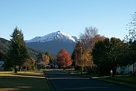 Autumn view along Mararoa Drive with snow-dusted Mount Moturau in the distance
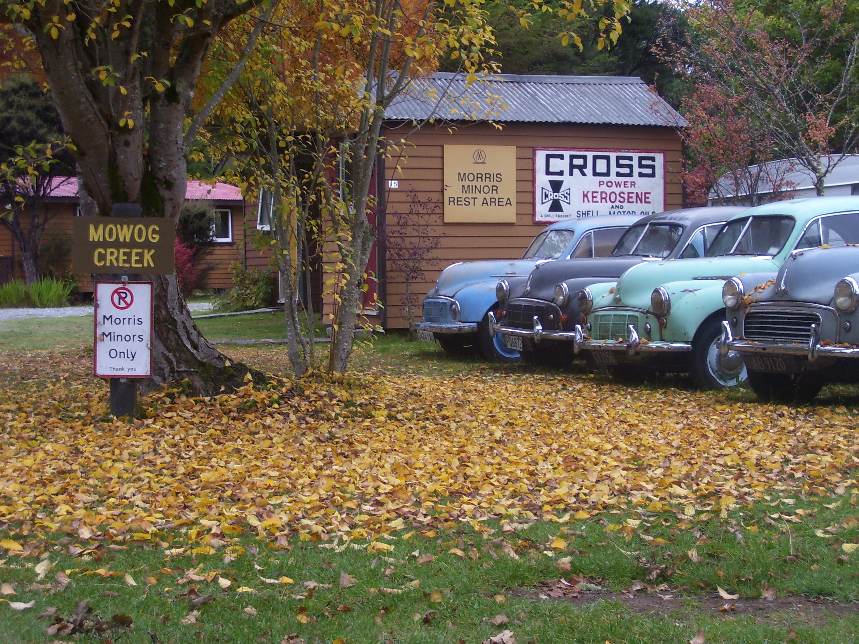
 Manapouri commerce
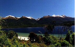
 Manapouri township from Lake Manapouri


References
- "ArcGIS Web Application". statsnz.maps.arcgis.com. Retrieved 27 January 2022.
- "Statistical area 1 dataset for 2018 Census". Statistics New Zealand. March 2020. 7029126.
- "Manapouri, Southland - NZ Topo Map". NZ Topo Map. Land Information New Zealand. Retrieved 7 November 2016.
- Harding, Evan. "Tiwai aluminium smelter to stay open until end of 2024". Stuff. Archived from the original on 14 January 2021. Retrieved 14 January 2021.
- Dan Hutchinson, "Manapouri NZ's biggest water consumer", 8 December 2010, https://www.stuff.co.nz/southland-times/news/4433869/Manapouri-NZs-biggest-water-consumer
- NZ Herald, "Fiordland water export scheme rejected", 8 April 2002, https://www.nzherald.co.nz/nz/fiordland-water-export-scheme-rejected/XQINOW24PDBE7BND7LXUXE4OUQ/
- 2018 Census place summary: Mararoa
- "Frazers Beach, Southland - NZ Topo Map". NZ Topo Map. Land Information New Zealand. Retrieved 7 November 2016.
- Ian Brodie, The Lord of the Rings Location Guidebook (2002, HarperCollins), 85.
- Director's commentary for the Two Towers (2002)
- Brodie, Location Guidebook, 84-85.
- Che Baker, "Reports Lord of the Rings' television crew in Manapouri", 21 February 2021, https://www.stuff.co.nz/entertainment/film/124287237/reports-lord-of-the-rings-television-crew-in-manapouri
- Neil Ratley (photo 11 of 12) (27 June 2012). "Snow adds to danger on roads". Stuff. Retrieved 7 November 2016.
- "Climate Data and Activities". NIWA. 28 February 2007. Retrieved 19 October 2013.
External links
| Wikimedia Commons has media related to Manapouri. |
На других языках
[de] Manapouri
Manapouri ist ein Dorf im Southland District der Region Southland auf der Südinsel von Neuseeland.- [en] Manapouri
Другой контент может иметь иную лицензию. Перед использованием материалов сайта WikiSort.org внимательно изучите правила лицензирования конкретных элементов наполнения сайта.
WikiSort.org - проект по пересортировке и дополнению контента Википедии