world.wikisort.org - Netherlands
Zoelen is a village in the Dutch province of Gelderland. It is a part of the municipality of Buren, and lies about 3 km north of Tiel. Castle Zoelen is located near the village.
Zoelen | |
|---|---|
Village | |
 Zoelen seen from the south | |
 Coat of arms | |
 Zoelen Location in the province of Gelderland  Zoelen Zoelen (Netherlands) | |
| Coordinates: 51.9102°N 5.4048°E | |
| Country | Netherlands |
| Province | Gelderland |
| Municipality | Buren |
| Area | |
| • Total | 12.31 km2 (4.75 sq mi) |
| Elevation | 5 m (16 ft) |
| Population (2021)[1] | |
| • Total | 1,540 |
| • Density | 130/km2 (320/sq mi) |
| Time zone | UTC+1 (CET) |
| • Summer (DST) | UTC+2 (CEST) |
| Postal code | 4011[1] |
| Dialing code | 0344 |
Zoelen was a separate municipality until 1978, when it was merged with Buren.[3]
History
It was first mentioned in 1139 as Sovlen, and means "settlement along the river Zoel".[4] The village developed as a stretched out settlement along the former river. The Stefanus Church is from 1545, however the tower and church contain 15th century elements.[5] In 1840, it was home to 918 people.[6]
Castle Soelen
Castle Soelen dates from the 13th century.[5] In 1355, it is destroyed by the Duke Edward of Gelre. In 1362, Arnold van Soelen submits to the Duke, and rebuilds the castle.[7] In 1574, the castle is burnt to ground to prevent it falling into Spanish hands. In 1643, it was rebuilt.[5] In 1992, the castle and the 157 hectares (390 acres) park became property of the State who transferred it to Staatsbosbeheer. The castle has been rebuilt as an apartment building.[6]
Gallery
 Church of Zoelen
![Castle Soelen [nl]](//upload.wikimedia.org/wikipedia/commons/thumb/9/94/Soelen_%2815%29.JPG/120px-Soelen_%2815%29.JPG) Castle Soelen
Castle Soelen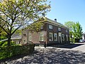 Farm in Zoelen
 De Linge near Zoelen

![Castle Soelen [nl]](http://upload.wikimedia.org/wikipedia/commons/9/94/Soelen_%2815%29.JPG)


References
- "Kerncijfers wijken en buurten 2021". Central Bureau of Statistics. Retrieved 21 March 2022.
two entries
- "Postcodetool for 4011BD". Actueel Hoogtebestand Nederland (in Dutch). Het Waterschapshuis. Retrieved 21 March 2022.
- Ad van der Meer and Onno Boonstra, Repertorium van Nederlandse gemeenten, KNAW, 2011.
- "Zoelen - (geografische naam)". Etymologiebank (in Dutch). Retrieved 21 March 2022.
- Ronald Stenvert & Sabine Broekhoven (2000). "Zoelen" (in Dutch). Zwolle: Waanders. p. 352. ISBN 90 400 9406 3. Retrieved 21 March 2022.
- "Zoelen". Plaatsengids (in Dutch). Retrieved 21 March 2022.
- "Kasteel Soelen in Zoelen". Regionaal Uitgelicht (in Dutch). Retrieved 21 March 2022.
External links
 Media related to Zoelen, Netherlands at Wikimedia Commons
| Authority control |
|
|---|
This Gelderland location article is a stub. You can help Wikipedia by expanding it. |
Другой контент может иметь иную лицензию. Перед использованием материалов сайта WikiSort.org внимательно изучите правила лицензирования конкретных элементов наполнения сайта.
WikiSort.org - проект по пересортировке и дополнению контента Википедии