world.wikisort.org - Netherlands
Utrechtse Heuvelrug (Dutch: [ˈytrɛxtsə ˈɦøːvəlrʏx] (![]() listen); English: "Utrecht Hill Ridge") is a municipality in the Netherlands, in the province of Utrecht. It was formed on 1 January 2006 by merging the former municipalities of Amerongen, Doorn, Driebergen-Rijsenburg, Leersum, and Maarn.
listen); English: "Utrecht Hill Ridge") is a municipality in the Netherlands, in the province of Utrecht. It was formed on 1 January 2006 by merging the former municipalities of Amerongen, Doorn, Driebergen-Rijsenburg, Leersum, and Maarn.
Utrechtse Heuvelrug | |
|---|---|
Municipality | |
 Utrecht Hill Ridge | |
 Flag Coat of arms | |
 Location in Utrecht | |
| Coordinates: 52°2′N 5°21′E | |
| Country | Netherlands |
| Province | Utrecht |
| Established | 1 January 2006[1] |
| Government | |
| • Body | Municipal council |
| • Mayor | Frits Naafs (VVD) |
| Area | |
| • Total | 133.94 km2 (51.71 sq mi) |
| • Land | 132.01 km2 (50.97 sq mi) |
| • Water | 1.93 km2 (0.75 sq mi) |
| Elevation | 7 m (23 ft) |
| Population (January 2019)[5] | |
| • Total | 49,515 |
| • Density | 375/km2 (970/sq mi) |
| Time zone | UTC+1 (CET) |
| • Summer (DST) | UTC+2 (CEST) |
| Postcode | 3940–3941, 3950–3959, 3970–3972 |
| Area code | 0343 |
| Website | www |
Name
The name of the municipality is derived from the Utrecht Hill Ridge, a ridge of sandhills that covers part of the province of Utrecht. All the former municipalities that merged into Utrechtse Heuvelrug are situated on the southern part of this ridge. In this southern part lies the Utrechtse Heuvelrug National Park, that covers 6,000 ha (15,000 acres) and was established in 2003.
Population centres
The municipality of Utrechtse Heuvelrug consists of the following cities, towns, villages and/or districts: Amerongen, Darthuizen, Doorn, Driebergen-Rijsenburg, Leersum, Maarn, Maarsbergen, Overberg.

Dutch topographic map of the municipality of Utrechtse Heuvelrug, June 2015
Transportation
Railway stations: Driebergen-Zeist, Maarn
Twin towns
 Victoria, Romania
Notable people

Public thinking & Public Service
- Frederick Nassau de Zuylestein (1624–1672) illegitimate son of Frederick Henry, Prince of Orange who gave him Castle Zuylestein in 1640
- Godert de Ginkell, 1st Earl of Athlone (1644 in Amerongen – 1703) a Dutch general in the service of England
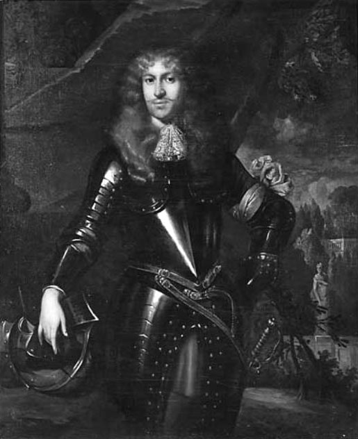
- William Nassau de Zuylestein, 1st Earl of Rochford (1649 in Castle Zuylestein – 1708) a Dutch soldier and diplomat in the service of his cousin William III of England
- Rogier Verbeek (1845 in Doorn – 1926) a Dutch geologist and natural scientist
- Wilhelm II, German Emperor (1859 – 1941 in Huis Doorn) the last German Emperor (Kaiser) and King of Prussia, lived in Doorn 1919–1941
- Princess Hermine Reuss of Greiz (1887–1947) married Wilhelm II (1859–1941) in Doorn
- Louis Beel (1902 in Roermond – 1977) a Dutch politician, Prime Minister of the Netherlands 1946/8 and 1958/1959
- Ria Beckers (1938 in Driebergen – 2006) Dutch politician, co-founder of the GreenLeft party
- Herman Wijffels (born 1942 in Turkeye) a retired Dutch politician and businessman.
- Ben Verwaayen (born 1952 in Driebergen) Dutch businessman, CEO of Alcatel-Lucent 2008/13.
- Aart Jan de Geus (born 1955 in Doorn) a retired Dutch politician and businessman
- Dick Benschop (born 1957 in Driebergen) a retired Dutch politician and businessman
- Olaf Stuger (born 1969 in Driebergen) a Dutch politician and Member of the European Parliament
- Tjalling Halbertsma (born 1969 in Doorn) a lawyer and anthropologist


The Arts
- Christian Mali (1832 in Darthuizen) – 1906) a German painter and art professor
- Anton van Wouw (1862 in Driebergen - 1945) sculptor, the father of South African sculpture
- Aldo van Eyck (1918 in Driebergen – 1999) an architect, protagonist of Structuralism.
- Peter Bree (1949 in Driebergen) a Dutch oboist and radio presenter
- Gijs Scholten van Aschat (born 1959 in Doorn) a Dutch actor[6]
- Job ter Burg (born 1972 in Maarn) a Dutch film editor[7]
- Nicky Romero (born 1989 in Amerongen) a Dutch musician, DJ, record producer and remixer
Sport
- Jan de Beaufort (1880 in Doorn – 1946) a Dutch fencer, competed at three Olympic Games
- Jops Reeman (1886 in Amerongen – 1959) a Dutch football player who won bronze in the 1908 Summer Olympics
- Gratia Schimmelpenninck van der Oye (1912 in Doorn – 2012) a Dutch alpine skier, competed at the 1936 Winter Olympics
- Carel Godin de Beaufort (1934 in Maarsbergen – 1964) a Dutch nobleman and motorsport driver
- Nienke Kingma (born 1982 in Driebergen) is a rower, silver medallist in the 2008 Summer Olympics and bronze medallist at the 2012 Summer Olympics
- Claudia Belderbos (born 1985 in Doorn) a Dutch rower who won bronze at the 2012 Summer Olympics
Gallery
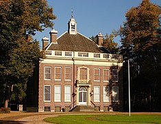 Sparrendaal Driebergen
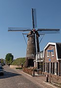 Amerongen, korenmolen Maallust
 Sterkenburg Castle
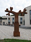 Doorn - Sculptuur voor het gemeentehuis op het Dorpsplein
 Maarn Tuindorpweg Bushokje
 Driebergen, church (de Grote Kerk)
 Doorn, heath: the Dartheide


References
- "Gemeentelijke indeling op 1 januari 2006" [Municipal divisions on 1 January 2006]. cbs.nl (in Dutch). CBS. Retrieved 9 April 2014.
- "College van B&W" [Board of mayor and aldermen] (in Dutch). Gemeente Utrechtse Heuvelrug. Retrieved 9 April 2014.
- "Kerncijfers wijken en buurten 2020" [Key figures for neighbourhoods 2020]. StatLine (in Dutch). CBS. 24 July 2020. Retrieved 19 September 2020.
- "Postcodetool for 3941HV". Actueel Hoogtebestand Nederland (in Dutch). Het Waterschapshuis. Retrieved 9 April 2014.
- "Bevolkingsontwikkeling; regio per maand" [Population growth; regions per month]. CBS Statline (in Dutch). CBS. 1 January 2019. Retrieved 1 January 2019.
- IMDb Database retrieved 31 August 2019
- IMDb Database retrieved 31 August 2019
External links
 Media related to Utrechtse Heuvelrug at Wikimedia Commons
- Official website
Places adjacent to Utrechtse Heuvelrug | ||||||||||||||||
|---|---|---|---|---|---|---|---|---|---|---|---|---|---|---|---|---|
| ||||||||||||||||
Municipalities of Utrecht | ||
|---|---|---|
|  | |
| ||
| Authority control: National libraries |
|---|
This Utrecht location article is a stub. You can help Wikipedia by expanding it. |
Другой контент может иметь иную лицензию. Перед использованием материалов сайта WikiSort.org внимательно изучите правила лицензирования конкретных элементов наполнения сайта.
WikiSort.org - проект по пересортировке и дополнению контента Википедии