world.wikisort.org - Netherlands
Rumpt is a village in the Betuwe region in the Netherlands. It is a part of the municipality of West Betuwe, and is situated about halfway between Utrecht and Den Bosch, on the Linge river.
Rumpt | |
|---|---|
Village | |
 House in Rumpt | |
 Coat of arms | |
 Rumpt Location in the Netherlands  Rumpt Rumpt (Netherlands) | |
| Coordinates: 51.88337°N 5.17689°E | |
| Country | Netherlands |
| Province | Gelderland |
| Municipality | West Betuwe |
| Area | |
| • Total | 9.67 km2 (3.73 sq mi) |
| Elevation | 2 m (7 ft) |
| Population (2021)[1] | |
| • Total | 745 |
| • Density | 77/km2 (200/sq mi) |
| Time zone | UTC+1 (CET) |
| • Summer (DST) | UTC+2 (CEST) |
| Postal code | 4156[1] |
| Dialing code | 0345 |
History
Rumpt was first mentioned as Rumpst around the year 960 in a document listing the possessions of St. Martin's Church in Utrecht. Other names used for the village and the surrounding areas in historical documents were Rumede, Romde en Rumt.[3] A stretched out esdorp developed along the Linge. The tower of the Dutch Reformed Church dates from around 1300. The church was built 15th century. The Catholic Church was built from 1851 to 1852 in neo-gothic style.[4]
In 1840, Rumpt was home to 658 people. The name was officially changed to Rumt in 1883, because the "p" is silent. The name change was undone in the early-20th century.[5]
Gallery
 Dutch Reformed Church in Rumpt
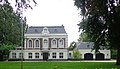 Villa "Domus Pacis"
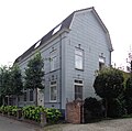 House in Rumpt
 Catholic Church in Rumpt


References
- "Kerncijfers wijken en buurten 2021". Central Bureau of Statistics. Retrieved 24 March 2022.
two entries
- "Postcodetool for 4156AA". Actueel Hoogtebestand Nederland (in Dutch). Het Waterschapshuis. Retrieved 24 March 2022.
- De Bommeler- en de Tielerwaard - F.A.J. Vermeulen
- Ronald Stenvert & Sabine Broekhoven (2000). "Rumpt" (in Dutch). Zwolle: Waanders. ISBN 90 400 9406 3. Retrieved 24 March 2022.
- "Rumpt". Plaatsengids (in Dutch). Retrieved 24 March 2022.
This Gelderland location article is a stub. You can help Wikipedia by expanding it. |
Другой контент может иметь иную лицензию. Перед использованием материалов сайта WikiSort.org внимательно изучите правила лицензирования конкретных элементов наполнения сайта.
WikiSort.org - проект по пересортировке и дополнению контента Википедии