world.wikisort.org - Netherlands
Raerd (Dutch: Rauwerd) is a village in Súdwest-Fryslân municipality in the province Friesland, the Netherlands. It had a population of around 630 in January 2017.[3]
Rauwerd
Raerd | |
|---|---|
Village | |
 | |
 Flag  Coat of arms | |
 Location in the former Boarnsterhim municipality | |
 Rauwerd Location in the Netherlands  Rauwerd Rauwerd (Netherlands) | |
| Coordinates: | |
| Country | |
| Province | |
| Municipality | |
| Area | |
| • Total | 7.67 km2 (2.96 sq mi) |
| Elevation | −0.1 m (−0.3 ft) |
| Population (2021)[1] | |
| • Total | 660 |
| • Density | 86/km2 (220/sq mi) |
| Postal code | 9012[1] |
| Dialing code | 0566 |
History
The village was first mentioned in the 13th century as Rawertham, and means "terp covered in reed".[4] In the 11th or 12th century, a dike was built along the Moezel river.[4] Raerd is a terp (artificial living hill) village with a radial structure dating from the early middle ages.[5] The village was located near the former Middelzee.[6]
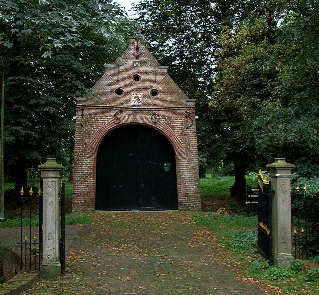
The Dutch Reformed church was built in 1814 as a replacement of its medieval predecessor.[5] When the stins Jongema State was built is unknown, but it was destroyed in 1515 by Saxon mercenaries, however the gate house remains. A 19th century villa is located at the former stins, but it is still surrounded by a double moat.[7] The forest around the estate are currently owned by It Fryske Gea and is a park with a large colony of rooks and herons.[6] The park has limited access during breeding season.[8]
Raerd was home to 549 people in 1840.[8] Before 2011, the village was part of the Boarnsterhim municipality and before 1984 it was the seat of Rauwerdhem municipality.[8]
Gallery
 Church of Raerd
 Former town hall of Rauwerdhem
 Gate of Jonhema State
 Houses in Raerd (1968)


References
- "Kerncijfers wijken en buurten 2021". Central Bureau of Statistics. Retrieved 6 April 2022.
- "Postcodetool for 9012CK". Actueel Hoogtebestand Nederland (in Dutch). Het Waterschapshuis. Retrieved 6 April 2022.
- Kerncijfers wijken en buurten 2017 - CBS Statline
- "Raerd - (geografische naam)". Etymologiebank (in Dutch). Retrieved 6 April 2022.
- Ronald Stenvert & Sabine Broekhoven (2000). "Raerd" (in Dutch). Zwolle: Waanders. ISBN 90 400 9476 4. Retrieved 6 April 2022.
- "Raerd". Friesland Wonderland (in Dutch). Retrieved 6 April 2022.
- "Jongema State te Rauwerd". Stinsen in Friesland (in Dutch). Retrieved 6 April 2022.
- "Raerd". Plaatsengids (in Dutch). Retrieved 6 April 2022.
External links
![]() Media related to Raerd at Wikimedia Commons
Media related to Raerd at Wikimedia Commons
Другой контент может иметь иную лицензию. Перед использованием материалов сайта WikiSort.org внимательно изучите правила лицензирования конкретных элементов наполнения сайта.
WikiSort.org - проект по пересортировке и дополнению контента Википедии