world.wikisort.org - Netherlands
Koudum is a village in the northern Netherlands. It is located in Súdwest-Fryslân, Friesland.[3] Nearby villages include Molkwerum to the west, Workum to the north and Hemelum to the south. The population of Koudum was 2,700 in 2019.[4][5] The nearest train station is the Koudum-Molkwerum railway station.[6]
Koudum | |
|---|---|
Village | |
 Martini church | |
 Flag  Coat of arms | |
 Location in the former Nijefurd municipality | |
 Koudum Location in the Netherlands  Koudum Koudum (Netherlands) | |
| Coordinates: | |
| Country | |
| Province | |
| Municipality | |
| Area | |
| • Total | 16.75 km2 (6.47 sq mi) |
| Elevation | 6 m (20 ft) |
| Population (2021)[1] | |
| • Total | 2,660 |
| • Density | 160/km2 (410/sq mi) |
| Postal code | 8723[1] |
| Dialing code | 0514 |
| Website | https://koudum.nl |
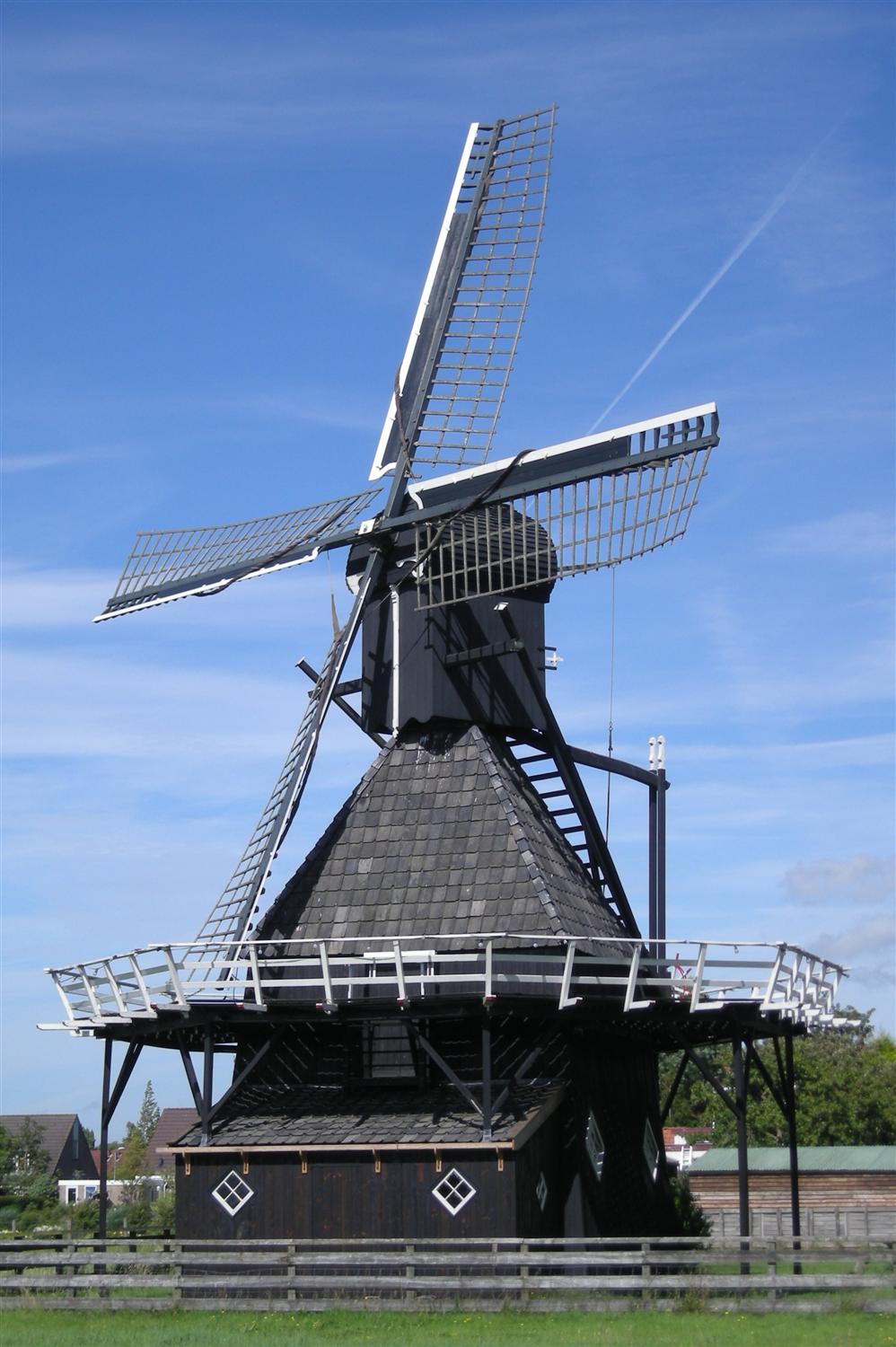
There is a restored windmill in the village, De Vlijt.
History
The village was first mentioned in 855 as Coluuidum, and means "charcoal woods".[7] Koudum developed on the higher clay ground in the Gaasterland region. It used to be a linear settlement with a little centre around the church.[8] Koudum was the capital of the former municipality of Hemelumer Oldeferd until 1984.[9]
Between 1614 and 1617, a church was built with a 60 metres (200 ft) high tower, however both the church and tower were replaced by a new church in 1857 with a more modest tower.[8][9]
Koudum was home to 925 people in 1840.[10] Before 2011, Koudum was the seat of the former municipality of Nijefurd. Before 1984, it was part of Hemelumer Oldeferd municipality.[10]
Population
- 1954 - 1,966
- 1959 - 1,861
- 1964 - 1,915
- 1969 - 2,213
- 1973 - 2,268
- 2004 - 2,600
- 2017 - 2,695
- 2019 - 2,700
De Vlijt
De Vlijt is a restored windmill in the village. The mill was originally built in the 18th century as a polder mill in Oppenhuizen or Sneek. In 1986, the mill was moved to its current location and rebuilt into a corn rack mill.[5]
Gallery
 View to the village from the polder
 Windmill De Vlijt
 Street view
 Village centre


References
- "Kerncijfers wijken en buurten 2021". Central Bureau of Statistics. Retrieved 6 April 2022.
two entries
- "Postcodetool for 8723AA". Actueel Hoogtebestand Nederland (in Dutch). Het Waterschapshuis. Retrieved 6 April 2022.
- "Omgeving Kuilart". De Kuilart [EN]. Retrieved 2020-02-12.
- Statistiek, Centraal Bureau voor de. "Kerncijfers wijken en buurten 2019". Centraal Bureau voor de Statistiek (in Dutch). Retrieved 2020-02-11.
- "Koudum". De Kuilart [EN]. Retrieved 2020-02-11.
- "Koudum-Molkwerum - OV in Nederland Wiki". wiki.ovinnederland.nl. Retrieved 2020-02-13.
- "Koudum - (geografische naam)". Etymologiebank (in Dutch). Retrieved 6 April 2022.
- Ronald Stenvert & Sabine Broekhoven (2000). "Koudum" (in Dutch). Zwolle: Waanders. ISBN 90 400 9476 4. Retrieved 6 April 2022.
- "Koudum". Friesland wonderland (in Dutch). Retrieved 6 April 2022.
- "Koudum". Plaatsengids (in Dutch). Retrieved 6 April 2022.
External links
![]() Media related to Koudum at Wikimedia Commons
Media related to Koudum at Wikimedia Commons
На других языках
- [en] Koudum
[ru] Каудюм
Каудюм (з.-фриз. Koudum) — деревня в общине Юго-Западная Фрисландия провинции Фрисландия на севере Нидерландов. Население Каудюма составляет 2687 жителей на 1 июля 2011 года.Другой контент может иметь иную лицензию. Перед использованием материалов сайта WikiSort.org внимательно изучите правила лицензирования конкретных элементов наполнения сайта.
WikiSort.org - проект по пересортировке и дополнению контента Википедии