world.wikisort.org - Netherlands
Oudega (West Frisian: Aldegea) is a small village in De Fryske Marren municipality in the province of Friesland, the Netherlands. It had a population of around 265 in 2017.[3]
Oudega
Aldegea | |
|---|---|
Village | |
 Oudega church | |
 Coat of arms | |
 Location in the former Gaasterlân-Sleat municipality | |
 Oudega Location in the Netherlands  Oudega Oudega (Netherlands) | |
| Coordinates: | |
| Country | |
| Province | |
| Municipality | |
| Area | |
| • Total | 6.53 km2 (2.52 sq mi) |
| Elevation | −1.0 m (−3.3 ft) |
| Population (2021)[1] | |
| • Total | 265 |
| • Density | 41/km2 (110/sq mi) |
| Postal code | 8582[1] |
| Dialing code | 0514 |
History
It was first mentioned in 1412 as Oldegae, and means "old village".[4] The Dutch Reformed Church dates from 1850, and has been built on a terp (artificial living mound). In 1840, Oudega was home to 366 people.[5]
Before 2014, Oudega was part of the Gaasterlân-Sleat municipality and before 1984 it belonged to Hemelumer Oldeferd which was named Hemelumer Oldephaert & Noordwolde (H.O.N.). before 1956.[5]
Gallery
![Art by Evert van Hemert [nl]](//upload.wikimedia.org/wikipedia/commons/thumb/0/0b/Fiets_kunst_van_Evert_van_Hemert.JPG/120px-Fiets_kunst_van_Evert_van_Hemert.JPG) Art by Evert van Hemert
Art by Evert van Hemert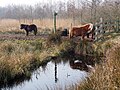 Ponies in Oudega
![Art by Evert van Hemert [nl]](http://upload.wikimedia.org/wikipedia/commons/0/0b/Fiets_kunst_van_Evert_van_Hemert.JPG)

References
- "Kerncijfers wijken en buurten 2021". Central Bureau of Statistics. Retrieved 29 March 2022.
- "Postcodetool for 8582KM". Actueel Hoogtebestand Nederland (in Dutch). Het Waterschapshuis. Retrieved 29 March 2022.
- Kerncijfers wijken en buurten 2017 - CBS
- "Oudega - (geografische naam)". Etymologiebank (in Dutch). Retrieved 29 March 2022.
- "Oudega (Gaasterland)". Plaatsengids (in Dutch). Retrieved 29 March 2022.
Wikimedia Commons has media related to Oudega (De Fryske Marren).
This Friesland location article is a stub. You can help Wikipedia by expanding it. |
Текст в блоке "Читать" взят с сайта "Википедия" и доступен по лицензии Creative Commons Attribution-ShareAlike; в отдельных случаях могут действовать дополнительные условия.
Другой контент может иметь иную лицензию. Перед использованием материалов сайта WikiSort.org внимательно изучите правила лицензирования конкретных элементов наполнения сайта.
Другой контент может иметь иную лицензию. Перед использованием материалов сайта WikiSort.org внимательно изучите правила лицензирования конкретных элементов наполнения сайта.
2019-2025
WikiSort.org - проект по пересортировке и дополнению контента Википедии
WikiSort.org - проект по пересортировке и дополнению контента Википедии