world.wikisort.org - Netherlands
Ooltgensplaat is a village in the Dutch province of South Holland. It is a part of the municipality of Goeree-Overflakkee, and lies about 17 km south of Spijkenisse.
Ooltgensplaat | |
|---|---|
Village | |
 Street view | |
 Coat of arms | |
 Ooltgensplaat Location in the province of South Holland in the Netherlands  Ooltgensplaat Location in the Netherlands | |
| Coordinates: 51.6825096°N 4.3453989°E | |
| Country | Netherlands |
| Province | South Holland |
| Municipality | Goeree-Overflakkee |
| Area | |
| • Total | 23.42 km2 (9.04 sq mi) |
| Elevation | 0.9 m (3.0 ft) |
| Population (2021)[1] | |
| • Total | 2,660 |
| • Density | 110/km2 (290/sq mi) |
| Time zone | UTC+1 (CET) |
| • Summer (DST) | UTC+2 (CEST) |
| Postal code | 3257[1] |
| Dialing code | 0187 |
History
The village was first mentioned in 1554 as Oitkensplate, and means "shoal of Oltken (person)".[3] Ooltgensplaat developed after the Het Oudeland polder was created between 1481 and 1483. The village has a harbour canal to the Volkerak. Ooltgensplaats became strategically important during the Eighty Years' War because it controlled the access to the Volkerak.[4]
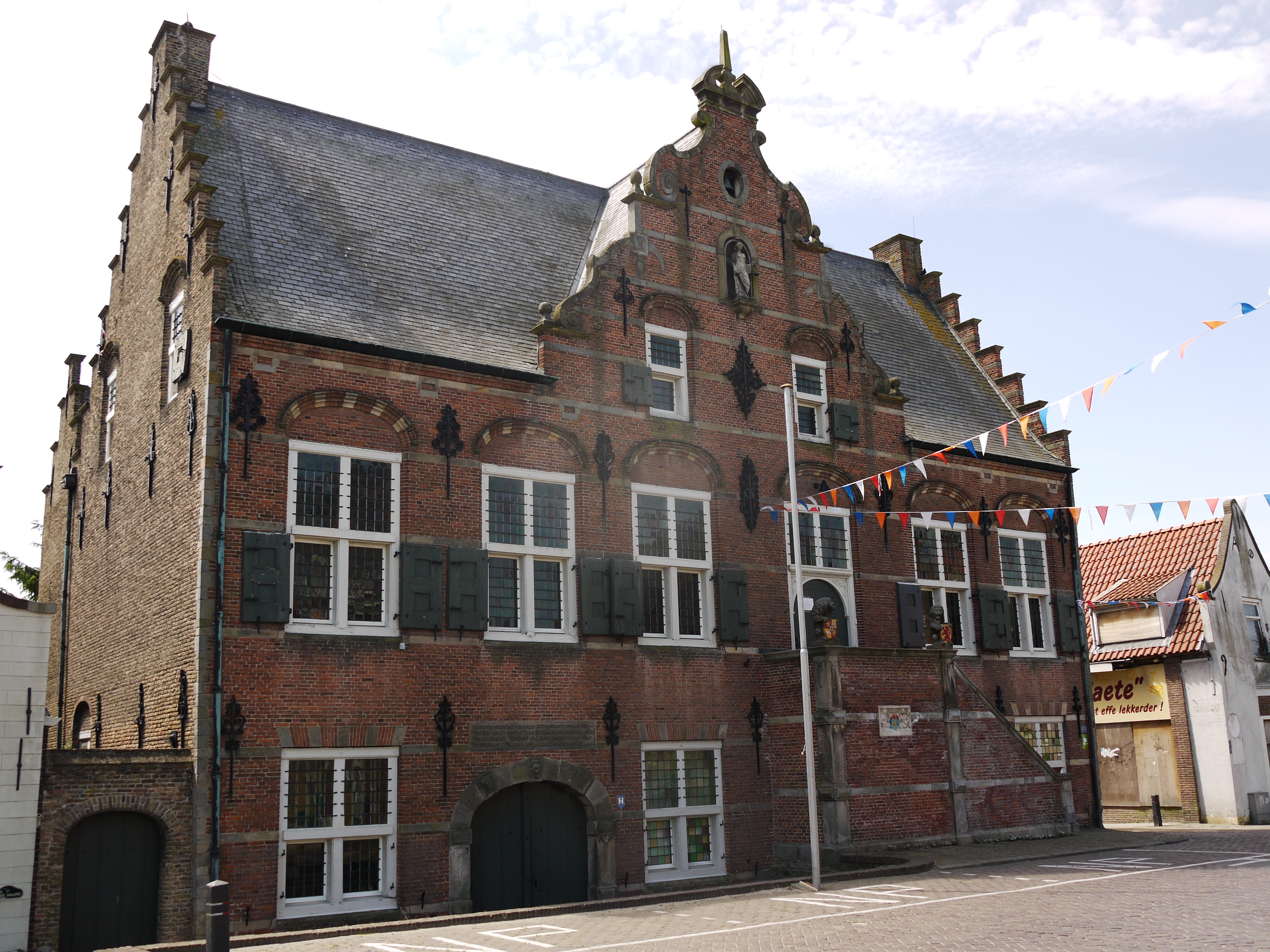
The Dutch Reformed church is an aisleless L-shaped church which was built in 1847 as a replacement of the 16th century church. The former town hall is a building in mannerist style built between 1617 and 1618. It was restored between 1938 and 1939, and many of the alterations from 1839 were undone.[4]
Fort Prins Hendrik was built as Fort Duquesne by the French. It is a square fortress surrounded by a moat with bastions on the corners. L-shaped barracks were added between 1880 and 1883. The fortress was decommissioned in 1928. In 1969, it was used as a holiday resort.[4] The company went bankrupt in 2014, and in 2018, the fort and surrounding area was bought by the municipality.[5]
Ooltgensplaat was home to 1,583 people in 1840.[5] It was a separate municipality until 1966, when it became part of Oostflakkee.[6] In 2013, it became part of the municipality of Goeree-Overflakkee.[5]
Gallery
 Dutch Reformed church
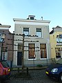 House in Oolgensplaat
 Former town hall
 Supermarket


References
- "Kerncijfers wijken en buurten 2021". Central Bureau of Statistics. Retrieved 3 May 2022.
- "Postcodetool for 3257AA". Actueel Hoogtebestand Nederland (in Dutch). Het Waterschapshuis. Retrieved 3 May 2022.
- "Ooltgensplaat - (geografische naam)". Etymologiebank (in Dutch). Retrieved 3 May 2022.
- Ronald Stenvert & Sabine Broekhoven (2004). "Ooltgensplaats" (in Dutch). Zwolle: Waanders. ISBN 90 400 9034 3. Retrieved 3 May 2022.
- "Ooltgensplaat". Plaatsengids (in Dutch). Retrieved 3 May 2022.
- Ad van der Meer and Onno Boonstra, Repertorium van Nederlandse gemeenten, KNAW, 2011.
Другой контент может иметь иную лицензию. Перед использованием материалов сайта WikiSort.org внимательно изучите правила лицензирования конкретных элементов наполнения сайта.
WikiSort.org - проект по пересортировке и дополнению контента Википедии