world.wikisort.org - Netherlands
Mander (Tweants: Maander) is a village in the Dutch province of Overijssel. It is a part of the municipality of Tubbergen, and lies about 15 km northeast of Almelo.
Mander
Maander (Twents) | |
|---|---|
Hamlet | |
 Bels' watermill | |
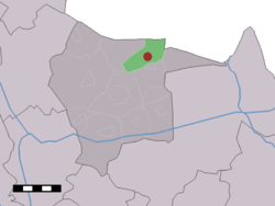 The village (dark red) and the statistical district (light green) of Mander in the municipality of Tubbergen. | |
 Mander Location in province of Overijssel in the Netherlands  Mander Mander (Netherlands) | |
| Coordinates: 52°27′N 6°50′E | |
| Country | Netherlands |
| Province | Overijssel |
| Municipality | Tubbergen |
| Area | |
| • Total | 10.06 km2 (3.88 sq mi) |
| Elevation | 33 m (108 ft) |
| Population (2021)[1] | |
| • Total | 625 |
| • Density | 62/km2 (160/sq mi) |
| Demonym(s) | Grupndrieters |
| Time zone | UTC+1 (CET) |
| • Summer (DST) | UTC+2 (CEST) |
| Postal code | 7664[1] |
| Dialing code | 0541 |
It was first mentioned in 797 as Manheri. The etymology is unclear.[3] In 1840, it was home 440 people.[4]
Among the points of special interest are two watermills, some hidden tumuli, and the land art project 'Mander Circles' by Paul de Kort.[4] The crop circles are old, and have not been made by aliens, but were constructed in the 1920s by Jannink to improve efficiency. The circles had become overgrown, and were restored in 2000. They are best observed from the air.[5]
Gallery
 Tumuli near mander
 Mander circles
 Mander circles
 View on Mander


References
- "Kerncijfers wijken en buurten 2021". Central Bureau of Statistics. Retrieved 17 March 2022.
- "Postcodetool for 7664VA". Actueel Hoogtebestand Nederland (in Dutch). Het Waterschapshuis. Retrieved 17 March 2022.
- "Mander - (geografische naam)". Etymologiebank (in Dutch). Retrieved 17 March 2022.
- "Mander". Plaatsengids (in Dutch). Retrieved 17 March 2022.
- "Mandercirkels". Hotspot Holland (in Dutch). Retrieved 17 March 2022.
Wikimedia Commons has media related to Mander.
This Overijssel location article is a stub. You can help Wikipedia by expanding it. |
Текст в блоке "Читать" взят с сайта "Википедия" и доступен по лицензии Creative Commons Attribution-ShareAlike; в отдельных случаях могут действовать дополнительные условия.
Другой контент может иметь иную лицензию. Перед использованием материалов сайта WikiSort.org внимательно изучите правила лицензирования конкретных элементов наполнения сайта.
Другой контент может иметь иную лицензию. Перед использованием материалов сайта WikiSort.org внимательно изучите правила лицензирования конкретных элементов наполнения сайта.
2019-2026
WikiSort.org - проект по пересортировке и дополнению контента Википедии
WikiSort.org - проект по пересортировке и дополнению контента Википедии