world.wikisort.org - Netherlands
Maasniel is a neighbourhood of Roermond in the Dutch province of Limburg. It is located east of the city centre.
Maasniel | |
|---|---|
Neighbourhood and former village | |
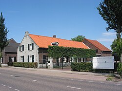
 Veterinarian in Maasniel | |
| Coordinates: 51°11′57″N 6°0′49″E | |
| Country | Netherlands |
| Province | Limburg |
| Municipality | Roermond |
| Area | |
| • Total | 1.01 km2 (0.39 sq mi) |
| Elevation | 27 m (89 ft) |
| Population (2021)[1] | |
| • Total | 3,610 |
| • Density | 3,600/km2 (9,300/sq mi) |
| Time zone | UTC+1 (CET) |
| • Summer (DST) | UTC+2 (CEST) |
| Postal code | 6042[1] |
| Dialing code | 0475 |
Maasniel used to be a separate village. It was a separate municipality until 1959, when it was merged with Roermond.[3]
References
- "Kerncijfers wijken en buurten 2021". Central Bureau of Statistics. Retrieved 25 April 2022.
- "Postcodetool for 6042AA". Actueel Hoogtebestand Nederland (in Dutch). Het Waterschapshuis. Retrieved 25 April 2022.
- Ad van der Meer and Onno Boonstra, "Repertorium van Nederlandse gemeenten", KNAW, 2006. "KNAW > Publicaties > Detailpagina". Archived from the original on 2007-02-20. Retrieved 2009-12-03.
На других языках
[de] Maasniel
Maasniel (limburgisch Neel) ist ein Stadtteil von Roermond und ein ehemaliges Dorf in der niederländischen Provinz Limburg. Bis 1959 war es eine selbstständige Gemeinde und wurde danach Stadtviertel von Roermond. Seit 2004 hat Maasniel wieder seine eigenen Ortstafeln.- [en] Maasniel
Текст в блоке "Читать" взят с сайта "Википедия" и доступен по лицензии Creative Commons Attribution-ShareAlike; в отдельных случаях могут действовать дополнительные условия.
Другой контент может иметь иную лицензию. Перед использованием материалов сайта WikiSort.org внимательно изучите правила лицензирования конкретных элементов наполнения сайта.
Другой контент может иметь иную лицензию. Перед использованием материалов сайта WikiSort.org внимательно изучите правила лицензирования конкретных элементов наполнения сайта.
2019-2025
WikiSort.org - проект по пересортировке и дополнению контента Википедии
WikiSort.org - проект по пересортировке и дополнению контента Википедии


