world.wikisort.org - Netherlands
Maarsbergen is a settlement in the Dutch province of Utrecht. It is a part of the municipality of Utrechtse Heuvelrug, and lies about 18 km east of Utrecht.
Maarsbergen | |
|---|---|
Village | |
 Valkenheide museum | |
 Maarsbergen Location in the Netherlands  Maarsbergen Maarsbergen (Netherlands) | |
| Coordinates: 52°3′27″N 5°24′19″E | |
| Country | Netherlands |
| Province | Utrecht |
| Municipality | Utrechtse Heuvelrug |
| Area | |
| • Total | 6.16 km2 (2.38 sq mi) |
| Elevation | 8 m (26 ft) |
| Population (2021)[1] | |
| • Total | 1,285 |
| • Density | 210/km2 (540/sq mi) |
| Time zone | UTC+1 (CET) |
| • Summer (DST) | UTC+2 (CEST) |
| Postal code | 3953[1] |
| Dialing code | 0343 |
| Major roads | A12, N226 |
History
It was first mentioned in 1134 as Merseberch. The etymology is unclear.[3] The village developed near Huis Maarsbergen. Huis Maarsbergen was a 15th century walled castle. The castle was confiscated in 1656, and sold to Samuel de Marez who transformed it into an estate. The Dutch Reformed Church was built between 1883 and 1884, and a tower was added in 1934.[4] In 1840, Maarsbergen was home to 262 people.[5] Between 1845 and 1972, there was a railway station in Maarsbergen.[6]
In 1934 it was the birthplace of Count Carel Pieter Antoni Jan Hubertus Godin de Beaufort, a motor racing driver who competed in Formula One between 1957 and 1964.
Gallery
 Huis Maarsbergen
 Hotel restaurant De Weistaar
 Former railway station
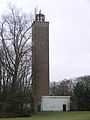 Watertower


References
- "Kerncijfers wijken en buurten 2021". Central Bureau of Statistics. Retrieved 27 March 2022.
three entries
- "Postcodetool for 3953BA". Actueel Hoogtebestand Nederland (in Dutch). Het Waterschapshuis. Retrieved 27 March 2022.
- "Maarsbergen - (geografische naam)". Etymologiebank (in Dutch). Retrieved 27 March 2022.
- Ronald Stenvert & Chris Kolman (1996). "Maarsbergen" (in Dutch). Zwolle: Waanders. ISBN 90 400 9757 7. Retrieved 26 March 2022.
- "Maarsbergen". Plaatsengids (in Dutch). Retrieved 27 March 2022.
- "Halte Maarsbergen". Stationweb (in Dutch). Retrieved 27 March 2022.
This Utrecht location article is a stub. You can help Wikipedia by expanding it. |
Другой контент может иметь иную лицензию. Перед использованием материалов сайта WikiSort.org внимательно изучите правила лицензирования конкретных элементов наполнения сайта.
WikiSort.org - проект по пересортировке и дополнению контента Википедии