world.wikisort.org - Netherlands
Lexmond is a village in the Dutch province of Utrecht. It is a part of the municipality of Vijfheerenlanden, and lies about 7 km south of IJsselstein.
Lexmond | |
|---|---|
Village | |
 | |
 Flag  Coat of arms | |
 Lexmond Location in the Netherlands  Lexmond Lexmond (Netherlands) | |
| Coordinates: 51.9620°N 5.0351°E | |
| Country | Netherlands |
| Province | Utrecht |
| Municipality | Vijfheerenlanden |
| Area | |
| • Total | 22.82 km2 (8.81 sq mi) |
| Elevation | 2 m (7 ft) |
| Population (2021)[1] | |
| • Total | 2,960 |
| • Density | 130/km2 (340/sq mi) |
| Time zone | UTC+1 (CET) |
| • Summer (DST) | UTC+2 (CEST) |
| Postal code | 4128[1] |
| Dialing code | 0347 |
Lexmond was a separate municipality in the province of South Holland until 1986, when it became part of Zederik.[3] When Zederik merged into the new municipality Vijfheerenlanden in 2019, it became a part of the province of Utrecht.[4]
History
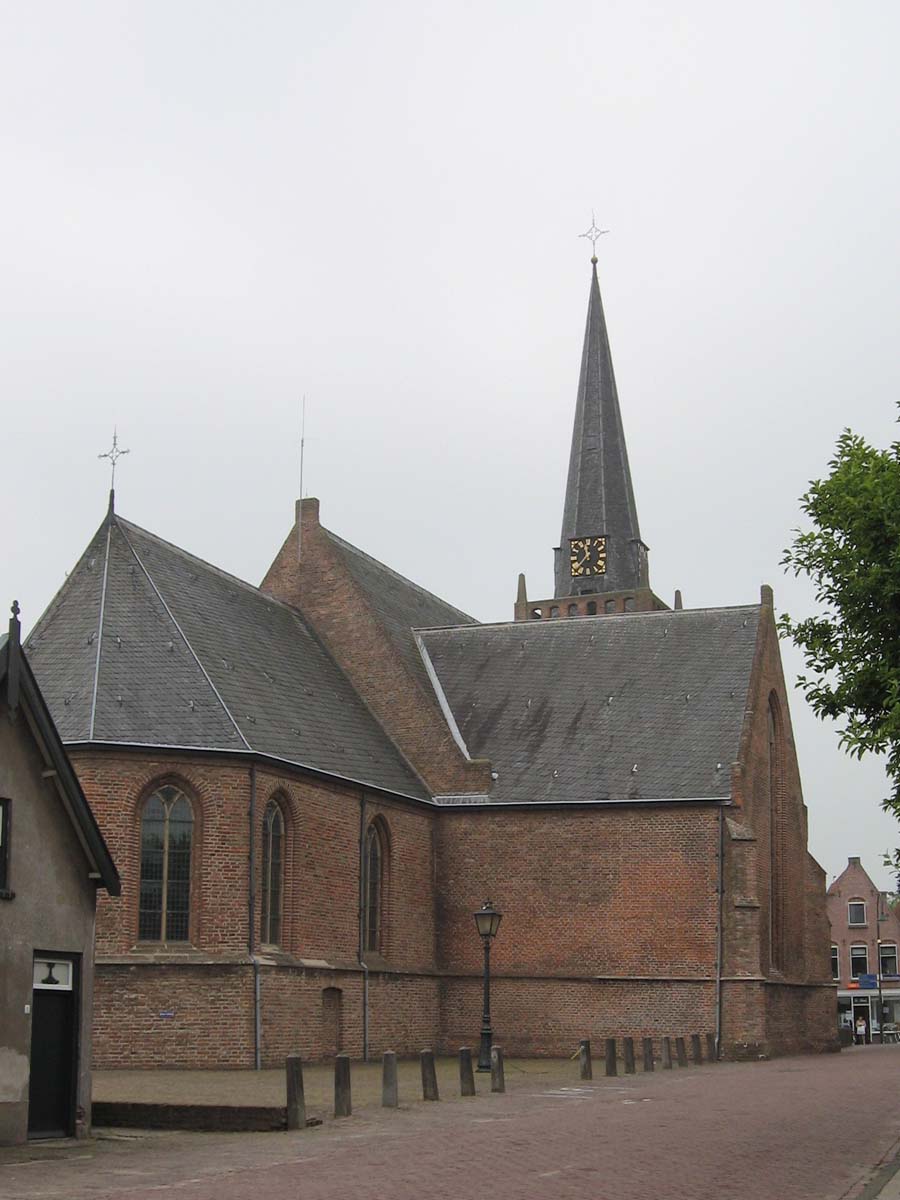
The village was first mentioned in 1180 as Lakesmunde, and means "mouth of the Laak (river)".[5] Lexmond started as a dike village along the Lek River. In 1277, the Laak was dammed and a little harbour was constructed. The Dutch Reformed Church dates from the 14th century and was extensively restored between 1954 and 1958.[6] In 1840, it was home to 700 people.[7]
Gallery
 New Reformed Church
 Lexmond in 1866.
 View on the pumping station


References
- "Kerncijfers wijken en buurten 2021". Central Bureau of Statistics. Retrieved 26 March 2022.
two entries
- "Postcodetool for 4128BK". Actueel Hoogtebestand Nederland (in Dutch). Het Waterschapshuis. Retrieved 26 March 2022.
- Ad van der Meer and Onno Boonstra, "Repertorium van Nederlandse gemeenten", KNAW, 2006. "KNAW > Publicaties > Detailpagina". Archived from the original on February 20, 2007. Retrieved December 3, 2009.
- "Fusiegemeente Vijfheerenlanden in provincie Utrecht". AD.nl. Retrieved 12 January 2019.
- "Lexmond - (geografische naam)". Etymologiebank (in Dutch). Retrieved 26 March 2022.
- Ronald Stenvert and Sabine Broekhoven (2004). Lexmond (in Dutch). Zwolle: Waanders. ISBN 90-400-9034-3. Retrieved 26 March 2022.
- "Lexmond". Plaatsengids (in Dutch). Retrieved 26 March 2022.
This Utrecht location article is a stub. You can help Wikipedia by expanding it. |
Другой контент может иметь иную лицензию. Перед использованием материалов сайта WikiSort.org внимательно изучите правила лицензирования конкретных элементов наполнения сайта.
WikiSort.org - проект по пересортировке и дополнению контента Википедии