world.wikisort.org - Netherlands
Kantens is a village in the Dutch province of Groningen. It is located in the municipality of Het Hogeland, about 16 km north of the city of Groningen. It had a population of around 965 including the surrounding area in January 2017.[3]
Kantens | |
|---|---|
Village | |
 The church of Kantens | |
 Kantens Location of Kantens in the province of Groningen  Kantens Kantens (Netherlands) | |
| Coordinates: 53°21′56″N 6°38′2″E | |
| Country | Netherlands |
| Province | Groningen |
| Municipality | Het Hogeland |
| Area | |
| • Total | 31.54 km2 (12.18 sq mi) |
| Elevation | 0.3 m (1.0 ft) |
| Population (2021)[1] | |
| • Total | 955 |
| • Density | 30/km2 (78/sq mi) |
| Postal code | 9995[1] |
| Dialing code | 0595 |
Kantens was a separate municipality until 1990, when it became a part of Hefshuizen.[4]
Gallery
 Landscape near Kantens
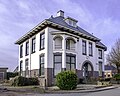 Villa in Kantens
 Street view
 Farm in Kantens


References
- "Kerncijfers wijken en buurten 2021". Central Bureau of Statistics. Retrieved 8 April 2022.
two entries
- "Postcodetool for 9995NC". Actueel Hoogtebestand Nederland (in Dutch). Het Waterschapshuis. Retrieved 8 April 2022.
- Kerncijfers wijken en buurten 2017 - CSB Statline
- Ad van der Meer and Onno Boonstra, "Repertorium van Nederlandse gemeenten", KNAW, 2006. "KNAW > Publicaties > Detailpagina". Archived from the original on 2007-02-20. Retrieved 2009-12-03.
External links
 Media related to Kantens at Wikimedia Commons
| Authority control |
|
|---|
This Groningen location article is a stub. You can help Wikipedia by expanding it. |
Текст в блоке "Читать" взят с сайта "Википедия" и доступен по лицензии Creative Commons Attribution-ShareAlike; в отдельных случаях могут действовать дополнительные условия.
Другой контент может иметь иную лицензию. Перед использованием материалов сайта WikiSort.org внимательно изучите правила лицензирования конкретных элементов наполнения сайта.
Другой контент может иметь иную лицензию. Перед использованием материалов сайта WikiSort.org внимательно изучите правила лицензирования конкретных элементов наполнения сайта.
2019-2026
WikiSort.org - проект по пересортировке и дополнению контента Википедии
WikiSort.org - проект по пересортировке и дополнению контента Википедии