world.wikisort.org - Netherlands
Noordwolde is a village in Het Hogeland municipality in the province of Groningen, the Netherlands. It had a population of around 275 in January 2017.[3]
Noordwolde | |
|---|---|
Village | |
 Noordwolde Church | |
 Noordwolde Location in the province of Groningen in the Netherlands  Noordwolde Noordwolde (Netherlands) | |
| Coordinates: 53°16′N 6°35′E | |
| Country | Netherlands |
| Province | Groningen |
| Municipality | Het Hogeland |
| Area | |
| • Total | 6.19 km2 (2.39 sq mi) |
| Elevation | −0.3 m (−1.0 ft) |
| Population (2021)[1] | |
| • Total | 260 |
| • Density | 42/km2 (110/sq mi) |
| Postal code | 9784[1] |
| Dialing code | 050 |
History
The village was first mentioned in 1384 as Nordawalda, and means "northern woods". Noord (north) was added to distinguish between Zuidwolde.[4] Noordwolde developed in the middle ages in a forest rich moorland. It was initially build on small house terps (artificial living hills), but developed into a linear settlement with two churches: Noordwolde and Zuidwolde.[5]
The Dutch Reformed church is built without transepts in the late-13th century, but has been modified several times throughout its history. The tower has a onion-shaped spire which was added in 1639.[5][6]
Noordwolde was home to 275 people in 1840.[6]
The draw bridge Ellerhuizerklap was constructed over the Boterdiep between 1927 and 1929. The bridge has one arm, due to the angular crossing. One armed bridges are very rare prior to 1940.[7] Noordwolde used to be part of the municipality of Bedum. In 2019, it became part of the municipality of Het Hogeland.[6]
Gallery
 Street view
 One armed draw bridge Ellerhuizerklap
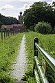 Footpath to Noordwolde
 Farm in Noordwolde


References
- "Kerncijfers wijken en buurten 2021". Central Bureau of Statistics. Retrieved 8 April 2022.
two entries
- "Postcodetool for 9784PA". Actueel Hoogtebestand Nederland (in Dutch). Het Waterschapshuis. Retrieved 8 April 2022.
- Kerncijfers wijken en buurten 2017 - CBS Statline
- "Noordwolde". Etymologiebank (in Dutch). Retrieved 8 April 2022.
- Ronald Stenvert & Redmer Alma (1998). "Zuidwolde" (in Dutch). Zwolle: Waanders. ISBN 90 400 9258 3. Retrieved 8 April 2022.
- "Noordwolde (Groningen)". Plaatsengids (in Dutch). Retrieved 8 April 2022.
- "Monumentnummer: 510679 Bij Willemsstreek 1 9784 TB te Noordwolde". Dutch Monument Register (in Dutch). Retrieved 8 April 2022.
This Groningen location article is a stub. You can help Wikipedia by expanding it. |
Другой контент может иметь иную лицензию. Перед использованием материалов сайта WikiSort.org внимательно изучите правила лицензирования конкретных элементов наполнения сайта.
WikiSort.org - проект по пересортировке и дополнению контента Википедии