world.wikisort.org - Netherlands
Hoevelaken is a town in the Dutch province of Gelderland. It is a part of the municipality of Nijkerk, and lies about 5 km east of Amersfoort.
Hoevelaken | |
|---|---|
Town | |
 Farm in Hoevelaken | |
 Flag  Coat of arms | |
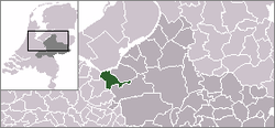 | |
 The town centre (dark green) and the statistical district (light green) of Hoevelaken in the municipality of Nijkerk. | |
| Coordinates: 52°10′N 5°28′E | |
| Country | Netherlands |
| Province | Gelderland |
| Municipality | Nijkerk |
| Area | |
| • Total | 7.38 km2 (2.85 sq mi) |
| Elevation | 4 m (13 ft) |
| Population (2021)[1] | |
| • Total | 9,570 |
| • Density | 1,300/km2 (3,400/sq mi) |
| Time zone | UTC+1 (CET) |
| • Summer (DST) | UTC+2 (CEST) |
| Postal code | 3871[1] |
| Dialing code | 033 |
Hoevelaken was a separate municipality until 2000, when it was merged with Nijkerk.[3]
History
It was first mentioned in 1132 as Hovelaken, and means "estate near the river Laak".[4] It started as a linear settlement. In 1402, the castle Huis te Hoevelaken was built. In 1672, it was destroyed and probably most of the village was destroyed as well. Between 1806 and 1809, the road from Amersfoort to Deventer was paved which resulted in an increase of economical activity in the village. The tower of the Dutch Reformed Church dates from the 16th century. The medieval church has disappeared during the extensions of 1866 and 1930.[5] In 1840, Hoevelaken was home to 742 people.[6]
Transport links
In national context, the town is mostly known because of the homonymous motorway interchange between the E30, E231 and E232. This interchange is an important hub for north- and eastbound traffic in the Netherlands.
Hoevelaken railway station opened in 2012 to serve the town.
Notable residents
- Henry Timmer, football player
- Levi van Veluw, artist and photographer
- Conny Vandenbos, singer
Gallery
 Railway station
 Huis te Hoevelaken
 Bandstand
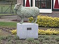 Sheep statue


References
- "Kerncijfers wijken en buurten 2021". Central Bureau of Statistics. Retrieved 23 March 2022.
- "Postcodetool for 3871AA". Actueel Hoogtebestand Nederland (in Dutch). Het Waterschapshuis. Retrieved 23 March 2022.
- Ad van der Meer and Onno Boonstra, Repertorium van Nederlandse gemeenten, KNAW, 2011.
- "Hoevelaken - (geografische naam)". Etymologiebank (in Dutch). Retrieved 23 March 2022.
- Ronald Stenvert & Sabine Broekhoven (2000). "Hoevelaken" (in Dutch). Zwolle: Waanders. p. 205. ISBN 90 400 9406 3. Retrieved 23 March 2022.
- "Hoevelaken". Plaatsengids (in Dutch). Retrieved 23 March 2022.
Authority control | |
|---|---|
| General |
|
| National libraries | |
Другой контент может иметь иную лицензию. Перед использованием материалов сайта WikiSort.org внимательно изучите правила лицензирования конкретных элементов наполнения сайта.
WikiSort.org - проект по пересортировке и дополнению контента Википедии