world.wikisort.org - Netherlands
Haule (West Frisian: De Haule) is a village consisting of about 600 inhabitants in the municipality of Ooststellingwerf[3] in the east of Friesland in the Netherlands.
Haule
De Haule | |
|---|---|
Village | |
 Protestant Church | |
 Location in Ooststellingwerf municipality | |
 Haule Location in the Netherlands  Haule Haule (Netherlands) | |
| Coordinates: | |
| Country | |
| Province | |
| Municipality | |
| Area | |
| • Total | 14.70 km2 (5.68 sq mi) |
| Elevation | 6 m (20 ft) |
| Population (2021)[1] | |
| • Total | 590 |
| • Density | 40/km2 (100/sq mi) |
| Postal code | 8432[1] |
| Dialing code | 0516 |
The village was first mentioned in 1408 as Die Hauwele. The etymology is unclear.[4] Haule started as a stretched agricultural community on a sandy ridge surrounded by moorland. Up to the 16th century, wolves used to roam the wilderness. The church was built in 1328. Haule was home to 142 people in 1840.[5]
Gallery
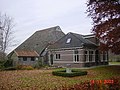 Farm in Haule
 The Blauwe Bos (Blue Forest)


References
- "Kerncijfers wijken en buurten 2021". Central Bureau of Statistics. Retrieved 1 April 2022.
- "Postcodetool for 8432PA". Actueel Hoogtebestand Nederland (in Dutch). Het Waterschapshuis. Retrieved 1 April 2022.
- Villages Archived 2017-09-28 at the Wayback Machine - Ooststellingwerf Municipality (in Dutch)
- "Haule - (geografische naam)". Etymologiebank (in Dutch). Retrieved 1 April 2022.
- "Haule". Plaatsengids (in Dutch). Retrieved 1 April 2022.
External links
 Media related to Haule, Ooststellingwerf at Wikimedia Commons
- Korfball club VZK De Haule
This Friesland location article is a stub. You can help Wikipedia by expanding it. |
Текст в блоке "Читать" взят с сайта "Википедия" и доступен по лицензии Creative Commons Attribution-ShareAlike; в отдельных случаях могут действовать дополнительные условия.
Другой контент может иметь иную лицензию. Перед использованием материалов сайта WikiSort.org внимательно изучите правила лицензирования конкретных элементов наполнения сайта.
Другой контент может иметь иную лицензию. Перед использованием материалов сайта WikiSort.org внимательно изучите правила лицензирования конкретных элементов наполнения сайта.
2019-2026
WikiSort.org - проект по пересортировке и дополнению контента Википедии
WikiSort.org - проект по пересортировке и дополнению контента Википедии