world.wikisort.org - Netherlands
Dronryp (Dutch: Dronrijp[3]) is a village in the Dutch municipality of Waadhoeke. On 1 January 2017, it had 3,281 inhabitants.[4]
Dronryp
Dronrijp | |
|---|---|
Village | |
 Street in 2010 | |
 Flag  Coat of arms | |
 Location in the province of Friesland in the Netherlands | |
 Location in the municipality of Menameradiel | |
 Dronryp Location in the Netherlands  Dronryp Dronryp (Netherlands) | |
| Coordinates: 53°12′N 5°39′E | |
| Country | |
| Province | |
| Municipality | |
| Area | |
| • Total | 15.83 km2 (6.11 sq mi) |
| Elevation | 0.7 m (2.3 ft) |
| Population (2021)[1] | |
| • Total | 3,275 |
| • Density | 210/km2 (540/sq mi) |
| Postal code | 9035[1] |
| Dialing code | 0517 |
History and architecture
Before 2018, the village was part of the Menameradiel municipality. A few centuries BC, a settlement developed around where the street Tsjerkebuorren is now (Stenvert et al., 2000). Another settlement came into existence nearby when a canal between Leeuwarden and Harlingen was completed in 1507. (Part of it was filled up in 1940.) Between roughly 1850 and 1950, these two gradually merged.
The oldest known reference to the village dates from 1132, when it was called Denningrip, meaning a "rip" (narrow stretch of land) where a family called Drenninga lived.[5]
Of the old mansions in the area only the early 18th century Schatzenburg remains.
Miscellaneous information
The van Harinxmakanaal, completed in 1953, runs along the south side of the town. The A31 runs along the north side. Dronryp also has a railway station.
Painter Sir Lawrence Alma-Tadema was born in the house at Dûbelestreek 2, Eise Eisinga, famous for his planetarium, at Tsjerkebuorren 13.
Transportation
Windmills
There are three windmills in Dronryp; De Poelen, Kingmatille, and the Hatsumermolen.
Gallery
 Church of Dronryp
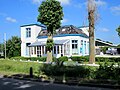 Restaurant "Op Hatsum"
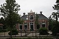 House in Dronryp
 Houses in Dronryp


References
- Stenvert, R. et al. (2000), Monumenten in Nederland: Fryslân, Waanders Uitgevers, Zwolle, the Netherlands. ISBN 90-400-9476-4.
- "Kerncijfers wijken en buurten 2021". Central Bureau of Statistics. Retrieved 4 April 2022.
- "Postcodetool for 9035AA". Actueel Hoogtebestand Nederland (in Dutch). Het Waterschapshuis. Retrieved 4 April 2022.
- Taalunie (2019). "Friese namen" (in Dutch). Retrieved 18 November 2019.
- Feiten en cijfers - Menameradiel
- Groenedijk, T. (2000). Nederlandse plaatsnamen. Slingenberg Boekproducties, Hoogeveen, 2000. ISBN 90-76113-81-5. (Presumably, Groenedijk means "Drenningrip" here.)
External links
 Media related to Dronryp at Wikimedia Commons
Authority control | |
|---|---|
| General | |
| National libraries | |
Другой контент может иметь иную лицензию. Перед использованием материалов сайта WikiSort.org внимательно изучите правила лицензирования конкретных элементов наполнения сайта.
WikiSort.org - проект по пересортировке и дополнению контента Википедии