world.wikisort.org - Netherlands
Dalerpeel is a village in the Netherlands and it is part of the Coevorden municipality in Drenthe.
Dalerpeel | |
|---|---|
Village | |
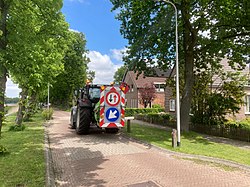 Tractor in Dalerpeel | |
 Dalerpeel  Dalerpeel | |
| Coordinates: 52°40′43″N 6°39′32″E | |
| Country | Netherlands |
| Province | Drenthe |
| Municipality | Coevorden |
| Area | |
| • Total | 14.49 km2 (5.59 sq mi) |
| Elevation | 13 m (43 ft) |
| Population (2021)[1] | |
| • Total | 860 |
| • Density | 59/km2 (150/sq mi) |
| Time zone | UTC+1 (CET) |
| • Summer (DST) | UTC+2 (CEST) |
| Postal code | 7751 & 7753[1] |
| Dialing code | 0528 |
Dalerpeel was first mentioned in 1936, and means "the swamp of Dalen".[3] It was originally a peat colony and the workers came from North Brabant. The village shares resources with neighbouring Nieuwe Krim.[4]
References
- "Kerncijfers wijken en buurten 2021". Central Bureau of Statistics. Retrieved 12 March 2022.
two entries. Postcode 7753 is the village proper
- "Postcodetool for 7751AA". Actueel Hoogtebestand Nederland (in Dutch). Het Waterschapshuis. Retrieved 12 March 2022.
- "Dalerpeel - (geografische naam)". Etymologiebank (in Dutch). Retrieved 12 March 2022.
- "Dalerpeel". Plaatsengids (in Dutch). Retrieved 12 March 2022.
| Wikimedia Commons has media related to Dalerpeel. |
This Drenthe location article is a stub. You can help Wikipedia by expanding it. |
Текст в блоке "Читать" взят с сайта "Википедия" и доступен по лицензии Creative Commons Attribution-ShareAlike; в отдельных случаях могут действовать дополнительные условия.
Другой контент может иметь иную лицензию. Перед использованием материалов сайта WikiSort.org внимательно изучите правила лицензирования конкретных элементов наполнения сайта.
Другой контент может иметь иную лицензию. Перед использованием материалов сайта WikiSort.org внимательно изучите правила лицензирования конкретных элементов наполнения сайта.
2019-2026
WikiSort.org - проект по пересортировке и дополнению контента Википедии
WikiSort.org - проект по пересортировке и дополнению контента Википедии