world.wikisort.org - Netherlands
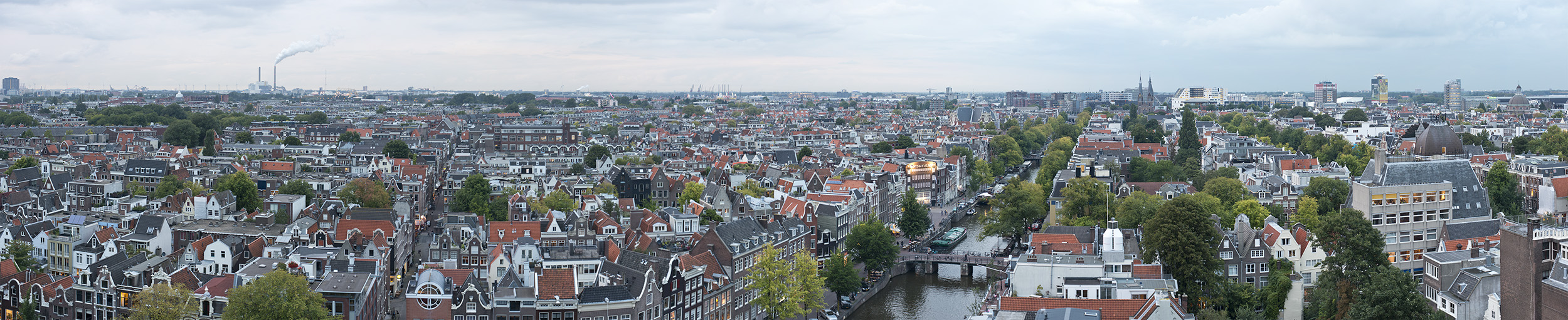
The Amsterdam metropolitan area (Dutch: Metropoolregio Amsterdam) is the city region around the city of Amsterdam, the capital of the Netherlands. It lies in the Noordvleugel (English: "North Wing") of the larger polycentric Randstad metropolitan area and encompasses the city of Amsterdam, the provinces of North Holland and Flevoland, as well as 36 further municipalities within the two provinces,[4] with a total population of over 2.5 million inhabitants.
Greater Amsterdam
Metropoolregio Amsterdam | |
|---|---|
Metropolitan region | |
| Metropolitan Region Amsterdam | |
    | |
 Flag  Coat of arms | |
| Motto(s): Heldhaftig, Vastberaden, Barmhartig (Valiant, Steadfast, Compassionate) | |
| Coordinates: 52°22′00″N 4°54′00″E | |
| Country | Netherlands |
| Provinces | North Holland Flevoland |
| Core city | Amsterdam |
| Satellite cities | Almere, Haarlem, Zaanstad, Haarlemmermeer, Hilversum, Amstelveen, Purmerend, Lelystad, Velsen, Gooise Meren, Huizen, Beverwijk, Heemskerk, Aalsmeer |
| Area | |
| • Metropolitan region | 2,580.26 km2 (996.24 sq mi) |
| • Urban | 1,140.2 km2 (440.2 sq mi) |
| • Agglomeration[lower-alpha 2] | 448.44 km2 (173.14 sq mi) |
| • Municipality[lower-alpha 3] | 219.32 km2 (84.68 sq mi) |
| Population (2021) | |
| • Metropolitan region | 2,520,000 |
| • Density | 980/km2 (2,500/sq mi) |
| • Urban | 1,575,263 |
| • Urban density | 1,400/km2 (3,600/sq mi) |
| • Agglomeration | 1,112,165 |
| • Agglomeration density | 2,500/km2 (6,400/sq mi) |
| • Municipality | 871,873 |
| • Municipality density | 4,000/km2 (10,000/sq mi) |
| Demonym | Amsterdammer |
| Time zone | UTC+1 (CET) |
| • Summer (DST) | UTC+2 (CEST) |
| Area codes | 020, 036, 023, 075, 0252, 0297, 0299, 0320, 0294, 035, 0251, |
| GeoTLD | .amsterdam |
| Website | www |
The administrative responsibility for the Amsterdam metropolitan area lies with the Amsterdam Metropolitan Area Central Administration (BKG).
Members
- Provinces of North Holland and Flevoland
- Municipalities of Aalsmeer, Almere, Amstelveen, Amsterdam, Beemster, Beverwijk, Blaricum, Bloemendaal, Diemen, Edam-Volendam, Gooise Meren, Haarlem, Haarlemmermeer, Heemskerk, Heemstede, Hilversum, Huizen, Landsmeer, Laren, Lelystad, Oostzaan, Ouder-Amstel, Purmerend, Uitgeest, Uithoorn, Velsen, Waterland, Weesp, Wijdemeren, Wormerland, Zaanstad and Zandvoort
See also
- Randstad
- Haaglanden
- Rijnmond
- Drechtsteden
- Brabantse Stedenrij
- Metropoolregio Eindhoven
- City Region Arnhem Nijmegen
Notes
- Amsterdam Urban Region (SG)[1]
Municipalities: Amsterdam · Almere · Zaanstad · Haarlemmermeer · Amstelveen · Purmerend · Diemen · Waterland · Wormerland · Ouder-Amstel · Landsmeer · Oostzaan · Muiden · Zeevang - Amsterdam Agglomeration (GA)[2]
Municipalities: Amsterdam · Zaanstad · Amstelveen · Diemen · Wormerland · Landsmeer · Oostzaan - Municipality of Amsterdam[3]
Boroughs: Amsterdam-Centrum · Amsterdam-Noord · Amsterdam Nieuw-West · Amsterdam-Oost · Amsterdam-West · Amsterdam Westpoort · Amsterdam-Zuid · Amsterdam-Zuidoost
References
- "Amsterdam (SG)". CBS. 2014.
Stadsgewest Amsterdam
- "Amsterdam (GA)". CBS. 2014.
Grootstedelijke Agglomeratie Amsterdam
- "Amsterdam". CBS. 2014.
Gemeente Amsterdam
- Official Website, accessed January 2018.
External links
- Metropolitan Region Amsterdam (MRA)
- Amsterdam metropolitan area 2030, promotional flyer for the future development of the metro area, City of Amsterdam
- * Vervoerregio Amsterdam
Текст в блоке "Читать" взят с сайта "Википедия" и доступен по лицензии Creative Commons Attribution-ShareAlike; в отдельных случаях могут действовать дополнительные условия.
Другой контент может иметь иную лицензию. Перед использованием материалов сайта WikiSort.org внимательно изучите правила лицензирования конкретных элементов наполнения сайта.
Другой контент может иметь иную лицензию. Перед использованием материалов сайта WikiSort.org внимательно изучите правила лицензирования конкретных элементов наполнения сайта.
2019-2026
WikiSort.org - проект по пересортировке и дополнению контента Википедии
WikiSort.org - проект по пересортировке и дополнению контента Википедии