world.wikisort.org - Nepal
Dhangadhi (Nepali: धनगढी) is a sub-metropolitan city[3] and the district headquarters of Kailali District in Sudurpashchim Province of Nepal.Dhangadhi is also the temporary capital of Sudurpashchim Province. It shares a border with Uttar Pradesh, India in the south, Godawari and Gauriganga Municipality in the North, Kailari Rural Municipality in the east and Kanchanpur District in the west. Dhangadhi is a sub-metropolis divided into 19 wards.[4] It has a population of about 147,181 and thus is the 10th biggest city of Nepal. It has an area of 261.75 km2 (101.06 sq mi). It is one of the major cities of Far - West Province of Nepal along with Bhimdatta.[5][6]
This article needs additional citations for verification. (September 2020) |
Dhangadhi Sub-Metropolitan City
धनगढी उप-महानगरपालिका Dhangadhi City | |
|---|---|
Sub-Metropolitan City | |
 Behda Baba Temple | |
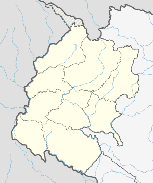 Dhangadhi Sub-Metropolitan City Location in Nepal  Dhangadhi Sub-Metropolitan City Dhangadhi Sub-Metropolitan City (Nepal) | |
| Coordinates: 28°42′49″N 80°34′09″E | |
| Country | |
| Province | Sudurpashchim Province |
| District | Kailali |
| Government | |
| • Mayor | Gopal Hamal (Independent)[1] |
| • Deputy Mayor | Kandakala Kumari Rana (UML) |
| Area | |
| • Total | 261.75 km2 (101.06 sq mi) |
| Elevation | 109 m (358 ft) |
| Population (2021)[2] | |
| • Total | 204,788 |
| • Rank | 7th largest |
| • Density | 780/km2 (2,000/sq mi) |
| Time zone | UTC+5:45 (NST) |
| Post code | 10900 |
| Area code | 091 |
| Website | www |
Dhangadhi was established in 1976.[7] It became the first sub-metropolitan city in the far-west after it was upgraded to a sub-metropolis from municipality status on 18 September 2015 as the village development committees Fulbari and Urma were merged into Dhangadhi. There is a fable. Rana Tharu of Dhangadhi used to bury their wealth in the ground due to the fear of robbers. That is why the name of Dhangadhi remained Dhangadhi [8]
Transportation
Road
This section does not cite any sources. (September 2020) |
Dhangadhi is well connected with other major cities of Nepal and the Indian state of Uttar Pradesh. Indian and Nepali nationals may cross the international border without restrictions, however there is a customs checkpoint for goods and third country nationals. Local transport includes Cycle Rickshaws, Taxis and Public City Buses.[citation needed]
Air
Dhangadhi Airport is located 10 km from the administrative center and about 660 kilometers west of Kathmandu.[9] The runway has been extended to 1,524 metres (5,000 ft) length and blacktopped to accommodate Fokker 100 aircraft.[10][11][12]
Demographics
Languages

language in Dhangadhi
At the time of the 2011 Census of Nepal, 36% of the population in the City spoke Tharu, 31% Doteli, 22% Nepali, 2% Hindi, 2% Maithili, 1% Magar, and 6% spoke other languages as their first language.[14]
Ethnic groups
Ethnic groups in Dhangadhi
The largest ethnic group is Tharu, who makes 37% of the population, Chhetris with 21% comes to second place, while the Hill Brahman population is 17%. Other groups in Dhangadhi includes the Thakuri (6%), Kami (6%), Magar (3%) and others various ethnic gropups makes(12%) of the population.[15]
Climate
Dhanghadi has a monsoon-influenced humid subtropical climate (Cwa according to the Köppen climate classification). The highest temperature ever recorded in Dhangadhi was 46.4 °C (115.5 °F) on 16 June 1995, which is the highest temperature to have ever been recorded in Nepal.[16] The lowest temperature ever recorded was 0.0 °C (32.0 °F) on 11 January 1985.[17]
| Month | Jan | Feb | Mar | Apr | May | Jun | Jul | Aug | Sep | Oct | Nov | Dec | Year |
|---|---|---|---|---|---|---|---|---|---|---|---|---|---|
| Average high °C (°F) | 20.8 (69.4) |
24.8 (76.6) |
30.4 (86.7) |
35.9 (96.6) |
37.2 (99.0) |
36.3 (97.3) |
33.1 (91.6) |
32.8 (91.0) |
32.4 (90.3) |
31.5 (88.7) |
27.8 (82.0) |
23.3 (73.9) |
30.5 (86.9) |
| Daily mean °C (°F) | 14.0 (57.2) |
17.0 (62.6) |
21.7 (71.1) |
26.8 (80.2) |
29.8 (85.6) |
30.7 (87.3) |
29.4 (84.9) |
29.1 (84.4) |
28.3 (82.9) |
25.1 (77.2) |
20.1 (68.2) |
15.8 (60.4) |
24.0 (75.2) |
| Average low °C (°F) | 7.1 (44.8) |
9.3 (48.7) |
13.0 (55.4) |
17.6 (63.7) |
22.5 (72.5) |
25.2 (77.4) |
25.7 (78.3) |
25.5 (77.9) |
24.2 (75.6) |
18.7 (65.7) |
12.4 (54.3) |
8.2 (46.8) |
17.5 (63.5) |
| Average precipitation mm (inches) | 30.6 (1.20) |
39.1 (1.54) |
22.7 (0.89) |
21.3 (0.84) |
70.1 (2.76) |
301.5 (11.87) |
655.9 (25.82) |
674.7 (26.56) |
412.2 (16.23) |
55.4 (2.18) |
4.0 (0.16) |
15.4 (0.61) |
2,302.9 (90.66) |
| Source: Department of Hydrology and Meteorology (Nepal)[18] | |||||||||||||
Education
Colleges
- Kailali Multiple Campus (Campus Road)[20]
- Kailali Model Higher Secondary School, Utter Behadi
- Sudur Paschimanchal Campus (Sontoshi tole)
- Aishwarya Multiple Campus was established in 2063 B.S. & has been conditioning the bachelor level programs with affiliation to Tribhuwan University, Kirtipur, Kathmandu, Nepal. The programs currently offered are: B.Sc. (Bachelor of Science), BBS (Bachelor of Business Studies).It is the one of the best college of Nepal which provides quality education.
- Dhangadhi Engineering College was established in 2000 A.D. & has been conducting the bachelor level programs with affiliation to Pokhara University, Nepal. The programs currently offered are: Bachelor of Computer Engineering (B.E Computer), Bachelor of Computer Application (B.C.A), Bachelor of Business Administration (B.B.A), and Bachelor of Civil Engineering (B.E Civil).
- Nepal Western Academy is another renowned college located in Santoshi Tole. It is affiliated to Pokhara University. Currently it has been running BBA BI and BHM programs.
- National Academy of science and technology (Uttar Behendi)
- Western International Business School (LN chowk). Currently it has been running BBA and MBA. It is affiliated to Delta International University of New Orleans USA[21]
Schools
- Kailali Vidya Niketan (Dhangadhi-8, shiksyanagar)
- Shree Milan English School
- Aristo English Boarding High School (Campus Road)
- Three Stars English Boarding School Dhangadhi-8,Kailali
- Caspian Academy English Boarding School Dhangadhi-*,kailali
- Aishwarya Vidya Niketan Higher Secondary School, Hasanpur, Kailali
- Stepping Stone English School, Chauraha-2, Dhangadhi
- Golden Jyoti English Boarding School, Jugeda, Dhangadhi
- Broad Vision International Academy, Chatakpur, Dhangadhi.
- Kailali Model Higher Secondary School, Uttarbehadi, Dhangadhi
- Panchodaya Higher Secondary School
- Green Land Public School - Dhangadhi
- Malika Higher Secondary English School
- Unique Modern Academy santoshitole-2.
- Shree Basu Devi Higher Secondary School (dhangadhi,06, jali)
- Far West Secondary School (jai)
- Galaxy Higher Secondary School (Hasanpur)
- Emerald Academy (Dhangadhi-3, Bishalnagar)
- Manilek International School Dhangadhi-3, Chatakpur
- Doon Academy, Bhanshar Road, Dhangadhi-3, Kailali
- Glee Academy School
- Himal Academy Dhangadhi, Chauraha-2, Dhangadhi
- Siddhartha Shishu Sadan Higher Secondary School, L.N. Chwok
- Shree Navadurga Secondary School, Dhangadhi-2, Bhansar
- Jaycees Everest English School, Dhangadhi-2
- Western Crystal Academy Dhangadhi-2
- Mountsaipal English Boarding School
- Crescent City School, Baiyabehadi-2, Dhangadhi
- Discovery English Boarding School Dhangadhi-8, Kantipur Tole
- Navajeevan English School, Santoshitole-2, Dhangadhi
- Delight Boarding School
- Alliance International School, Baiyahehadi,
Health
Hospital
- Seti Provincial Hospital, Main Road, Dhagadhi
- City Metro Hospital
- Navajeevan Hospital
- CP Hospital, Chatakpur
- Maya Metro Hospital
- Nisarga Hospital
- Dhangadhi Netralaya Eye Hospital, Chatakpur
- Joshi Medical
- NOVA Hospital
- Om Aasha Hospital, Campusroad, Dhangadhi
References
- "धनगढीका मेयर गोपाल हमालको मतले कैलाली जिससमा गठबन्धन विजयी".
- "Preliminary Report of National Population 2021". Central Bureau Statistics, Nepal. 27 January 2022. Retrieved 9 March 2022.
- "The Kathmandu Post :: Govt declares 26 new municipalities". Archived from the original on 22 November 2017. Retrieved 13 March 2016.
- "Dhangadhi Sub-Metropolitan City". Retrieved 1 May 2018.
- "Archived copy" (PDF). Archived from the original (PDF) on 18 April 2013. Retrieved 1 November 2012.
{{cite web}}: CS1 maint: archived copy as title (link) - "PSU Dhangadhi | Local Governance and Community Development Programme (LGCDP) - II". lgcdp.gov.np. Archived from the original on 29 June 2019. Retrieved 29 June 2019.
- "Brief Introduction". Dhangadhi Sub-Metropolitan City. Archived from the original on 13 May 2018. Retrieved 1 May 2018.
- "26 new Municipalities announced". The Rising Nepal. 18 September 2015. Archived from the original on 27 September 2015. Retrieved 1 May 2018.
- Dhangadhi Airport
- "Flights To Dhangadhi - Book Tickets Online To Dhangadhi | Buddha Air". www.buddhaair.com. Archived from the original on 19 April 2019. Retrieved 29 June 2019.
- "Dhangadhi airport closed for a month from today". The Himalayan Times. 5 May 2019. Archived from the original on 29 June 2019. Retrieved 29 June 2019.
- CHHATYAL, DIL BAHADUR. "Dhangadhi airport shut for a month for upgrading". My Republica. Archived from the original on 29 June 2019. Retrieved 29 June 2019.
- "NepalMap profile: Dhangadhi Sub-Metropolitan City". NepalMap. Retrieved 15 July 2022.
- "NepalMap profile: Dhangadhi Sub-Metropolitan City". NepalMap. Retrieved 15 July 2022.
- "NepalMap profile: Dhangadhi Sub-Metropolitan City". NepalMap. Retrieved 15 July 2022.
- "Climatic Extremities in Nepal". Compendium of Environmental Statistics Nepal 2015. Central Bureau of Statistics. 2016. pp. 43–44. Archived from the original on 19 December 2019. Retrieved 18 December 2019.
- "Archived copy" (PDF). Archived from the original (PDF) on 4 March 2016. Retrieved 27 February 2016.
{{cite web}}: CS1 maint: archived copy as title (link). Retrieved 27 February 2016. - "Normals from 1981-2010" (PDF). Department of Hydrology and Meteorology (Nepal). Archived (PDF) from the original on 11 May 2013. Retrieved 20 October 2012.
- "Dhangadhi Weather Forecast". WorldWeatherOnline.com. Archived from the original on 29 June 2019. Retrieved 29 June 2019.
- "Kailali Multiple Campus". Archived from the original on 28 October 2020. Retrieved 22 December 2016.
- "1st match, Dhangadi Premier League at Dhangadi, Mar 31 2018 - Dhangadhi Stars vs Kathmandu Goldens, Dhangadi Premier League 2018, 1st match Match Live Score, Summary". ESPNcricinfo. Archived from the original on 29 June 2019. Retrieved 29 June 2019.
На других языках
[de] Dhangadhi
Dhangadhi (Nepali .mw-parser-output .Deva{font-size:120%}@media all and (min-width:800px){.mw-parser-output .Deva{font-size:calc(120% - ((100vw - 800px)/80))}}@media all and (min-width:1000px){.mw-parser-output .Deva{font-size:100%}}धनगढी नगरपालिका) ist eine Stadt im äußersten Westen Nepals im Distrikt Kailali in der Provinz Sudurpashchim.- [en] Dhangadhi
[ru] Дхангадхи
Дхангадхи (непальск. धनगढी) — город в западной части Непала. Учреждён в 1976 году и в настоящее время разделён на 19 административных районов. Является центром района Кайлали, расположенного в провинции Судурпаштин-Прадеш. Дхангадхи граничит с индийским штатом Уттар-Прадеш.Другой контент может иметь иную лицензию. Перед использованием материалов сайта WikiSort.org внимательно изучите правила лицензирования конкретных элементов наполнения сайта.
WikiSort.org - проект по пересортировке и дополнению контента Википедии