world.wikisort.org - Nepal
Amlekhganj (also Amlekhgunj) (Nepali:अमलेखगंज) is a town and Village Development Committee (now Sub Metropolitan City) in Bara District in the Narayani Zone of south-eastern Nepal. At the time of the 2011 Nepal census it had a population of 6,709 people living in 1370 individual households. There were 3,413 males and 3,296 females at the time of census.[1] At one time it was famed as the starting point of the Nepal Government Railway (NGR) which connected it with Raxaul in India.
Amlekhganj
अमलेखगञ्ज | |
|---|---|
Village Development Committee | |
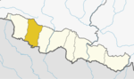
 Amlekhganj Location in Nepal | |
| Coordinates: 27°17′N 84°59′E | |
| Country | |
| Zone | Narayani Zone |
| District | Bara District |
| Population (2011) | |
| • Total | 6,709 |
| Time zone | UTC+5:45 (Nepal Time) |
Transport

The town was served by a branch railway from Raxaul, It has no formal transportation service; most people have their own vehicle.[2]
Churiya Mai Temple at Amlekhganj, Bara, Nepal Churiya Mai temple lies on the Hetauda - Birgunj Highway built during Rana era, it is believed that the Mai protects their devotees from accidents, crash or any types of unpleasant situations.
See also
- Railway stations in Nepal
- Churia Tunnel
References
- "Nepal Census 2001". Nepal's Village Development Committees. Digital Himalaya. Archived from the original on 12 October 2008. Retrieved 18 September 2008.
- "Transport in Nepal, Transport to Nepal". Archived from the original on 2008-12-29. Retrieved 2008-12-21.
External links

Bara District | ||
|---|---|---|
Headquarter: Kalaiya | ||
| Sub-Metropolitan Cities |
|  |
| Municipalities |
| |
| Rural municipalities |
| |
Administrative divisions of Nepal | ||
This article about a location in Bara District, Nepal is a stub. You can help Wikipedia by expanding it. |
Другой контент может иметь иную лицензию. Перед использованием материалов сайта WikiSort.org внимательно изучите правила лицензирования конкретных элементов наполнения сайта.
WikiSort.org - проект по пересортировке и дополнению контента Википедии