world.wikisort.org - Mexico
Piedras Negras Municipality is one of the 38 municipalities of Coahuila, in north-eastern Mexico. The municipal seat lies at Piedras Negras. The municipality covers an area of 914.2 km² and is located on the international border between Mexico and the USA, here formed by the Río Bravo del Norte (Rio Grande), adjacent to the U.S. state of Texas.
Piedras Negras | |
|---|---|
Municipality | |
 Seal | |
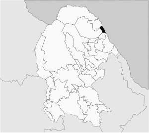 Municipality of Piedras Negras in Coahuila | |
Piedras Negras Location in Mexico | |
| Coordinates: 28°43′20″N 100°34′5″W | |
| Country | |
| State | Coahuila |
| Municipal seat | Piedras Negras |
| Area | |
| • Total | 914.2 km2 (353.0 sq mi) |
| Elevation | 223 m (732 ft) |
| Population (2010) | |
| • Total | 152,806 |
As of 2010, the municipality had a total population of 152,806.[1]
Towns and villages
The largest localities (cities, towns, and villages) are:
| Name | 2010 Census Population |
|---|---|
| Piedras Negras | 150,178 |
| Centro de Readaptación Social Piedras Negras | 830 |
| Fraccionamiento Villa Real | 767 |
| El Moral | 390 |
| La Navaja (La Loma) | 156 |
| San Isidro | 117 |
| El Centinela | 110 |
| Total Municipality | 152,806 |
Adjacent municipalities and counties
- Nava Municipality - south
- Zaragoza Municipality - west
- Jiménez Municipality - north
- Maverick County, Texas - northeast
References
- 2010 census tables: INEGI Archived 2013-05-02 at the Wayback Machine accessdate=April 29, 2011
Places adjacent to Piedras Negras Municipality | ||||||||||||||||
|---|---|---|---|---|---|---|---|---|---|---|---|---|---|---|---|---|
| ||||||||||||||||
Saltillo (capital) | ||
| Topics |
|  |
| Municipalities and (municipal seats) |
| |
| Protected areas |
| |
This article about a location in the Mexican state of Coahuila is a stub. You can help Wikipedia by expanding it. |
На других языках
- [en] Piedras Negras Municipality
[es] Municipio de Piedras Negras
El municipio de Piedras Negras es uno de los 38 municipios en que se divide el estado mexicano de Coahuila de Zaragoza. Fronterizo con los Estados Unidos, su cabecera es la ciudad de Piedras Negras.[ru] Пьедрас-Неграс (муниципалитет)
Пьедрас-Неграс (исп. Piedras Negras) — муниципалитет в Мексике, штат Коауила, с административным центром в одноимённом городе. Численность населения, по данным переписи 2020 года, составила 176 327 человек.Текст в блоке "Читать" взят с сайта "Википедия" и доступен по лицензии Creative Commons Attribution-ShareAlike; в отдельных случаях могут действовать дополнительные условия.
Другой контент может иметь иную лицензию. Перед использованием материалов сайта WikiSort.org внимательно изучите правила лицензирования конкретных элементов наполнения сайта.
Другой контент может иметь иную лицензию. Перед использованием материалов сайта WikiSort.org внимательно изучите правила лицензирования конкретных элементов наполнения сайта.
2019-2026
WikiSort.org - проект по пересортировке и дополнению контента Википедии
WikiSort.org - проект по пересортировке и дополнению контента Википедии