world.wikisort.org - Mexico
Ixtapa Municipality is one of the 119 municipalities of Chiapas, in southern Mexico.
Ixtapa Municipality | |
|---|---|
Municipality | |
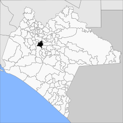 Municipality of Ixtapa in Chiapas | |
Ixtapa Municipality Location in Mexico | |
| Coordinates: 16°48′N 92°54′W | |
| Country | |
| State | Chiapas |
| Area | |
| • Total | 313 km2 (121 sq mi) |
| Population (2010) | |
| • Total | 24,517 |
As of 2010, the municipality had a total population of 24,517,[1] up from 18,533 as of 2005.[2] It covers an area of 313 km².
As of 2010, the town of Ixtapa had a population of 6,086.[1] Other than the town of Ixtapa, the municipality had 82 localities, the largest of which (with 2010 populations in parentheses) were: El Nopal (1,903), Cacate (1,225), Aztlán (Rancho Nuevo) (1,148), Concepción (1,133), and El Zapotillo (1,058), classified as rural.[1]
References
- "Ixtapa". Catálogo de Localidades. Secretaría de Desarrollo Social (SEDESOL). Retrieved 23 April 2014.
- "Ixtapa". Enciclopedia de los Municipios de México. Instituto Nacional para el Federalismo y el Desarrollo Municipal / Gobierno del Estado de Chiapas. Archived from the original on September 27, 2007. Retrieved July 25, 2008.

| Authority control |
|
|---|
This article about a location in the Mexican state of Chiapas is a stub. You can help Wikipedia by expanding it. |
Текст в блоке "Читать" взят с сайта "Википедия" и доступен по лицензии Creative Commons Attribution-ShareAlike; в отдельных случаях могут действовать дополнительные условия.
Другой контент может иметь иную лицензию. Перед использованием материалов сайта WikiSort.org внимательно изучите правила лицензирования конкретных элементов наполнения сайта.
Другой контент может иметь иную лицензию. Перед использованием материалов сайта WikiSort.org внимательно изучите правила лицензирования конкретных элементов наполнения сайта.
2019-2026
WikiSort.org - проект по пересортировке и дополнению контента Википедии
WikiSort.org - проект по пересортировке и дополнению контента Википедии