world.wikisort.org - Mexico
Doctor Arroyo Municipality is a municipality located in the northeastern Mexican state of Nuevo León. It has a territorial extension of 5,106.2 km2. The municipality was named in honor of José Francisco Arroyo de Anda. The municipality was renamed on September 22, 1826. The municipality had 33,269 inhabitants in the 2010 census.
This article includes a list of general references, but it lacks sufficient corresponding inline citations. (July 2013) |
Doctor Arroyo Municipality | |
|---|---|
Municipality | |
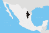
Doctor Arroyo Municipality Location in Mecico | |
| Coordinates: 23°40′N 100°10′W | |
| Country | |
| State | Nuevo León |
| Municipal seat | Doctor Arroyo |
| Area | |
| • Total | 5,106.2 km2 (1,971.5 sq mi) |
| Elevation | 1,720 m (5,640 ft) |
| Population (2010[1]) | |
| • Total | 9,339 |
| Time zone | UTC-6 (CST) |
| • Summer (DST) | UTC-5 (CDT) |
Located
It lies in the Sierra Madre Oriental, it borders the municipalities of Aramberri and Galeana to the north, Mier y Noriega and the state of San Luis Potosí to the south and the municipalities of Aramberri, General Zaragoza, the state of Tamaulipas to the east. Doctor Arroyo is located in the zone there are great rivers of intermittent streams and a large mountain range, where occasional snowfall occurs in winter.
References
- Instituto Nacional de Estadística y Geografía (2010). "Principales resultados por localidad 2010 (ITER)".
External links
Monterrey (capital) | ||
| Topics |
|  |
| Municipalities |
| |
| Regions |
| |
Текст в блоке "Читать" взят с сайта "Википедия" и доступен по лицензии Creative Commons Attribution-ShareAlike; в отдельных случаях могут действовать дополнительные условия.
Другой контент может иметь иную лицензию. Перед использованием материалов сайта WikiSort.org внимательно изучите правила лицензирования конкретных элементов наполнения сайта.
Другой контент может иметь иную лицензию. Перед использованием материалов сайта WikiSort.org внимательно изучите правила лицензирования конкретных элементов наполнения сайта.
2019-2025
WikiSort.org - проект по пересортировке и дополнению контента Википедии
WikiSort.org - проект по пересортировке и дополнению контента Википедии