world.wikisort.org - Mexico
Salinas Victoria, is a municipality located to in the center of the state of Nuevo León, Mexico. It shares borders with 11 municipalities including, to the north Villaldama and Sabinas Hidalgo; to the south Escobedo and Apodaca; to the east Higueras, Ciénega de Flores and General Zuazua; and finally to the west with Mina, Hidalgo, Abasolo and El Carmen.
Salinas Victoria | |
|---|---|
 Coat of arms | |
| Motto(s): Cultura, Fidelidad, Trabajo | |
 | |
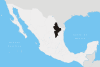
| Coordinates: 25°58′N 100°18′W | |
| Country | Mexico |
| State | Nuevo León |
| Founded | No precise date, between 1586 or 1587 |
| Government | |
| • Mayor | Rebeca Lozano Débora ( |
| Area | |
| • City | 1,334.20 km2 (515.14 sq mi) |
| Elevation | 464 m (1,522 ft) |
| Population (2005) | |
| • City | 27,848 |
| • Metro | 3,664,334 |
| Time zone | UTC-6 (Central Standard Time) |
| • Summer (DST) | UTC-5 (Central Daylight Time) |
| Website | https://www.salinasvictoria.gob.mx/ |
Salinas Victoria's extension is 1,334.20 square kilometers. According to the 2005 census, it has a population of 27,848 people.[1]
Origin of the name
"Salinas" (Spanish for salt marshes) was chosen because the lands present saline characteristics. "Victoria" after the first Mexican president Guadalupe Victoria.[2]
References
- Link to tables of population data from Census of 2005 Archived 2011-06-13 at the Wayback Machine INEGI: Instituto Nacional de Estadística, Geografía e Informática
- Government of Nuevo León, "Salinas Victoria"
External links
Monterrey Metropolitan Area | ||
|---|---|---|
| ||
Monterrey (capital) | ||
| Topics |
|  |
| Municipalities |
| |
| Regions |
| |
This article about a location in the Mexican state of Nuevo León is a stub. You can help Wikipedia by expanding it. |
На других языках
- [en] Salinas Victoria
[es] Salinas Victoria
Salinas Victoria, ciudad del estado mexicano de Nuevo León, localizada a 25°58' latitud norte y 100°18' longitud oeste, en la región centro del estado o región del Golfo, a 32 km al noroeste de la capital Monterrey, y a una altura de 464 m sobre el nivel del mar. Colinda con 11 municipios: al norte con Villaldama y Sabinas Hidalgo; al sur con General Escobedo y Apodaca; al este con Higueras, Ciénega de Flores y General Zuazua y al oeste con Mina, Hidalgo, Abasolo y El Carmen, su territorio mide 1,334.20 kilómetros cuadrados. Su población según el censo del INEGI de 2010 es de 32,625 habitantes. Se le denominó Salinas por sus suelos salitrosos y Victoria en honor al General Guadalupe Victoria.[4]Другой контент может иметь иную лицензию. Перед использованием материалов сайта WikiSort.org внимательно изучите правила лицензирования конкретных элементов наполнения сайта.
WikiSort.org - проект по пересортировке и дополнению контента Википедии