world.wikisort.org - Mali
Gabero is a rural commune in the Cercle of Gao in the Gao Region of south-eastern Mali. The commune covers an area of approximately 2,007 square kilometers and includes 15 villages.[3] In the 2009 census the commune had a population of 25,688.[2] The Niger River crosses the commune from north to south. The administrative center (chef-lieu) is Haoussa Foulane that lies on the left (east) bank of the Niger. The village is 45 km south of Gao, on the road, the N17, linking Gao and Ansongo.
Gabero | |
|---|---|
Commune | |
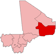
 Gabero Location in Mali | |
| Coordinates: 15°59′42″N 0°7′55″E | |
| Country | |
| Region | Gao Region |
| Cercle | Gao Cercle |
| Area | |
| • Total | 2,007 km2 (775 sq mi) |
| Population (2009 census)[2] | |
| • Total | 25,688 |
| • Density | 13/km2 (33/sq mi) |
| Time zone | UTC+0 (GMT) |
The climate is sahelian, and is characterized by the alternation of two seasons: a long dry season (October to June) and a short wet season (July to September). The annual rainfall varies between 200 and 250 mm depending on the year.[4]
References
- Common and Fundamental Operational Datasets Registry: Mali, United Nations Office for the Coordination of Humanitarian Affairs, archived from the original on 2012-01-06. commune_mali.zip (Originally from the Direction Nationale des Collectivités Territoriales, République du Mali)
- Resultats Recensement Général de la Population et de l’Habitat 2009 (Région de Gao) (PDF) (in French), République de Mali: Institut National de la Statistique, archived from the original (PDF) on 2011-07-22.
- Communes de la Région de Gao (PDF) (in French), Ministère de l’administration territoriale et des collectivités locales, République du Mali, archived from the original (PDF) on 2014-12-16.
- Plan de Sécurité Alimentaire Commune de Gabero 2005-2009 (PDF) (in French), Commissariat à la Sécurité Alimentaire, République du Mali, USAID-Mali, 2005, archived from the original (PDF) on 2012-09-18, retrieved 2012-09-01.
Capital: Gao | ||
| Ansongo Cercle |
|  |
| Bourem Cercle | ||
| Gao Cercle |
| |
This Gao Region location article is a stub. You can help Wikipedia by expanding it. |
Другой контент может иметь иную лицензию. Перед использованием материалов сайта WikiSort.org внимательно изучите правила лицензирования конкретных элементов наполнения сайта.
WikiSort.org - проект по пересортировке и дополнению контента Википедии