world.wikisort.org - Mali
Taboye is a rural commune and village in the Cercle of Bourem in the Gao Region of south-eastern Mali. The commune is crossed by the River Niger and includes the villages of Bia, Dagha, Ha, Moudakane, Ouani, Tondibi and Taboye. In the 2009 census the commune had a population of 20,503.
Taboye | |
|---|---|
Commune and village | |
 Taboye Location in Mali | |
| Coordinates: 16°42′53″N 0°15′31″W | |
| Country | |
| Region | Gao Region |
| Cercle | Bourem Cercle |
| Area | |
| • Total | 1,452 km2 (561 sq mi) |
| Population (2009 Census)[2] | |
| • Total | 20,503 |
| • Density | 14/km2 (37/sq mi) |
| Time zone | UTC+0 (GMT) |
References
- Schéma Directeur de Lutte Contre L’ensablement dans le Nord Du Mali (6ème Et 7ème Régions): Monographie de la Commune de Taboye (PDF) (in French), Ministère de l’Environnement et de L’assainissement, République du Mali, 2004, archived from the original (PDF) on 2011-10-06.
- Resultats Provisoires RGPH 2009 (Région de Gao) (PDF) (in French), République de Mali: Institut National de la Statistique.
External links
- Plan de Sécurité Alimentaire Commune de Taboye 2005-2009 (PDF) (in French), Commissariat à la Sécurité Alimentaire, République du Mali, USAID-Mali, 2005, archived from the original (PDF) on 2012-05-13.
Capital: Gao | ||
| Ansongo Cercle | 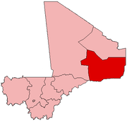 | |
| Bourem Cercle | ||
| Gao Cercle |
| |
This Gao Region location article is a stub. You can help Wikipedia by expanding it. |
Текст в блоке "Читать" взят с сайта "Википедия" и доступен по лицензии Creative Commons Attribution-ShareAlike; в отдельных случаях могут действовать дополнительные условия.
Другой контент может иметь иную лицензию. Перед использованием материалов сайта WikiSort.org внимательно изучите правила лицензирования конкретных элементов наполнения сайта.
Другой контент может иметь иную лицензию. Перед использованием материалов сайта WikiSort.org внимательно изучите правила лицензирования конкретных элементов наполнения сайта.
2019-2026
WikiSort.org - проект по пересортировке и дополнению контента Википедии
WikiSort.org - проект по пересортировке и дополнению контента Википедии