world.wikisort.org - Kyrgyzstan
Sary-Tash (Kyrgyz: Сары-Таш) is a village and major crossroads in the Alay Valley of Osh Region, Kyrgyzstan. Its population was 2,337 in 2021.[1] Until 2012 it was an urban-type settlement.[2] Nearby towns and villages to the north include Ak-Bosogo (8 km or 5 mi) and Chagyr (14 km or 9 mi).
Sary-Tash
Kyrgyz: Сары-Таш | |
|---|---|
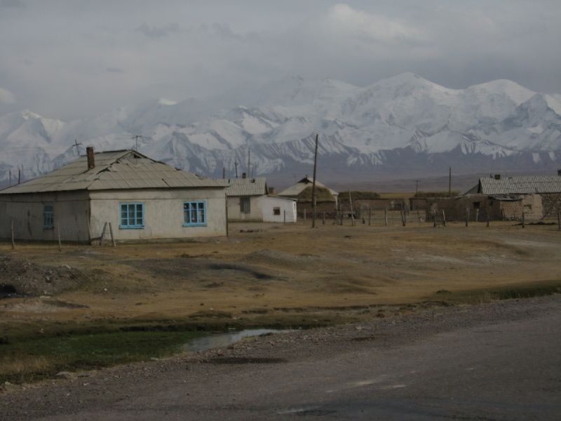
 Sary Tash village with the Pamir mountains | |
 Sary-Tash | |
| Coordinates: 39°43′48″N 73°15′00″E | |
| Country | Kyrgyzstan |
| Region | Osh Region |
| District | Alay District |
| Established | 1950 |
| Elevation | 3,170 m (10,400 ft) |
| Population (2021) | |
| • Total | 2,337 |
| Time zone | UTC+6 (KGT) |
Although this remote village has only some shop-cafes, a petrol station and five guest houses (March 2016), it is an important road junction connecting China, Kyrgyzstan and Tajikistan. Its name is derived from Turkic roots and means "yellow-stone".[3]
To the north, M41 goes over the Taldyk Pass to Gülchö and Osh in the Ferghana Valley. To the south, after leaving the Alay Valley the M41 rises to the 4280m Kyzylart Pass into Tajikistan as part of the Pamir Highway. 80 kilometres (50 miles) to the east on A371 is the Irkestam pass to Kashgar, Xinjiang province, China. To the west, the A372 leads down the Alay Valley. The pass at the west end (towards Dushanbe, Tajikistan) is a bilateral border crossing closed to foreigners.[4]
Population
| Year | Pop. | ±% p.a. |
|---|---|---|
| 1970 | 870 | — |
| 1979 | 1,072 | +2.35% |
| 1989 | 1,278 | +1.77% |
| 1999 | 1,502 | +1.63% |
| 2009 | 1,427 | −0.51% |
| 2021 | 2,337 | +4.20% |
| Note: resident population; Sources:[5][1] | ||
History
Sary-Tash was visited in 1894 by Swedish traveller Sven Hedin, who wrote his caravan before his mountaineering ascent "fell on their knees in the snow, offering Allah a prayer for a happy pass through the dangerous Kyzyl-Art, where sudden disastrous storms often occur." Exploring the pass, he saw a pile of stones piled in a heap, decorated with "tutami", a type of poles, which were hung with fur pendants, colorful rags of fabric, horns of mountain goats and rams.
Notes
- "Population of regions, districts, towns, urban-type settlements, rural communities and villages of Kyrgyz Republic" (XLS) (in Russian). National Statistics Committee of the Kyrgyz Republic. 2021. Archived from the original on 10 November 2021.
- Law 27 September 2012 No. 168 on the transformation of individual urban settlements of the Kyrgyz Republic and relating them to the category of village or city
- Taylor, Isaac (1898). Names and their histories: a handbook of historical geography and topographical nomenclature (2nd ed.). Rivingtons. p. 317.
- "Kyrgyzstan border crossings". Caravanistan.
- "2009 population and housing census of the Kyrgyz Republic: Osh Region" (PDF) (in Russian). National Statistics Committee of the Kyrgyz Republic. 2010. p. 201.
External links
- Satellite map at Maplandia.com
- Laurence Mitchell, Kyrgyzstan, Bradt Travel Guides, 2008
This Osh Region location article is a stub. You can help Wikipedia by expanding it. |
На других языках
- [en] Sary-Tash
[ru] Сары-Таш
Сары-Таш (кирг. Сары-Таш - Жёлтый камень) — высокогорное село (в 1950—2012 — посёлок городского типа) в восточной части Алайской долины на территории Алайского района Ошской области Киргизии[1]. Основан в 1950 году.Другой контент может иметь иную лицензию. Перед использованием материалов сайта WikiSort.org внимательно изучите правила лицензирования конкретных элементов наполнения сайта.
WikiSort.org - проект по пересортировке и дополнению контента Википедии