world.wikisort.org - Japan
Myōkō (妙高市, Myōkō-shi) is a city located in Niigata Prefecture, Japan. As of 1 November 2020[update], the city had an estimated population of 31,374 in 12,408 households, and a population density of 70 persons per km².[1] The total area are of the city was 445.63 square kilometres (172.06 sq mi). Myōkō is a member of the World Health Organization’s Alliance for Healthy Cities (AFHC).[2]
Myōkō
妙高市 | |||||||||||||||||||
|---|---|---|---|---|---|---|---|---|---|---|---|---|---|---|---|---|---|---|---|
City | |||||||||||||||||||
    
| |||||||||||||||||||
 Flag  Seal | |||||||||||||||||||
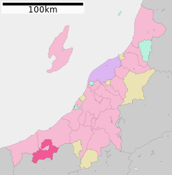 Location of Myōkō in Niigata | |||||||||||||||||||
 Myōkō | |||||||||||||||||||
| Coordinates: 37°1′30.7″N 138°15′12.7″E | |||||||||||||||||||
| Country | Japan | ||||||||||||||||||
| Region | Chūbu (Kōshin'etsu) (Hokuriku) | ||||||||||||||||||
| Prefecture | Niigata | ||||||||||||||||||
| Area | |||||||||||||||||||
| • Total | 445.63 km2 (172.06 sq mi) | ||||||||||||||||||
| Population (November 1, 2020) | |||||||||||||||||||
| • Total | 31,374 | ||||||||||||||||||
| • Density | 70/km2 (180/sq mi) | ||||||||||||||||||
| Time zone | UTC+9 (Japan Standard Time) | ||||||||||||||||||
| Phone number | 0255-72-5111 | ||||||||||||||||||
| Address | 5-1 Sakaemachi, Myoko-shi, Niigata-ken 944-8686 | ||||||||||||||||||
| Climate | Cfa | ||||||||||||||||||
| Website | Official website | ||||||||||||||||||
| Symbols | |||||||||||||||||||
| Bird | Blue-and-white flycatcher | ||||||||||||||||||
| Flower | Glaucidium palmatum | ||||||||||||||||||
| Tree | Fagus crenata | ||||||||||||||||||

Geography
Myōkō is located in an inland region of north-central Niigata Prefecture, on the border of Nagano Prefecture. It lies in mountain surroundings near the historical entrance to the Echigo Plains. The city is surrounded by five mountains. Mount Madarao, Mount Myōkō, Mount Kurohime, Mount Togakushi and Mount Iizuna are collectively known as the Five Mountains of Northern Shinshu (北信五岳, Hokushingogaku). They make up the border of Nagano and Niigata Prefectures. Most of the city is covered with mountains and forests. As the city name implies, Mount Myōkō (2,454 metres (8,051 feet)) is in the city, much of which is within the borders of the Myōkō-Togakushi Renzan National Park. In addition to its namesake, Mount Myōkō, the city is home to two other 100 Famous Japanese Mountains, Mount Hiuchi (2,462) and Mount Takatsuma (2,353m).
Surrounding municipalities
- Niigata Prefecture
- Jōetsu
- Itoigawa
- Nagano Prefecture
Climate
Myōkō has a Humid climate (Köppen Cfa) characterized by warm, wet summers and cold winters with heavy snowfall. The average annual temperature in Myōkō is 11.9 °C (53.4 °F). The average annual rainfall is 1,924.4 mm (75.76 in) with September as the wettest month. The temperatures are highest on average in August, at around 24.4 °C (75.9 °F), and lowest in January, at around 0.0 °C (32.0 °F).[3]
| Climate data for Sekiyama, Myōkō (1991−2020 normals, extremes 1978−present) | |||||||||||||
|---|---|---|---|---|---|---|---|---|---|---|---|---|---|
| Month | Jan | Feb | Mar | Apr | May | Jun | Jul | Aug | Sep | Oct | Nov | Dec | Year |
| Record high °C (°F) | 15.2 (59.4) |
17.8 (64.0) |
22.1 (71.8) |
29.6 (85.3) |
30.2 (86.4) |
32.2 (90.0) |
34.1 (93.4) |
35.5 (95.9) |
34.2 (93.6) |
30.1 (86.2) |
24.4 (75.9) |
22.8 (73.0) |
35.5 (95.9) |
| Average high °C (°F) | 3.3 (37.9) |
3.9 (39.0) |
7.8 (46.0) |
15.0 (59.0) |
20.7 (69.3) |
23.4 (74.1) |
27.1 (80.8) |
28.6 (83.5) |
24.6 (76.3) |
18.8 (65.8) |
12.9 (55.2) |
6.6 (43.9) |
16.1 (60.9) |
| Daily mean °C (°F) | 0.0 (32.0) |
0.3 (32.5) |
3.4 (38.1) |
9.8 (49.6) |
15.6 (60.1) |
19.3 (66.7) |
23.2 (73.8) |
24.4 (75.9) |
20.3 (68.5) |
14.5 (58.1) |
8.5 (47.3) |
2.9 (37.2) |
11.9 (53.3) |
| Average low °C (°F) | −2.7 (27.1) |
−3.0 (26.6) |
−0.3 (31.5) |
5.0 (41.0) |
11.0 (51.8) |
15.7 (60.3) |
20.1 (68.2) |
21.1 (70.0) |
16.9 (62.4) |
10.9 (51.6) |
4.9 (40.8) |
−0.1 (31.8) |
8.3 (46.9) |
| Record low °C (°F) | −10.5 (13.1) |
−10.0 (14.0) |
−7.9 (17.8) |
−5.1 (22.8) |
1.1 (34.0) |
7.8 (46.0) |
12.5 (54.5) |
12.8 (55.0) |
7.0 (44.6) |
1.7 (35.1) |
−2.9 (26.8) |
−7.1 (19.2) |
−10.5 (13.1) |
| Average precipitation mm (inches) | 284.2 (11.19) |
178.6 (7.03) |
127.8 (5.03) |
74.2 (2.92) |
81.4 (3.20) |
118.6 (4.67) |
179.9 (7.08) |
150.0 (5.91) |
160.8 (6.33) |
151.9 (5.98) |
142.5 (5.61) |
256.6 (10.10) |
1,924.4 (75.76) |
| Average snowfall cm (inches) | 385 (152) |
291 (115) |
159 (63) |
18 (7.1) |
trace | 0 (0) |
0 (0) |
0 (0) |
0 (0) |
0 (0) |
12 (4.7) |
220 (87) |
1,061 (418) |
| Average precipitation days (≥ 1.0 mm) | 22.4 | 18.2 | 17.6 | 11.6 | 10.8 | 12.4 | 14.9 | 12.5 | 13.0 | 13.0 | 15.2 | 19.7 | 181.3 |
| Average snowy days (≥ 3 cm) | 20.1 | 16.0 | 13.4 | 2.6 | 0.1 | 0 | 0 | 0 | 0 | 0 | 0.8 | 11.7 | 64.7 |
| Mean monthly sunshine hours | 58.1 | 76.5 | 110.4 | 163.4 | 192.3 | 131.1 | 122.1 | 161.0 | 114.5 | 119.2 | 102.2 | 71.0 | 1,430.5 |
| Source: Japan Meteorological Agency[4][3] | |||||||||||||
Demographics
Per Japanese census data,[5] the population of Myōkō has declined steadily over the past 60 years.
| Year | Pop. | ±% |
|---|---|---|
| 1960 | 49,859 | — |
| 1970 | 44,158 | −11.4% |
| 1980 | 41,980 | −4.9% |
| 1990 | 41,072 | −2.2% |
| 2000 | 39,699 | −3.3% |
| 2010 | 35,457 | −10.7% |
| 2020 | 30,383 | −14.3% |
History
The area of present-day Myōkō was part of ancient Echigo Province. During the Edo period the area was divided between the holdings of Takada Domain and tenryō territory administered directly by the Tokugawa shogunate. With the creation of the modern municipalities system on June 26, 1890, the village of Arai was created within Nakakubiki District, Niigata. Arai was raised to town status on September 9, 1892 and to city status on November 1, 1954. The city of Myōkō was created on April 1, 2005, by the merger of the city of Arai with the town of Myōkōkōgen, and the village of Myōkō (both from Nakakubiki District).
Economy
The economy of Myōkō is dependent on seasonal tourism, agriculture and forestry, and light manufacturing.
Government
Myōkō has a mayor-council form of government with a directly elected mayor and a unicameral city legislature of 18 members. Myōkō contributes one member to the Niigata Prefectural Assembly. In terms of national politics, the city is part of Niigata 6th district of the lower house of the Diet of Japan.
Education
Myōkō has nine public elementary schools and three public middle schools operated by the city government, and one public high school operated by the Niigata Prefectural Board of Education. The prefecture also operates one special education school for the handicapped.
Transportation
Railway
![]() – Hokuriku Shinkansen
– Hokuriku Shinkansen
![]() Echigo Tokimeki Railway - Myōkō Haneuma Line
Echigo Tokimeki Railway - Myōkō Haneuma Line
- Myōkō-Kōgen - Sekiyama - <Nihongi> - Arai - Kita-Arai
![]() Shinano Railway - Kita-Shinano Line
Shinano Railway - Kita-Shinano Line
Highway
 Jōshin-etsu Expressway – Myōkō IC
 National Route 18
 National Route 292
A Note: Jōetsumyōkō station is actually in Jōetsu, 1.5 km away from the border with Myōkō.
Local attractions
- Myōkōkōgen and the former village of Myōkō are famed for their ski resorts.[6] The first of these, Akakura, was founded in the 1930s, making it one of the oldest established ski areas in the world. It is also a traditional mountain retreat of Japan's imperial family. The Myōkō Ski Area has nine main mountain resorts: Myōkō Akakura, Ikenotaira Onsen, Myōkō Suginohara (which boasts the longest ski run in Japan), Seki Onsen, Kyukamura, Myōkō Ski Park, Lotte Arai Resort, Madarao Kogen and Tangram Ski Circus.[7]
- Myōkō Kōgen is also well known for its many local onsen (hot springs) emanating from the Jigoku-dani valley between Mts. Myōkō and Mae.[8]
- Kannondaira-Tenjindō Kofun Group is a Kofun period National Historic Site
- Samegao Castle, ruins of a Sengoku period castle and National Historic Site
- Hida Sites, Yayoi period archaeological site and National Historic Site
International relations
Twin towns — Sister cities
Myōkō is twinned with:
 Slovenj Gradec, Slovenia
References
- Myoko City official statistics (in Japanese)
- Alliance for Healthy Cities official home page
- 気象庁 / 平年値(年・月ごとの値). JMA. Retrieved March 24, 2022.
- 観測史上1~10位の値(年間を通じての値). JMA. Retrieved March 24, 2022.
- Myōkō population statistics
- Myoko Ski Resort
- Destination Joetsu Myoko
- Japan Onsen Guide - Niigata
External links
- Official Website (in Japanese)
- Travel Website (in English)
Niigata (capital) | ||||
| Niigata |
| |||
| Special cities | ||||
| Cities | ||||
| Districts | ||||
List of mergers in Niigata Prefecture | ||||
Authority control | |
|---|---|
| General | |
| National libraries | |
| Other |
|
На других языках
[de] Myōkō (Stadt)
Myōkō (jap. .mw-parser-output .Hani{font-size:110%}妙高市, -shi) ist eine Stadt in der Präfektur Niigata in Japan.- [en] Myōkō, Niigata
[ru] Мёко (Ниигата)
Мёко (яп. 妙高市 Мё:ко:-си) — город в Японии, расположенный в юго-западной части префектуры Ниигата. Основан 1 апреля 2005 года путём слияния города Араи, посёлка Мёкокоген и села Мёко уезда Накакубики.Другой контент может иметь иную лицензию. Перед использованием материалов сайта WikiSort.org внимательно изучите правила лицензирования конкретных элементов наполнения сайта.
WikiSort.org - проект по пересортировке и дополнению контента Википедии