world.wikisort.org - Japan
Kariwa (刈羽村, Kariwa-mura) is a village located in Niigata Prefecture, Japan. As of 1 July 2019[update], the village had an estimated population of 4,578 in 1613 households,[1] and a population density of 174 persons per km². The total area of the village was 26.27 square kilometres (10.14 sq mi).
Kariwa
刈羽村 | |
|---|---|
Village | |
 Kariwa village hall | |
 Flag  Seal | |
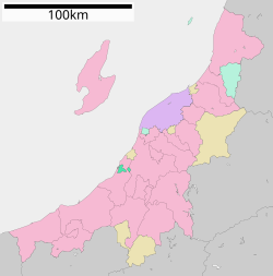 Location of Kariwa in Niigata | |
 Kariwa | |
| Coordinates: 37°25′20.1″N 138°37′21.1″E | |
| Country | Japan |
| Region | Chūbu (Kōshin'etsu) (Hokuriku) |
| Prefecture | Niigata |
| District | Kariwa |
| Area | |
| • Total | 26.27 km2 (10.14 sq mi) |
| Population (July 1, 2019) | |
| • Total | 4,578 |
| • Density | 170/km2 (450/sq mi) |
| Time zone | UTC+9 (Japan Standard Time) |
| Symbols | |
| • Tree | Japanese black pine |
| • Flower | Peach |
| Phone number | 0257-45-2244 |
| Address | 215-1 Warimachi-Shinden, Kariwa-mura, Kariwa-gun, Niigata-ken 945-0308 |
| Website | Official website |
Geography
Kariwa is located in central Niigata Prefecture, sandwiched between the cities of Nagaoka and Kashiwazaki, and consists of two discontinuous areas. Kariwa is located near the Sea of Japan but has no coastline. It takes over 3 hours to reach Tokyo by train (using local trains and Jōetsu Shinkansen from Nagaoka), or by car on the Kan-Etsu Expressway.
Surrounding municipalities
- Niigata Prefecture
Demographics
Per Japanese census data,[2] the population of Kariwa peaked at around the year 1990, and has declined steadily since.
| Year | Pop. | ±% |
|---|---|---|
| 1970 | 5,429 | — |
| 1980 | 5,346 | −1.5% |
| 1990 | 5,522 | +3.3% |
| 2000 | 5,028 | −8.9% |
| 2010 | 4,800 | −4.5% |
| 2020 | 4,380 | −8.8% |
History
The area of present-day Kariwa was part of ancient Echigo Province and was part of the tenryō holdings of the Tokugawa shogunate during the Edo period. The village of Kariwa was established within Kariwa District, Niigata with the creation of the modern municipalities system on April 1, 1889. On September 30, 1956 a part of the neighbouring village of Nakadori was absorbed into Kariwa. Likewise, on April 10, 1959 a part of neighbouring Futada village was absorbed into Kariwa
2007 Chūetsu offshore earthquake
A magnitude 6.8 earthquake hit off the coast of Kashiwazaki, killing 10 people, and injuring more than 1,200, causing massive power outages. Total over 340 houses were destroyed and thousands of people were forced to live at the shelters. The quake caused a fire at Kashiwazaki-Kariwa nuclear power plant in an electrical transformer, a leak of water from the spent fuel pool, and a host of other safety related events.[3][4][5]
Economy
Together with Kashiwazaki city, Kariwa is the home of the Tokyo Electric Power Company's Kashiwazaki-Kariwa nuclear power plant, once the largest nuclear generating station in the world by net electrical power rating. After the April 2011 earthquake, all restarted units were shut down and safety improvements are being carried out. As of August 2022[update] no units have been restarted.[6]
Education
Kariwa has three public elementary schools and one public middle school operated by the village government. The village does not have a high school.
Transportation
Railway
![]() JR East - Echigo Line
JR East - Echigo Line
- Arahama - Kariwa
Highway
 Hokuriku Expressway
 National Route 8
 National Route 116
 National Route 352
Sister cities
 Half Moon Bay, California, United States
Local attractions
- Kariwa Midden (Prehistoric site)
- Tohuku-in (temple)
- Joraku-ji (temple)
- Hozo-ji (temple)
- Katsuyama castle remains (Now used as hiking paths)
- Akada castle remains (Now used as hiking paths)
- Kariwa Village Life Learning Center "Rapika"
Festivals
- Takiya Toro Oshiai Matsuri (Lantern Battle Festival) (April)
- Peach Flower Festival (April)
- Kariwa-mura Furusato Matsuri (Village Festival) (August)
References
- Kariwa official statistics (in Japanese)
- Kariwa population statistics
- The European Parliament's Greens-EFA Group - The World Nuclear Industry Status Report 2007 Archived 2008-06-25 at the Wayback Machine p. 23.
- Niigata earthquake death toll rises to eleven Archived 2013-11-03 at the Wayback Machine Japan News Review, July 23
- "Japanese nuke plant leaked after earthquake". Associated Press. July 16, 2007. Archived from the original on August 10, 2007. Retrieved July 16, 2007.
- Kashiwazaki Kariwa PRIS database (accessed August 2022)
External links
 Media related to Kariwa, Niigata at Wikimedia Commons
- Official Website (in Japanese)
Niigata (capital) | ||||
| Niigata |
| |||
| Special cities |
| |||
| Cities |
| |||
| Districts | ||||
List of mergers in Niigata Prefecture | ||||
Authority control | |
|---|---|
| General | |
| National libraries | |
На других языках
- [en] Kariwa
[es] Kariwa
Kariwa (刈羽村, Kariwa-mura?) es una villa en la prefectura de Niigata, Japón, localizada en la parte centro-oeste de la isla de Honshū, en la región de Chūbu. El 1 de marzo de 2021 tenía una población estimada de 4434 habitantes y una densidad de población de 169 personas por km².[4][ru] Карива
Карива (яп. 刈羽村 Карива-мура) — село в Японии, расположенное в центральной части префектуры Ниигата (уезд Карива) на берегу Японского моря. Площадь села составляет 26,28 км²[1], население — 4726 человек (1 августа 2014)[2], плотность населения — 179,83 чел./км².Другой контент может иметь иную лицензию. Перед использованием материалов сайта WikiSort.org внимательно изучите правила лицензирования конкретных элементов наполнения сайта.
WikiSort.org - проект по пересортировке и дополнению контента Википедии