world.wikisort.org - Japan
Mihara (三原市, Mihara-shi) is a city located in Hiroshima Prefecture, Japan. The city was founded on November 15, 1936. As of July 31, 2016, the city has an estimated population of 97,324 and a population density of 206.62 persons per km2. The total area is 471.03 km2.
Mihara
三原市 | |
|---|---|
City | |
 | |
|
Flag Emblem | |
Location of Mihara in Hiroshima Prefecture | |
 Mihara Location in Japan | |
| Coordinates: 34°24′N 133°5′E | |
| Country | Japan |
| Region | Chūgoku (San'yō) |
| Prefecture | Hiroshima Prefecture |
| First official recorded | 3rd century (official)[citation needed] |
| Town settled | April 1, 1889 |
| City settled | November 15, 1936 |
| Government | |
| • Mayor | Yoshihiro Okada (from August 2020) |
| Area | |
| • Total | 471.03 km2 (181.87 sq mi) |
| Population (July 31, 2016) | |
| • Total | 97,324 |
| • Density | 206.62/km2 (535.1/sq mi) |
| Time zone | UTC+09:00 (JST) |
| City hall address | 3-5-1, Minatomachi, Mihara-shi, Hiroshima-ken 723-8601 |
| Climate | Cfa |
| Website | www |
| Symbols | |
| Flower | Ume and Satsuki azalea |
| Tree | Camphor laurel |
On March 22, 2005, the town of Daiwa (from Kamo District), the town of Kui (from Mitsugi District), and the town of Hongō (from Toyota District) were merged into Mihara.
History
- Mihara Castle was established as a waterfront castle (Umi-jiro) by Kobayakawa Takakage in 1582.
- The castle has been connected to the Seto Inland Sea to operate the Mōri clan water forces on the sea.
- For the Battle of Sekigahara, Fukushima Masanori entered Hiroshima Castle in 1600, and then Mihara Castle has been under controlled as the branch castle of Hiroshima castle.
- The domain was divided into Fukuyama Domain and Hiroshima Domain in 1619, and Tadayoshi Asano entered Mihara castle.
- Mihara was incorporated into a part of Hiroshima Prefecture for the Abolition of the han system in 1871.
- Mihara city was founded on November 15, 1936.
- On March 22, 2005, the town of Daiwa (from Kamo District), the town of Kui (from Mitsugi District), and the town of Hongō (from Toyota District) were merged into Mihara.

Geography
Climate
Mihara has a humid subtropical climate (Köppen climate classification Cfa) characterized by cool to mild winters and hot, humid summers. The average annual temperature in Mihara is 14.2 °C (57.6 °F). The average annual rainfall is 1,374.6 mm (54.12 in) with July as the wettest month. The temperatures are highest on average in August, at around 25.9 °C (78.6 °F), and lowest in January, at around 2.9 °C (37.2 °F).[1] The highest temperature ever recorded in Mihara was 36.3 °C (97.3 °F) on 24 July 2018; the coldest temperature ever recorded was −9.4 °C (15.1 °F) on 16 January 2011.[2]
| Climate data for Hiroshima Airport, Mihara (2003−2020 normals, extremes 2003−present) | |||||||||||||
|---|---|---|---|---|---|---|---|---|---|---|---|---|---|
| Month | Jan | Feb | Mar | Apr | May | Jun | Jul | Aug | Sep | Oct | Nov | Dec | Year |
| Record high °C (°F) | 14.5 (58.1) |
19.3 (66.7) |
21.6 (70.9) |
27.3 (81.1) |
29.4 (84.9) |
32.1 (89.8) |
36.3 (97.3) |
35.8 (96.4) |
34.9 (94.8) |
28.7 (83.7) |
23.1 (73.6) |
18.8 (65.8) |
36.3 (97.3) |
| Average high °C (°F) | 7.2 (45.0) |
8.5 (47.3) |
12.2 (54.0) |
17.7 (63.9) |
22.6 (72.7) |
25.2 (77.4) |
28.6 (83.5) |
30.4 (86.7) |
26.6 (79.9) |
21.2 (70.2) |
15.3 (59.5) |
9.3 (48.7) |
18.7 (65.7) |
| Daily mean °C (°F) | 2.9 (37.2) |
3.9 (39.0) |
7.2 (45.0) |
12.6 (54.7) |
17.6 (63.7) |
21.0 (69.8) |
24.6 (76.3) |
25.9 (78.6) |
22.3 (72.1) |
16.7 (62.1) |
11.0 (51.8) |
5.2 (41.4) |
14.2 (57.6) |
| Average low °C (°F) | −0.9 (30.4) |
−0.1 (31.8) |
2.5 (36.5) |
7.8 (46.0) |
13.1 (55.6) |
17.5 (63.5) |
21.6 (70.9) |
22.7 (72.9) |
19.0 (66.2) |
13.1 (55.6) |
7.2 (45.0) |
1.4 (34.5) |
10.4 (50.7) |
| Record low °C (°F) | −9.4 (15.1) |
−8.3 (17.1) |
−4.7 (23.5) |
−0.6 (30.9) |
3.5 (38.3) |
10.7 (51.3) |
15.4 (59.7) |
15.8 (60.4) |
10.9 (51.6) |
4.1 (39.4) |
−2.2 (28.0) |
−7.2 (19.0) |
−9.4 (15.1) |
| Average precipitation mm (inches) | 33.4 (1.31) |
53.9 (2.12) |
88.0 (3.46) |
115.3 (4.54) |
133.4 (5.25) |
189.7 (7.47) |
240.8 (9.48) |
140.6 (5.54) |
152.3 (6.00) |
105.6 (4.16) |
64.4 (2.54) |
57.2 (2.25) |
1,374.6 (54.12) |
| Average precipitation days (≥ 1.0 mm) | 4.8 | 7.4 | 9.0 | 9.3 | 8.7 | 10.4 | 10.9 | 7.7 | 8.7 | 6.9 | 6.1 | 6.4 | 96.3 |
| Source: Japan Meteorological Agency[1][2] | |||||||||||||
Demographics
Per Japanese census data, the population of Mihara in 2020 is 90,573 people.[3] Mihara has been conducting censuses since 1960.
| Year | Pop. | ±% |
|---|---|---|
| 1950 | 111,480 | — |
| 1955 | 112,720 | +1.1% |
| 1960 | 109,641 | −2.7% |
| 1965 | 108,059 | −1.4% |
| 1970 | 106,376 | −1.6% |
| 1975 | 107,602 | +1.2% |
| 1980 | 109,236 | +1.5% |
| 1985 | 111,108 | +1.7% |
| 1990 | 110,524 | −0.5% |
| 1995 | 108,617 | −1.7% |
| 2000 | 106,229 | −2.2% |
| 2005 | 104,196 | −1.9% |
| 2010 | 100,449 | −3.6% |
| 2015 | 96,194 | −4.2% |
| 2020 | 90,573 | −5.8% |
| Mihara population statistics[3] | ||
Economy
Fisheries
- Shunami Port
- Nouji Port
Industries
- Mitsubishi Heavy Industries's Itozaki, Kohama and Wada Plants
- Teijin Mihara Plant
- Sharp Mihara Plant
- Dai Nippon Printing Mihara Plant
- Koyo Dockyard
- Mexichem Flúor Mihara Plant
Sister cities
 – Yugawara, Kanagawa, Japan
 – Palmerston North, New Zealand
Educational Facilities
- Prefectural University of Hiroshima Mihara
- Mihara Nursing School
Transportation
Airports
Trains
- JR West lines
- Sanyō Shinkansen; Mihara Station
- San'yō Main Line; Itozaki Station, Mihara and Hongo Station
- Kure Line; Mihara, Sunami Station and Akisaizaki Station
Buses
- Geiyo Bus
- Chugoku Bus
- Tomotetsu Bus
- Onomichi Bus
Highways
- Sanyō Expressway
National Routes
- Japan National Route 2, 185, 486 and 432
Ports
- Mihara Port
- Onomichi-itozaki Port
- Sagi Port
- Sunami Port
Tourism
Castles
- Mihara Castle
- Niitakayama Castle - A castle ruin, one of the Continued Top 100 Japanese Castles.[4]
- Takayama Castle
Temples
- Daizen-ji
- Buttsū-ji – Chūgoku 33 Kannon Pilgrimage #12
Shrines
- Mitsugi-hachimangu
Festivals
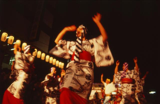
- Mihara Yassa Matsuri
- Mihara Shinmeiichi Festival
- Satsuki Matsuri
People
Historical
- Kobayakawa Takakage
- Fukushima Masanori
- Lady Kasuga
- Inaba Masanari
Famous
- Ayako Miyake (三宅綾子), dancer
- Choji Murata (村田兆治), baseball player
- Ko Hiura (火浦功), novelist
- Yoshihisa Ishida (石田義久), shot putter
- Leyona, singer and songwriter
- Masatoshi Kawahara, manga artist
- Ryuji Imada, professional golfer
- Satoshi Urushihara, manga artist
- Hisatoshi Shintaku, long-distance runner
- Toshiko Shirasu-Aihara, former Japanese gymnast and Bronze medalist of 1964 Summer Olympics in Tokyo
- Keiko Ikeda, former Japanese gymnast and Bronze medalist of 1964 Summer Olympics in Tokyo
Entertainment
A small island off the coast of Sagishima, called Sukune, was the location of Kaneto Shindo's film The Naked Island released in 1960.[5] Director Shindo and his wife Nobuko Otowa both had their ashes scattered on the island.[6]
References
- 気象庁 / 平年値(年・月ごとの値). JMA. Retrieved May 14, 2022.
- 観測史上1~10位の値(年間を通じての値). JMA. Retrieved May 14, 2022.
- Mihara population statistics
- "続日本100名城" (in Japanese). 日本城郭協会. Retrieved 25 July 2019.
- "A tourist guide to Sagishima" (in Japanese). Archived from the original on 2012-06-06.
- "Shindo Kaneto Kantoku "Hadaka no Shima" Sankotsu e". Nikkan Sports.
External links
 Media related to Mihara, Hiroshima at Wikimedia Commons
- Mihara City official website (in Japanese)
Hiroshima (capital) | |||
| Hiroshima |
| ||
| Core cities |
| ||
| Cities | |||
| Districts | |||
List of mergers in Hiroshima Prefecture | |||
Authority control | |
|---|---|
| General | |
| National libraries | |
| Other |
|
На других языках
- [en] Mihara, Hiroshima
[ru] Михара (город)
Михара (яп. 三原市 Михара-си) — город в Японии, находящийся в префектуре Хиросима. Площадь города составляет 471,19 км²[1], население — 97 068 человек (1 июля 2014)[2], плотность населения — 206,01 чел./км².Другой контент может иметь иную лицензию. Перед использованием материалов сайта WikiSort.org внимательно изучите правила лицензирования конкретных элементов наполнения сайта.
WikiSort.org - проект по пересортировке и дополнению контента Википедии