world.wikisort.org - Japan
Kawaguchi (川口町, Kawaguchi-machi) was a town located in Kitauonuma District, Niigata Prefecture, Japan.
This article needs additional citations for verification. (December 2009) |
Kawaguchi
川口町 | |
|---|---|
Former municipality | |
 | |
 Flag  Emblem | |
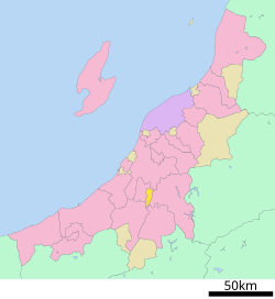 Location of Kawaguchi in Niigata Prefecture | |
| Country | Japan |
| Region | Hokuriku |
| Prefecture | Niigata Prefecture |
| District | Kitauonuma District |
| Merged | March 31, 2010 (now part of Nagaoka) |
| Area | |
| • Total | 50.03 km2 (19.32 sq mi) |
| Population (2010) | |
| • Total | 4,801 |
| Time zone | UTC+09:00 (JST) |
| Symbols | |
| Flower | Phlox subulata |
| Tree | Cherry blossom |

As of 2003, the town had an estimated population of 5,549 and a density of 110.91 persons per km². The total area was 50.03 km².
During the 2004 Chūetsu earthquake, Kawaguchi was the only town to report the maximum value of 7 on the Japan Meteorological Agency seismic intensity scale.
On March 31, 2010, Kawaguchi was merged into the expanded city of Nagaoka.[1]
Transportation
Railway
 JR East - Jōetsu Line
- Echigo-Kawaguchi
- JR East - Iiyama Line
- Echigo-Kawaguchi
Highway
 Kan-etsu Expressway – Echigo-Kawaguchi IC/SA
 National Route 17
 National Route 117
References
- "Archived copy". Archived from the original on 2013-10-04. Retrieved 2010-04-02.
{{cite web}}: CS1 maint: archived copy as title (link)
See also
- 2004 Chūetsu earthquake
Dissolved municipalities of | |||||||
|---|---|---|---|---|---|---|---|
| Niigata |
| ||||||
| Murakami |
| ||||||
| Tainai |
| ||||||
| Shibata |
| ||||||
| Agano |
| ||||||
| Gosen |
| ||||||
| Aga |
| ||||||
| Tsubame |
| ||||||
| Sanjō |
| ||||||
| Nagaoka |
| ||||||
| Kashiwazaki |
| ||||||
| Tōkamachi |
| ||||||
| Uonuma |
| ||||||
| Minamiuonuma |
| ||||||
| Jōetsu |
| ||||||
| Myōkō (Arai) |
| ||||||
| Itoigawa |
| ||||||
| Sado |
| ||||||
List of mergers in Niigata Prefecture | |||||||
Authority control | |
|---|---|
| General | |
| National libraries | |
This Niigata Prefecture location article is a stub. You can help Wikipedia by expanding it. |
На других языках
- [en] Kawaguchi, Niigata
[ru] Кавагути (Ниигата)
Кавагути (яп. 川口町 Кавагути-мати) — бывший посёлок в Японии, располагавшийся в центральной части префектуры Ниигата (уезд Китауонума). 31 марта 2010 года вошёл в состав города Нагаока. На 1 февраля 2010 года его площадь составляла 50,03 км², население — 4819 человек, а плотность населения — 96,32 чел./км².Текст в блоке "Читать" взят с сайта "Википедия" и доступен по лицензии Creative Commons Attribution-ShareAlike; в отдельных случаях могут действовать дополнительные условия.
Другой контент может иметь иную лицензию. Перед использованием материалов сайта WikiSort.org внимательно изучите правила лицензирования конкретных элементов наполнения сайта.
Другой контент может иметь иную лицензию. Перед использованием материалов сайта WikiSort.org внимательно изучите правила лицензирования конкретных элементов наполнения сайта.
2019-2025
WikiSort.org - проект по пересортировке и дополнению контента Википедии
WikiSort.org - проект по пересортировке и дополнению контента Википедии