world.wikisort.org - Italy
Panicale is a comune (municipality) in the Province of Perugia in the Italian region Umbria. Located on the eastern slope of Mount Petrarvella, in the southeast of Valdichiana, it overlooks Lake Trasimeno and it is about 35 km far from Perugia.
Panicale | |
|---|---|
Comune | |
| Comune di Panicale | |
 Backside of the Church of San Michele Arcangelo on Piazza Umberto I, the main square of Panicale | |
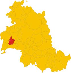 Position of Panicale within the Province of Perugia | |
Location of Panicale  | |
 Panicale Location of Panicale in Italy  Panicale Panicale (Umbria) | |
| Coordinates: 43°2′N 12°6′E | |
| Country | Italy |
| Region | Umbria |
| Province | Province of Perugia (PG) |
| Frazioni | Tavernelle, Colle San Paolo, Missiano, Casalini, Colle Calzolaro, Macereto, Mongiovino, Montale, Colgiordano, Gioveto, Migliaiolo |
| Government | |
| • Mayor | Giulio Cherubini (Partito Democratico) |
| Area | |
| • Total | 78.8 km2 (30.4 sq mi) |
| Elevation | 441 m (1,447 ft) |
| Population (Dec. 2012)[2] | |
| • Total | 5,669 |
| • Density | 72/km2 (190/sq mi) |
| Demonym(s) | Panicalesi |
| Time zone | UTC+1 (CET) |
| • Summer (DST) | UTC+2 (CEST) |
| Postal code | 06064, 06068 |
| Dialing code | 075 |
| Patron saint | Michael |
| Saint day | September 29 |
| Website | Official website |
As of 31 December 2012, it had a population of 5,669 and an area of 78.8 km².
The municipality of Panicale contains the frazioni (subdivisions, mainly villages and hamlets) Tavernelle, Colle San Paolo, Missiano, Casalini, Colle Calzolaro, Macereto, Mongiovino, Montale, Colgiordano, Gioveto and Migliaiolo.
Panicale borders the following municipalities: Castiglione del Lago, Magione, Paciano, Perugia and Piegaro.
Main sights

- Church of Saint Sebastian, contains Pietro Perugino's Fresco The Martyrdom of Saint Sebastian (1505)
- Teatro Caporali
Demographic evolution

References
- "Superficie di Comuni Province e Regioni italiane al 9 ottobre 2011". Italian National Institute of Statistics. Retrieved 16 March 2019.
- "Demo-Geodemo. - Mappe, Popolazione, Statistiche Demografiche dell'ISTAT".
External links
Wikimedia Commons has media related to Panicale.
Authority control | |
|---|---|
| General | |
| National libraries | |
| Other |
|
This Umbria location article is a stub. You can help Wikipedia by expanding it. |
На других языках
- [en] Panicale
[es] Panicale
Panicale es una localidad y comune italiana de la provincia de Perugia, región de Umbría, con 5.741 habitantes.[ru] Паникале
Паникале (итал. Panicale) — коммуна в Италии, располагается в регионе Умбрия, подчиняется административному центру Перуджа.Текст в блоке "Читать" взят с сайта "Википедия" и доступен по лицензии Creative Commons Attribution-ShareAlike; в отдельных случаях могут действовать дополнительные условия.
Другой контент может иметь иную лицензию. Перед использованием материалов сайта WikiSort.org внимательно изучите правила лицензирования конкретных элементов наполнения сайта.
Другой контент может иметь иную лицензию. Перед использованием материалов сайта WikiSort.org внимательно изучите правила лицензирования конкретных элементов наполнения сайта.
2019-2026
WikiSort.org - проект по пересортировке и дополнению контента Википедии
WikiSort.org - проект по пересортировке и дополнению контента Википедии