world.wikisort.org - Italy
Vallo di Nera is a comune (municipality) in the Province of Perugia in the Italian region Umbria, located about 60 km southeast of Perugia.
- Images of Vallo di Nera
 The church San Giovanni Battista
 The church Santa Maria
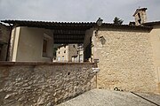 The church San Rocco


Vallo di Nera | |
|---|---|
Comune | |
| Comune di Vallo di Nera | |
 | |
 Coat of arms | |
Location of Vallo di Nera  | |
 Vallo di Nera Location of Vallo di Nera in Italy  Vallo di Nera Vallo di Nera (Umbria) | |
| Coordinates: 42°45′N 12°52′E | |
| Country | Italy |
| Region | Umbria |
| Province | Perugia (PG) |
| Frazioni | Borbonea, Geppa, La Pieve, Le Campore, Meggiano, Monte Fiorello, Paterno, Piedilacosta, Piedipaterno, Roccagelli |
| Government | |
| • Mayor | Agnese Benedetti |
| Area | |
| • Total | 36.0 km2 (13.9 sq mi) |
| Elevation | 467 m (1,532 ft) |
| Population (2007)[2] | |
| • Total | 419 |
| • Density | 12/km2 (30/sq mi) |
| Demonym(s) | Vallani |
| Time zone | UTC+1 (CET) |
| • Summer (DST) | UTC+2 (CEST) |
| Postal code | 06040 |
| Dialing code | 0743 |
| Patron saint | St.Giovanni Battista |
| Saint day | 24 June |
| Website | Official website |
Wikimedia Commons has media related to Vallo di Nera.
References
- "Superficie di Comuni Province e Regioni italiane al 9 ottobre 2011". Italian National Institute of Statistics. Retrieved 16 March 2019.
- All demographics and other statistics: Italian statistical institute Istat.
External links
Authority control | |
|---|---|
| General |
|
| National libraries | |
This Umbria location article is a stub. You can help Wikipedia by expanding it. |
На других языках
- [en] Vallo di Nera
[es] Vallo di Nera
Vallo di Nera es una localidad y comune italiana de la provincia de Perugia, región de Umbría, con 419 habitantes.[ru] Валло-ди-Нера
Валло-ди-Нера (итал. Vallo di Nera) — коммуна в Италии, располагается в регионе Умбрия, в провинции Перуджа.Текст в блоке "Читать" взят с сайта "Википедия" и доступен по лицензии Creative Commons Attribution-ShareAlike; в отдельных случаях могут действовать дополнительные условия.
Другой контент может иметь иную лицензию. Перед использованием материалов сайта WikiSort.org внимательно изучите правила лицензирования конкретных элементов наполнения сайта.
Другой контент может иметь иную лицензию. Перед использованием материалов сайта WikiSort.org внимательно изучите правила лицензирования конкретных элементов наполнения сайта.
2019-2026
WikiSort.org - проект по пересортировке и дополнению контента Википедии
WikiSort.org - проект по пересортировке и дополнению контента Википедии