world.wikisort.org - Iran
Golpayegan (Persian: گلپایگان, romanized: Golpāyegān; also known as Shahr-e Golpāyegān meaning "City of Golpayegan")[2] is a city and capital of Golpayegan County, Isfahan Province, Iran. At the 2006 census, its population was 47,849, in 14,263 families.[3] Golpayegan is located 186 kilometres (116 mi) northwest of Isfahan and 102 kilometres (63 mi) southeast of Arak, situated at an altitude of 1,830 m. Its temperature fluctuates between +37° and -10° Celsius. Its average annual rainfall is 300 mm.[4]
Golpayegan
گلپایگان | |
|---|---|
City | |
 Golpayegan | |
| Coordinates: 33°27′13″N 50°17′18″E | |
| Country | Iran |
| Province | Isfahan |
| County | Golpayegan |
| Bakhsh | Central |
| Elevation | 1,830 m (6,000 ft) |
| Population (2016 Census) | |
| • Total | 58,936[1] |
| Time zone | UTC+3:30 (IRST) |
| • Summer (DST) | UTC+4:30 (IRDT) |
| Area code | 031 |
| Website | http://www.akhale.ir/ (in Persian:آخاله |
Land of tulips
Historically, the name of the town has been recorded as Vartpadegān,[5] Jorfadeghan,[6] Darbayagan, Kuhpayegan,[7] and Golbādagān.[8] Golpayegan means "fortress of flowers" and "land of tulips" (Persian: سرزمین گلهای سرخ, romanized: Sarzamin-e golha-ye sorkh). According to Ḥamd-Allāh Mostawfi, the town of Golpāyegān was built by the daughter of Bahman, named Samra, also known as Homāy Bente Bahman in Persian.[9]
History
After Parsadan Gorgijanidze was dismissed from his post as prefect (darugheh) of Isfahan, he was appointed as the new eshik-agha (Master of Ceremonies) and given five villages in the confines of Golpayegan as a fief by king (shah) Abbas II (r. 1642-1666).[10][11] Historically, the name of the town has been recorded as Karbāyagān; Jarbāḏaqān; Darbāyagān; and Golbādagān.[12] Golpayegan Kebab is unique and made from endemic cows, it is registered in Iranian intagible heritage list.[13][14]
Climate
Golpayegan has a cold semi-arid climate (Köppen BSk).
| Climate data for Golpayegan | |||||||||||||
|---|---|---|---|---|---|---|---|---|---|---|---|---|---|
| Month | Jan | Feb | Mar | Apr | May | Jun | Jul | Aug | Sep | Oct | Nov | Dec | Year |
| Average high °C (°F) | 5.4 (41.7) |
8.3 (46.9) |
13.5 (56.3) |
18.6 (65.5) |
24.8 (76.6) |
31.4 (88.5) |
34.2 (93.6) |
33.0 (91.4) |
28.9 (84.0) |
21.7 (71.1) |
12.6 (54.7) |
7.9 (46.2) |
20.0 (68.0) |
| Daily mean °C (°F) | −1.3 (29.7) |
1.2 (34.2) |
6.3 (43.3) |
11.8 (53.2) |
17.9 (64.2) |
24.2 (75.6) |
27.3 (81.1) |
26.2 (79.2) |
21.7 (71.1) |
14.9 (58.8) |
6.2 (43.2) |
1.3 (34.3) |
13.1 (55.7) |
| Average low °C (°F) | −7.5 (18.5) |
−5.4 (22.3) |
−1.5 (29.3) |
3.7 (38.7) |
9.2 (48.6) |
15.1 (59.2) |
19.0 (66.2) |
17.8 (64.0) |
13.1 (55.6) |
7.1 (44.8) |
−0.2 (31.6) |
−4.8 (23.4) |
5.5 (41.9) |
| Average precipitation mm (inches) | 31 (1.2) |
31 (1.2) |
39 (1.5) |
32 (1.3) |
21 (0.8) |
3 (0.1) |
1 (0.0) |
0 (0) |
1 (0.0) |
13 (0.5) |
25 (1.0) |
25 (1.0) |
222 (8.6) |
| Average precipitation days (≥ 1.0 mm) | 4 | 5 | 5 | 6 | 4 | 1 | 0 | 0 | 0 | 3 | 4 | 4 | 36 |
| Average relative humidity (%) | 55 | 51 | 44 | 41 | 29 | 17 | 17 | 16 | 19 | 33 | 52 | 57 | 36 |
| Source: https://en.climate-data.org/asia/iran/isfahan/golpayegan-51591/ | |||||||||||||
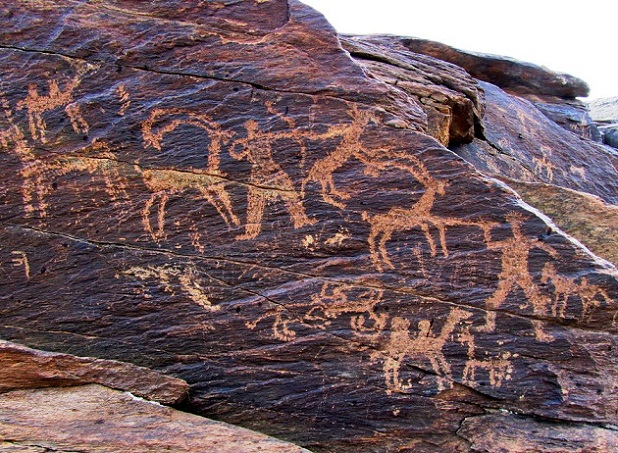
Historical monuments
Several historical monuments are located in the Jāme' mosque of Golpayegan (Persian: مسجد جامِع, "The Congregational Mosque"), a minaret (Manār) from the Seljuk period, the Sarāvar mosque from the 15th-16th centuries, as well as the Hevdah Tan shrine from the 17th century,[15] Gouged Stronghold, the stronghold was used as a caravansary, but during the war time or when the bandits attacked, it was used as a castle.
Gallery

References
- "Statistical Center of Iran > Home". Archived from the original on 2018-07-08. Retrieved 2018-09-27.
- Golpayegan can be found at GEOnet Names Server, at this link, by opening the Advanced Search box, entering "-3064684" in the "Unique Feature Id" form, and clicking on "Search Database".
- "Census of the Islamic Republic of Iran, 1385 (2006)" (Excel). Statistical Center of Iran. Archived from the original on 2011-11-11.
- (Wezārat-e defāʿ, pp. 218-19; Wezārat-e rāh wa tarābari, pp. 119-20).
- (Eṣṭaḵri, p. 198, n. c);
- Moqaddasi, p. 402;
- (Abu’l-Fedā, Taqwim, p. 419;
- (Nozhat al-qolub, ed. Le Strange, p. 68).
- (p. 95) and Qāżi Aḥmad Ḡaffāri (p. 30),
- Giunashvili 2016.
- Paghava, Turkia & Akopyan 2010, p. 22.
- Minu Yusofnezhad, "GOLPĀYAGĀN", Encyclopaedia Iranica Archived 2012-11-17 at the Wayback Machine
- "بوی کباب گلپایگان هزاران گردشگران را جذب کرد - ایسنا". www.isna.ir. Archived from the original on 2019-10-06. Retrieved 2020-12-13.
- "کباب گلپایگان در فهرست میراث ناملموس ثبت شد". ایرنا (in Persian). 2019-06-27. Archived from the original on 2019-07-15. Retrieved 2020-12-13.
- (Meškāti, pp. 64-67; Rafiʿi Mehrābādi, pp. 895-96, 898-901).

Sources
- Giunashvili, Jemshid (2016). "GORGIJANIDZE, PARSADAN". Encyclopaedia Iranica.
- Paghava, I., Turkia S., Akopyan A. (2010), "The cross-in-circle mark on the silver coins of the Safavid ruler, Sultān Husayn, from the Iravān mint", Journal of the Oriental Numismatic Society 202
External links
- ' Hamneshine Bahar: Golpayegan (golpayegun) shahre lalehaye vajgun همنشین بهار: گلپایگان (گلپایکون)، شهر لالههای واژگون
- Golpayegan Dam
- Golpayegan Dam . map
- Hamneshine Bahar : Golpayegan (video)
- The News Golpayeganiha
- The News Golpapress
| Capital |  | ||||||||||||||||||||||||||||||||||||||||||||||||
|---|---|---|---|---|---|---|---|---|---|---|---|---|---|---|---|---|---|---|---|---|---|---|---|---|---|---|---|---|---|---|---|---|---|---|---|---|---|---|---|---|---|---|---|---|---|---|---|---|---|
| Counties and cities |
| ||||||||||||||||||||||||||||||||||||||||||||||||
| Sights |
| ||||||||||||||||||||||||||||||||||||||||||||||||
| See also |
| ||||||||||||||||||||||||||||||||||||||||||||||||
| Capital | |||||||
|---|---|---|---|---|---|---|---|
| Districts |
| ||||||
| Authority control |
|
|---|
На других языках
- [en] Golpayegan
[ru] Гольпайеган
Гольпайега́н[1] (перс. گلپایگان) — город в центральном Иране, в провинции Исфахан. Административный центр одноимённого шахрестана.Другой контент может иметь иную лицензию. Перед использованием материалов сайта WikiSort.org внимательно изучите правила лицензирования конкретных элементов наполнения сайта.
WikiSort.org - проект по пересортировке и дополнению контента Википедии