world.wikisort.org - Indonesia
South Jakarta (Indonesian: Jakarta Selatan; Betawi: Jakarte Beludik) or simply as Jaksel, is one of the five administrative cities which form the Special Capital Region of Jakarta, Indonesia. South Jakarta is not self-governed and does not have a city council, hence it is not classified as a proper municipality. It had a population of 2,062,232 at the 2010 census[2] and 2,226,812 at the 2020 census,[3] and it is the third most populous among the five administrative cities of Jakarta, after East Jakarta and West Jakarta. The administrative centre is at Kebayoran Baru.
South Jakarta
Jakarta Selatan | |
|---|---|
Administrative city | |
| Administrative City of South Jakarta Kota Administrasi Jakarta Selatan | |
| Other transcription(s) | |
| • Betawi | Jakarte Belah Udik |
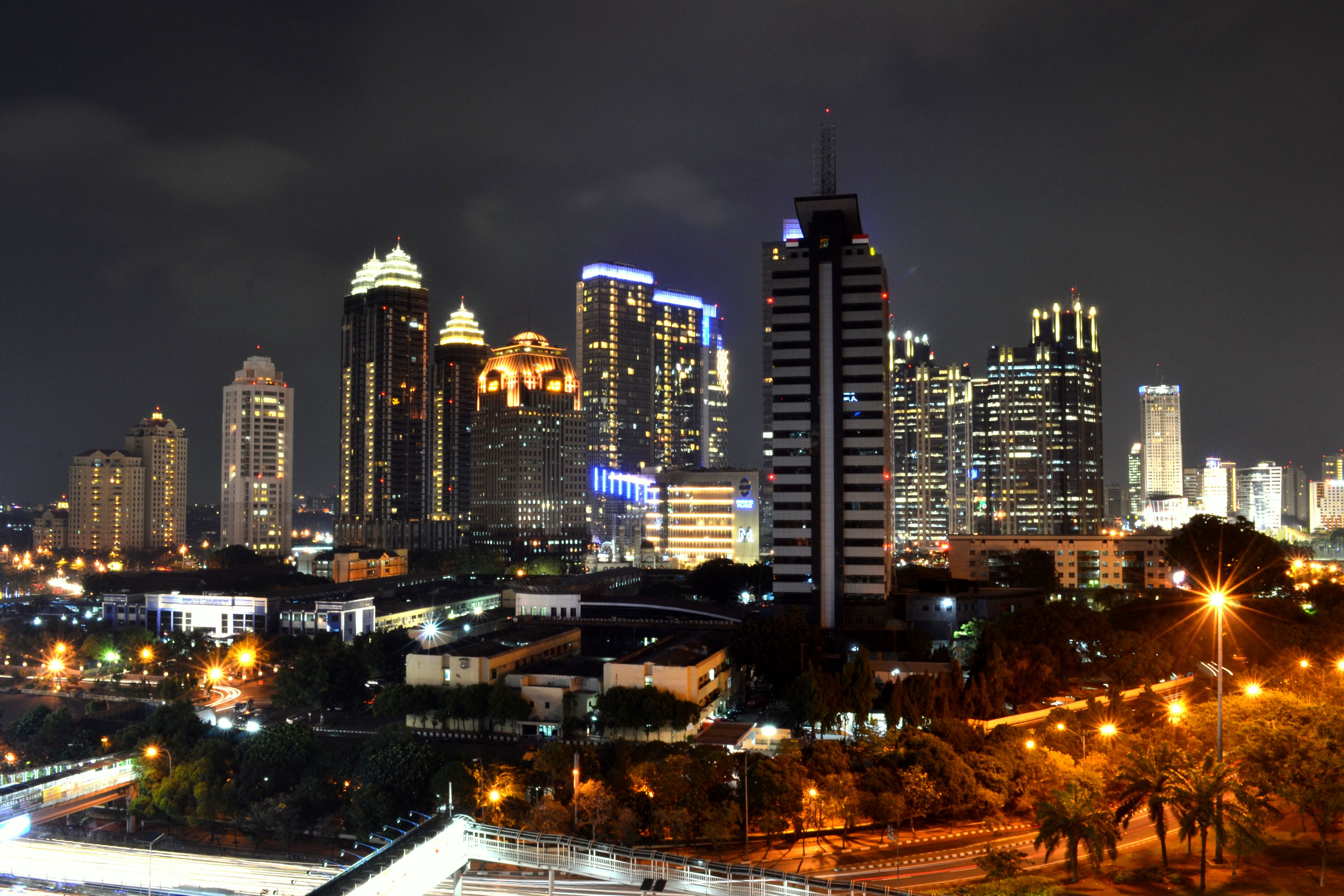
From top, left to right: Golden Triangle skyline, Sudirman Central Business District (SCBD) at night, Dirgantara Monument at Pancoran, Blok M BCA MRT station, Pondok Indah Mall in Pondok Indah, and aerial view of South Jakarta at night. | |
 Seal | |
 | |
| Country | |
| Province | Jakarta |
| Government | |
| • Mayor | Munjirin |
| • Vice Mayor | Isnawa Adji |
| Area | |
| • Total | 154.32 km2 (59.58 sq mi) |
| Population (2020 census)[1] | |
| • Total | 2,226,812 |
| • Density | 14,000/km2 (37,000/sq mi) |
| Demonym | Jakselian (unofficial) |
| Time zone | UTC+7 (WIB) |
| Website | selatan.jakarta.go.id |


South Jakarta is bounded by Central Jakarta to the north, East Jakarta to the east, Depok city to the south, West Jakarta to the northwest, and by Tangerang and South Tangerang cities to the west.
Districts
South Jakarta is subdivided into ten districts (kecamatan), listed below with their areas and their populations at the 2010 census and according to the mid-2019 official estimates:[4]
| District | Area (km2) | Population (2010 census) |
Population (2019 estimate) |
Population density 2019 (/km2) |
|---|---|---|---|---|
| Jagakarsa | 24.87 | 310,220 | 413,300 | 16,618.4 |
| Pasar Minggu | 21.69 | 287,731 | 310,600 | 14,320.0 |
| Cilandak | 18.16 | 189,406 | 203,600 | 11,211.5 |
| Pesanggrahan | 12.76 | 211,761 | 223,900 | 17,547.0 |
| Kebayoran Lama | 16.72 | 293,646 | 309,500 | 18,510.1 |
| Kebayoran Baru | 12.93 | 141,714 | 144,100 | 11,144.6 |
| Mampang Prapatan | 7.73 | 141,859 | 147,900 | 19,133.2 |
| Pancoran | 8.53 | 147,972 | 156,400 | 18,335.3 |
| Tebet | 9.03 | 209,041 | 211,900 | 23,466.2 |
| Setiabudi | 8.85 | 128,882 | 143,600 | 16,214.7 |
| Totals | 154.32 | 2,062,232 | 2,264,700 | 14,675.3 |
Economy
In the days following World War II, South Jakarta was planned to be a satellite city (especially the Kebayoran Baru area) and by using the oriental concept. This area also contains some industrial centers for different types of commodities. South Jakarta is a prosperous administrative city compared to the others, with much middle-to-upper class housing and major business centres.[5] South Jakarta has the highest Human Development Index of all Jakarta's administrative cities, with an HDI of 0.833.[6]
Much of the central business district is concentrated in Setiabudi, South Jakarta, such as Sudirman Central Business District (SCBD) in Senayan, Kebayoran Baru. Initially, SCBD was a service provider and real estate investment, but nowadays, it is becoming the most integrated mixed-use area in Indonesia.[7]
See also
- Jakarta
- Central Jakarta
- East Jakarta
- West Jakarta
- North Jakarta
- Thousand Islands (Indonesia)
References
- Badan Pusat Statistik, Jakarta, 2021.
- Biro Pusat Statistik, Jakarta, 2011.
- Badan Pusat Statistik, Jakarta, 2021.
- Badan Pusat Statistik, Jakarta, 2020.
- Jakarta, Jakarta Selatan, DKI. "Jakarta Selatan". selatan.jakarta.go.id. Retrieved 2019-03-24.
- "BPS Provinsi DKI Jakarta". 2016-10-03. Archived from the original on 2016-10-03. Retrieved 2019-03-24.
- "Tonggak Sejarah | SCBD - Kawasan Bisnis | CBD Indonesia | Office Building Jakarta | Pusat Bisnis Jakarta". SCBD. Retrieved 2019-03-23.
External links
- (in Indonesian) South Jakarta official website
| Authority control |
|
|---|
This Jakarta location article is a stub. You can help Wikipedia by expanding it. |
Другой контент может иметь иную лицензию. Перед использованием материалов сайта WikiSort.org внимательно изучите правила лицензирования конкретных элементов наполнения сайта.
WikiSort.org - проект по пересортировке и дополнению контента Википедии