world.wikisort.org - India
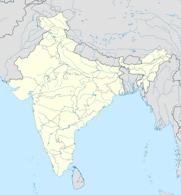
Il distretto urbano di Bangalore è un distretto del Karnataka, in India, di 6.523.110 abitanti. È situato nella divisione di Bangalore e il suo capoluogo è Bangalore.
| Distretto urbano di Bangalore distretto | |
|---|---|
| Bangalore Urban District | |
| Localizzazione | |
| Stato | |
| Stato federato | |
| Divisione | Bangalore |
| Amministrazione | |
| Capoluogo | Bangalore |
| Territorio | |
| Coordinate del capoluogo | 12°58′59.88″N 77°34′59.88″E |
| Superficie | 2 190 km² |
| Abitanti | 6 523 110 (2001) |
| Densità | 2 978,59 ab./km² |
| Altre informazioni | |
| Fuso orario | UTC+5:30 |
| Cartografia | |
 | |
| Sito istituzionale | |
Il distretto comprende cinque comuni (detti taluk): Bangalore Nord, Bangalore Nord (Additional), Bangalore Sud, Bangalore Est e Anekal[1].
Note
- (EN) Bangalore Urban official website, Deputy Commissioner's office Bangalore Urban District, su bangaloreurban.nic.in. URL consultato il 06-04-2009 (archiviato dall'url originale il 9 aprile 2009).
Altri progetti
 Wikimedia Commons contiene immagini o altri file su distretto Urbano di Bangalore
Collegamenti esterni
- Sito ufficiale, su bangaloreurban.nic.in.
| Controllo di autorità | VIAF (EN) 139630126 · LCCN (EN) n85313895 |
|---|
На других языках
[de] Bengaluru Urban
Der Distrikt Bengaluru Urban (Kannada: ಬೆಂಗಳೂರು ನಗರ ಜಿಲ್ಲೆ „Bangalore-Stadt“; auch: Distrikt Bangalore; früher Bangalore Urban) ist ein Distrikt des indischen Bundesstaats Karnataka. Er umfasst Bengaluru, die Hauptstadt Karnatakas und drittgrößte Stadt Indiens, samt Umland.[en] Bangalore Urban district
Bangalore Urban district, [2] is the most densely populated district in the Indian state of Karnataka[citation needed]. It is surrounded by the Bangalore Rural district on the east and north, the Ramanagara district on the west and the Krishnagiri district of Tamil Nadu on the south. Bangalore Urban district came into being in 1986, with the partition of the erstwhile Bangalore district into Bangalore Urban and Bangalore Rural districts. Bangalore Urban has five taluks: Hebbala (Bangalore North), Kengeri (Bangalore South), Krishnarajapura (Bangalore East), Yelahanka (Bangalore North Additional) and Anekal. [citation needed] The city of Bangalore is situated in the Bangalore Urban district and is the headquarters of the district. The district has 2 divisions, 5 talukas, 17 hoblies, 872 villages, 11 rural habitations, 5 towns, 1 tier-three city and 1 tier-one city, administered by 96 Village Panchayats (Grama Panchayitis) 97 Taluk Panchayats (Taluk Panchayitis), 5 Town Municipal Councils (Purasabes), 1 City Municipal Council (Nagarasabe) and 1 City Corporation (Mahanagara Palike).[3][4]- [it] Distretto urbano di Bangalore
[ru] Городской округ Бангалор
Городско́й о́круг Бангало́р (канн. ಬೆಂಗಳೂರು ನಗರ; англ. Bangalore Urban district) — округ в индийском штате Карнатака. Образован в 1986 году. Административный центр — город Бангалор. Площадь округа — 2190 км². По данным всеиндийской переписи 2001 года население округа составляло 6 537 124 человека. Уровень грамотности взрослого населения составлял 83 %, что значительно выше среднеиндийского уровня (59,5 %). Доля городского населения составляла 88,1 %.Текст в блоке "Читать" взят с сайта "Википедия" и доступен по лицензии Creative Commons Attribution-ShareAlike; в отдельных случаях могут действовать дополнительные условия.
Другой контент может иметь иную лицензию. Перед использованием материалов сайта WikiSort.org внимательно изучите правила лицензирования конкретных элементов наполнения сайта.
Другой контент может иметь иную лицензию. Перед использованием материалов сайта WikiSort.org внимательно изучите правила лицензирования конкретных элементов наполнения сайта.
2019-2025
WikiSort.org - проект по пересортировке и дополнению контента Википедии
WikiSort.org - проект по пересортировке и дополнению контента Википедии
