world.wikisort.org - India
Taherpur is a town and a notified area in Ranaghat subdivision of Nadia district in the Indian state of West Bengal.[2]
Taherpur | |
|---|---|
Town | |
 | |
 Taherpur Location in West Bengal, India  Taherpur Taherpur (India) | |
| Coordinates: 23.2665°N 88.5358°E | |
| Country | |
| State | West Bengal |
| District | Nadia |
| Government | |
| • Type | Notified Area |
| • Body | Taherpur Notified Area |
| Area | |
| • Town | 2.01 km2 (0.78 sq mi) |
| Population (2011)[1] | |
| • Town | 20,894 |
| • Density | 10,000/km2 (27,000/sq mi) |
| • Metro | 38,039 |
| Languages | |
| • Official | Bengali, English |
| Time zone | UTC+5:30 (IST) |
| ISO 3166 code | IN-WB |
| Vehicle registration | WB |
| Lok Sabha constituency | Ranaghat |
| Vidhan Sabha constituency | Ranaghat Uttar Paschim |
| Website | nadia |
History
Taherpur has been named after a certain Pathan fief-holder Tahir Khan. Kamdev Bhatta, a Brahmin of shandilya gotra defeated the Pathan fief-holder Tahir Khan and laid the foundation of the Taherpur zamindari during the independent Sultanate period (1338-1538) of Bengal. Kamdev descendant Raja Kangshanarayan of Taherpur organized the first grand autumn Durga Puja in Bengal.
Geography
M: municipal town/ city/notified area, CT: census town, R: rural/ urban centre.
Owing to space constraints in the small map, the actual locations in a larger map may vary slightly
Location
Taherpur is located at 23.2665°N 88.5358°E.
Area overview
Nadia district is mostly alluvial plains lying to the east of Hooghly River, locally known as Bhagirathi. The alluvial plains are cut across by such distributaries as Jalangi, Churni and Ichhamati. With these rivers getting silted up, floods are a recurring feature.[3] The Ranaghat subdivision has the Bhagirathi on the west, with Purba Bardhaman and Hooghly districts lying across the river. Topographically, Ranaghat subdivision is spread across the Krishnanagar-Santipur Plain, which occupies the central part of the district, and the Ranaghat-Chakdaha Plain, the low-lying area found in the south-eastern part of the district. The Churni separates the two plains. A portion of the east forms the boundary with Bangladesh. The lower portion of the east is covered by a portion of the North 24 Parganas district.[4] The subdivision has achieved reasonably high urbanisation. 41.68% of the population lives in urban areas and 58.32% lives in rural areas.[5]
Note: The map alongside presents some of the notable locations in the subdivision. All places marked in the map are linked in the larger full screen map. All the four subdivisions are presented with maps on the same scale – the size of the maps vary as per the area of the subdivision.
Transport
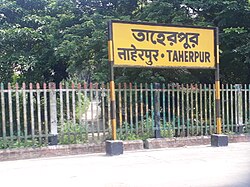
Taherpur is well connected with district headquarters and Kolkata by road. Taherpur railway station is situated on the Ranaghat–Krishnanagar line.[6]
Civic administration
Police station
Rananghat and Taherpur police stations have jurisdiction over Ranaghat, Birnagar, Taherpur and Ranaghat I CD block.[7][8] The total area covered by the Taherpur police station is 154.74 km2 and the population covered is 173,926 (2001 census).[9]
Demographics
According to the 2011 Census of India, Taherpur (Notified Area + Out Growth) had a total population of 38,039, of which 19,410 (51%) were males and 18,629 (49%) were females. Population in the age range 0–6 years was 3,200. The total number of literate persons in Taherpur was 30,166 (86.59% of the population over 6 years).[10]
The following municipality, notified area, outgrowths and census towns were part of Shantipur Urban Agglomeration in 2011 census: Shantipur (M), Taherpur (NA), Taherpur (OG), Barasat (OG), Bhaduri (OG), Mahisdanga (OG), Phulia (CT), Patuli (CT), Badkulla (CT), Ghoralia (CT), Beharia and Gangni.[11]
As of 2001[update] India census,[12] Taherpur had a population of 20,060. Males constitute 51% of the population and females 49%. Taherpur has an average literacy rate of 80%, higher than the national average of 59.5%: male literacy is 84%, and female literacy is 76%. In Taherpur, 9% of the population is under 6 years of age.
References
- "Taherpur Info".
- "District Wise List of Statutory Towns". Census of India 2001, Urban Frame. Directorate of Census Operations, West Bengal. Archived from the original on 27 September 2007. Retrieved 6 October 2007.
- Gangopadhyay, Basudev, Paschimbanga Parichay, 2001, (in Bengali), p. 70, Sishu Sahitya Sansad
- "District Census Handbook, Nadia, 2011, Series 20, Part XII A" (PDF). Pages 13,14. Directorate of Census Operations, West Bengal. Retrieved 16 October 2020.
- "District Statistical Handbook 2014 Nadia". Table 2.2, 2.4(a). Department of Planning and Statistics, Government of West Bengal. Retrieved 16 October 2020.
- roy, Joydeep. "Taherpur Railway Station Map/Atlas ER/Eastern Zone - Railway Enquiry". indiarailinfo.com. Retrieved 2 March 2022.
- "District Statistical Handbook 2014 Nadia". Table 2.1. Department of Statistics and Programme Implementation, Government of West Bengal. Retrieved 7 October 2020.
- "Nadia District Police". Police Unit. West Bengal Police. Retrieved 17 May 2017.
- "Taherpur Police Station Details". Nadia Police. Archived from the original on 29 March 2016. Retrieved 17 May 2017.
- "2011 Census – Primary Census Abstract Data Tables". West Bengal – District-wise. Registrar General and Census Commissioner, India. Retrieved 18 May 2017.
- "Provisional Population Totals, Census of India 2011" (PDF). Constituents of Urban Agglomeration Having Population Above 1 Lakh. Census of India 2011. Retrieved 18 October 2020.
- "Census of India 2001: Data from the 2001 Census, including cities, villages and towns (Provisional)". Census Commission of India. Archived from the original on 16 June 2004. Retrieved 1 November 2008.
Другой контент может иметь иную лицензию. Перед использованием материалов сайта WikiSort.org внимательно изучите правила лицензирования конкретных элементов наполнения сайта.
WikiSort.org - проект по пересортировке и дополнению контента Википедии
